The evolution of topographic mapping is a cornerstone of geospatial information science, transitioning from labor-intensive field surveys to sophisticated digital production systems. While traditional tools like total stations and GPS-RTK revolutionized data collection, they remain grounded, time-consuming, and often impractical in complex or inaccessible terrains. The advent of aerial photogrammetry and satellite imagery offered a broader perspective, yet challenges related to cost, turnaround time, and resolution for large-scale maps persisted. This technological gap paved the way for the rise of Unmanned Aerial Vehicle (UAV) based low-altitude photogrammetry. The agility, cost-effectiveness, and ability to capture high-resolution data make DJI drones particularly compelling. Traditionally, this process relies on a network of Ground Control Points (GCPs) for georeferencing, which demands significant field effort. The pursuit of image-free (or GCP-free) workflows is therefore of paramount importance, promising to drastically reduce fieldwork, lower costs, and enable mapping in areas where placing physical markers is dangerous or impossible. This article explores the application of an image-free workflow using a DJI drone, specifically the Phantom 4 RTK, for high-precision 3D modeling and digital mapping of a campus environment.
The core principle of image-free mapping with high-precision DJI drones lies in leveraging their integrated Real-Time Kinematic (RTK) positioning modules. These systems provide each captured image with centimeter-level accurate geotags (position) and orientation data directly from satellite observations. This precise exterior orientation for every image significantly reduces the need for traditional GCPs to “anchor” the photogrammetric model to the real-world coordinate system. While some studies utilize post-processed kinematic (PPK) methods, the integrated RTK system in modern DJI drones streamlines the process by providing corrected coordinates in real-time during flight. The accuracy of this direct georeferencing is often sufficient for producing topographic products that meet standard specifications for scales like 1:500, provided systematic errors are minimized through proper calibration and flight planning.
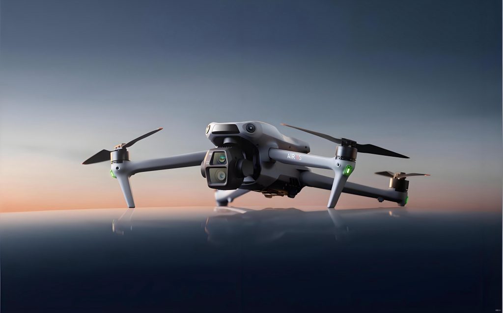
This study employed the DJI Phantom 4 RTK, a platform renowned for its survey-grade accuracy and operational simplicity. Its technical specifications are critical for understanding the feasibility of the image-free approach. The platform’s positioning accuracy is paramount, as it directly influences the final model’s absolute accuracy without GCPs. Key parameters of the platform and its integrated camera are summarized below.
| Parameter | Value | Parameter | Value |
|---|---|---|---|
| Takeoff Weight | 1,391 g | Max Service Ceiling | 6,000 m |
| Max Ascent Speed | 5 m/s | Max Flight Time | Approx. 30 min |
| Max Descent Speed | 3 m/s | Operating Temperature | 0°C to 40°C |
| Max Horizontal Speed (P-mode) | 50 km/h | Hover Accuracy (RTK enabled) | Vertical: ±0.1 m; Horizontal: ±0.1 m |
| Positioning System (RTK) | Horizontal: 1 cm + 1 ppm (RMS); Vertical: 1.5 cm + 1 ppm (RMS) | ||
The sensor payload is equally important. The DJI drone is equipped with a 1-inch CMOS sensor capable of capturing high-resolution imagery, which is essential for generating detailed 3D models and accurate feature extraction.
| Parameter | Value |
|---|---|
| Effective Pixels | 20 MP |
| Sensor Size | 1-inch CMOS |
| Lens Focal Length | 8.8 mm / 24 mm (35 mm format equivalent) |
| Field of View (FOV) | 84° |
| Aperture | f/2.8 – f/11 |
| Image Format | JPEG |
The project workflow commenced with thorough mission planning. A flat, campus area was selected as the test site. Using the dedicated flight planning software (DJI GS RTK App), a nadir grid mission was designed with key parameters optimized for high-resolution 3D reconstruction. The flight altitude was set at 80 meters above ground level (AGL) to balance ground sample distance (GSD) and coverage. To ensure robust stereo matching and dense point cloud generation, high overlap rates were specified: 80% front overlap and 80% side overlap. A total of five flight lines were executed in a single mission, lasting approximately 25 minutes, resulting in the capture of 433 images. Crucially, the DJI drone‘s RTK module was provided with a stable correction signal via a network RTK service (NTRIP) throughout the flight, ensuring each image was tagged with precise WGS84 coordinates (ellipsoidal height). No ground control points were placed or measured within the project area, adhering to the image-free methodology.
The post-processing pipeline is where the image-free data is transformed into measurable geospatial products. The first and most critical step is the generation of a highly accurate, georeferenced 3D model. All 433 images, along with their embedded RTK/INS metadata (position: X, Y, Z; orientation: Omega, Phi, Kappa), were imported into ContextCapture (Bentley Systems) software. In a traditional workflow, the aerial triangulation (AT) process requires manual identification of GCPs in the imagery to compute the bundle adjustment. In this image-free workflow, the precise camera positions from the DJI drone served as direct observations with high weight in the bundle adjustment. The software’s algorithm uses these, along with the image measurements of tie points (automatically matched features across overlapping images), to refine the exterior and interior orientation of all cameras simultaneously. The mathematical foundation is an enhanced bundle adjustment. For image *i* and point *j*, the collinearity equations incorporating the direct georeferencing observation are reinforced:
$$ x_{ij} – x_p = -c \frac{r_{11}(X_j – X_{0i}) + r_{12}(Y_j – Y_{0i}) + r_{13}(Z_j – Z_{0i})}{r_{31}(X_j – X_{0i}) + r_{32}(Y_j – Y_{0i}) + r_{33}(Z_j – Z_{0i})} + \Delta x $$
$$ y_{ij} – y_p = -c \frac{r_{21}(X_j – X_{0i}) + r_{22}(Y_j – Y_{0i}) + r_{23}(Z_j – Z_{0i})}{r_{31}(X_j – X_{0i}) + r_{32}(Y_j – Y_{0i}) + r_{33}(Z_j – Z_{0i})} + \Delta y $$
Where $(x_{ij}, y_{ij})$ are the image coordinates of point *j* in image *i*, $(x_p, y_p, c)$ are the interior orientation parameters, $r_{mn}$ are the elements of the rotation matrix for image *i*, $(X_{0i}, Y_{0i}, Z_{0i})$ is the precisely known camera position from the DJI drone RTK, $(X_j, Y_j, Z_j)$ are the unknown object space coordinates of point *j*, and $(\Delta x, \Delta y)$ are lens distortion corrections. The high accuracy of $(X_{0i}, Y_{0i}, Z_{0i})$ strongly constrains the solution, reducing the need for control from the object space (i.e., GCPs).
Following successful aerial triangulation, a high-resolution Textured 3D Mesh (in OSGB format) and a Digital Surface Model (DSM) were generated without any manual referencing to ground points. This model formed the basis for all subsequent mapping. The 3D mapping was performed using specialized software, SV365, which allows for stereoscopic measurement directly on the 3D mesh in a “glasses-free” or “naked-eye 3D” environment. The georeferenced OSGB model was loaded into SV365. The operator then used the digitizing tools to trace features of interest—such as building footprints, road edges, and other planimetric details—directly onto the surface of the 3D model. For this study, the focus was on extracting a detailed Digital Line Graphic (DLG) of a campus library building. The immersive 3D view allows for accurate interpretation and vectorization of features by providing real depth perception, a significant advantage over 2D orthophoto-based digitizing.
The ultimate test of the image-free workflow using the DJI drone is the positional accuracy of the final products. To evaluate this, a set of 10 checkpoints were independently surveyed using a high-precision total station (Suzhou FOIF RTS332SR5B, angular accuracy ±2″, distance accuracy ±(2 mm + 2 ppm×D)). These points were selected on stable, well-defined features like pavement corners and building steps distributed across the project area. Their coordinates were measured in the same project coordinate system. The corresponding points were then precisely identified and measured within the SV365 software on the 3D model derived from the DJI drone imagery. The discrepancies between the total station measurements (considered ground truth) and the model measurements were calculated for Easting (ΔX), Northing (ΔY), and Height (ΔZ).
| Checkpoint ID | Total Station (m) | 3D Model (m) | Discrepancy (m) |
|---|---|---|---|
| X, Y, Z | X, Y, Z | ΔX, ΔY, ΔZ | |
| CP01 | 90062.679, 3045.147, 1835.197 | 90062.699, 3045.184, 1835.240 | -0.020, +0.037, -0.043 |
| CP02 | 90078.010, 3045.844, 1835.250 | 90078.051, 3045.879, 1835.220 | -0.041, +0.035, +0.030 |
| CP03 | 90109.810, 3040.771, 1835.320 | 90109.852, 3040.783, 1835.340 | -0.042, +0.012, -0.020 |
| CP04 | 90139.669, 3053.500, 1835.243 | 90139.673, 3053.559, 1835.290 | -0.004, +0.059, -0.047 |
| CP05 | 90003.557, 3095.198, 1835.661 | 90003.578, 3095.221, 1835.620 | -0.021, +0.023, +0.041 |
| CP06 | 90002.630, 3086.020, 1835.547 | 90002.590, 3085.985, 1835.560 | +0.040, -0.035, -0.013 |
| CP07 | 90005.068, 3065.201, 1835.548 | 90005.053, 3065.190, 1835.540 | +0.015, -0.011, +0.008 |
| CP08 | 90009.490, 3045.211, 1835.421 | 90009.519, 3045.261, 1835.450 | -0.029, +0.050, -0.029 |
| CP09 | 90084.240, 2988.497, 1835.547 | 90084.285, 2988.525, 1835.590 | -0.045, +0.028, -0.043 |
| CP10 | 90092.251, 2988.570, 1835.544 | 90092.291, 2988.525, 1835.590 | -0.040, -0.045, -0.046 |
The Root Mean Square Error (RMSE) is the standard metric for assessing accuracy. It is calculated for horizontal (XY) and vertical (Z) components separately. The formulas are as follows:
$$ RMSE_{X} = \sqrt{\frac{\sum_{i=1}^{n} (\Delta X_i)^2}{n}} $$
$$ RMSE_{Y} = \sqrt{\frac{\sum_{i=1}^{n} (\Delta Y_i)^2}{n}} $$
$$ RMSE_{XY} = \sqrt{RMSE_{X}^2 + RMSE_{Y}^2} $$
$$ RMSE_{Z} = \sqrt{\frac{\sum_{i=1}^{n} (\Delta Z_i)^2}{n}} $$
Applying these formulas to the discrepancy data yields the following accuracy statistics:
| Statistical Item | X (m) | Y (m) | Horizontal (XY) (m) | Vertical (Z) (m) |
|---|---|---|---|---|
| Maximum Error | 0.045 | 0.059 | 0.060 | 0.047 |
| Minimum Error | 0.004 | 0.011 | 0.019 | 0.008 |
| Root Mean Square Error (RMSE) | 0.033 | 0.037 | 0.049 | 0.035 |
The achieved accuracy of RMSEXY = 0.049 m and RMSEZ = 0.035 m is exceptionally high. According to widely accepted international standards for large-scale mapping (e.g., ASPRS Positional Accuracy Standards for Digital Geospatial Data), these values comfortably satisfy the requirements for a 1:500 scale map, where the common accuracy threshold is often 0.1 m (10 cm) for well-defined points in planimetry and a similar range in elevation for flat terrain. This empirically validates that the image-free methodology powered by the high-precision DJI drone can deliver survey-grade results.
The successful application demonstrated in this study underscores the transformative potential of image-free workflows using RTK-enabled DJI drones. The elimination of ground control points slashes field time and logistical complexity by an estimated 50-70%, depending on project size and terrain. This makes rapid response mapping, frequent monitoring, and surveying in hazardous or inaccessible areas not only feasible but efficient. The seamless integration from the DJI drone flight controller to processing software like ContextCapture and then to 3D digitizing platforms like SV365 represents a highly automated pipeline. The direct georeferencing capability of the DJI drone is the linchpin, providing the necessary absolute positional constraint to the photogrammetric bundle adjustment. While this study focused on a relatively flat campus, the implications are broader. This technology is ideally suited for applications such as volumetric calculations in stockpiles and quarries, deformation monitoring of slopes or dams, infrastructure inspection, and creating baseline maps for construction projects. The high-resolution 3D model itself is a valuable asset for visualization, simulation, and facility management. It is important to note that achieving this level of accuracy consistently requires careful practice: ensuring the DJI drone‘s RTK module has a fixed integer solution throughout the flight, using appropriate flight parameters (high overlap, consistent lighting), and performing routine sensor calibration. Future developments will likely see even tighter integration between DJI drone systems and AI-powered processing software, enabling real-time quality assessment, automated feature extraction, and intelligent anomaly detection directly from the imagery stream, further solidifying the role of DJI drones as indispensable tools in the modern geospatial workflow.