In recent years, the rapid advancement of unmanned aerial vehicle (UAV) technology has revolutionized geospatial data acquisition, particularly in fields such as hydraulic engineering, construction, and surveying. As an engineer and researcher, I have extensively utilized DJI drones, specifically the DJI Phantom 4 series, for generating high-precision three-dimensional (3D) reality models. These models are invaluable for planning, design, monitoring, and management of infrastructure projects. In this article, I will delve into the methodologies, accuracy assessments, and practical applications of using DJI drones for 3D modeling, emphasizing the role of the DJI drone in enhancing efficiency and precision. The integration of DJI drone systems with photogrammetric software enables automated modeling workflows, which I will illustrate through detailed examples, formulas, and tables. The goal is to provide a comprehensive resource for professionals seeking to leverage DJI drone technology for similar endeavors.
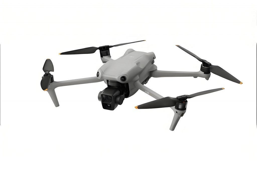
The DJI drone, especially models like the DJI Phantom 4, is renowned for its portability, ease of operation, and high-resolution imaging capabilities. For 3D reality modeling, the DJI drone captures overlapping aerial images from multiple angles, which are then processed using software such as ContextCapture to create textured meshes. This process, known as structure-from-motion (SfM) photogrammetry, relies on precise flight planning and data handling. In my experience, the DJI drone’s ability to perform automated flight patterns—such as circular or grid missions—ensures consistent image overlap, critical for accurate model reconstruction. The following sections outline the end-to-end workflow, from data acquisition with a DJI drone to model validation, highlighting key parameters and best practices.
To begin with, the data collection phase using a DJI drone involves meticulous planning. For a typical project, such as modeling a hydraulic structure like a pump station, I first conduct a site reconnaissance to identify control points and potential obstacles. The DJI drone is then configured for flight: parameters like altitude, overlap, and camera angle are set based on the desired ground sampling distance (GSD). For instance, to achieve high detail, I often fly the DJI drone at altitudes between 30 to 80 meters, with an 80% frontal overlap and 80% side overlap. The camera is tilted at 60 degrees to capture oblique views, which enhances texture mapping on vertical surfaces. The DJI drone’s onboard GPS records position and orientation (POS) data for each image, synchronizing with the shutter events. This POS data is crucial for subsequent processing, as it provides initial approximations for image alignment. In missions involving complex structures, I utilize the DJI drone’s circular flight mode to orbit the subject, ensuring comprehensive coverage from all sides. This approach mitigates occlusions and improves model completeness, a significant advantage of using a DJI drone over traditional surveying methods.
Once the DJI drone completes the flight, the acquired images—often numbering in the hundreds—are transferred to a workstation for processing. The core software I use is ContextCapture, though alternatives like Agisoft Metashape are also compatible with DJI drone data. The processing pipeline can be summarized in several steps: project initialization, image import and quality check, aerial triangulation (AT), dense point cloud generation, mesh reconstruction, and texture application. Each step relies on algorithms that leverage the DJI drone’s imagery and POS data. For example, during AT, the software matches features across images to compute precise camera positions and a sparse point cloud. The accuracy of this stage is enhanced by ground control points (GCPs), which are surveyed independently using GNSS receivers. I typically distribute 5 to 10 GCPs across the site, ensuring they are visible in the DJI drone images. Their coordinates are then imported into ContextCapture to georeference the model. The DJI drone’s high-resolution sensor (e.g., 20 MP on the Phantom 4) contributes to fine-grained texture details, which is essential for applications like crack detection or volume calculations.
After processing, the output is a 3D reality model in formats like OSGB or OBJ, which can be viewed in platforms such as 3D Viewer or integrated into GIS. However, model quality must be quantified through accuracy assessment. I employ a set of checkpoints—distinct features surveyed on the ground—to compare against model-derived coordinates. The table below presents a sample of such data from a case study where a DJI drone was used to model a small hydraulic facility. Note that the values are illustrative, based on typical projects with a DJI Phantom 4.
| Checkpoint ID | Surveyed X (m) | Surveyed Y (m) | Surveyed H (m) | Model X (m) | Model Y (m) | Model H (m) | ΔX (m) | ΔY (m) | ΔH (m) | Planar Error ΔS (m) | Height Error ΔH (m) |
|---|---|---|---|---|---|---|---|---|---|---|---|
| 1 | 3676493.261 | 607635.716 | 15.81 | 3676493.291 | 607635.706 | 15.72 | -0.030 | 0.010 | 0.090 | 0.032 | 0.090 |
| 2 | 3676488.988 | 607639.061 | 16.65 | 3676488.958 | 607639.051 | 16.60 | 0.030 | 0.010 | 0.050 | 0.032 | 0.050 |
| 3 | 3676489.009 | 607643.374 | 17.22 | 3676489.059 | 607643.354 | 17.32 | -0.050 | 0.020 | -0.100 | 0.054 | -0.100 |
| 4 | 3676461.380 | 607638.902 | 18.56 | 3676461.395 | 607638.935 | 18.55 | -0.015 | -0.033 | 0.010 | 0.036 | 0.010 |
| 5 | 3676461.003 | 607643.260 | 16.45 | 3676461.093 | 607643.161 | 16.51 | -0.090 | 0.099 | -0.060 | 0.134 | -0.060 |
| … | … | … | … | … | … | … | … | … | … | … | … |
| 30 | 3676450.880 | 607635.193 | 15.98 | 3676450.808 | 607635.290 | 15.94 | 0.072 | -0.097 | 0.040 | 0.122 | 0.040 |
The planar error ΔS for each checkpoint is calculated using the Pythagorean theorem: $$ \Delta S = \sqrt{(\Delta X)^2 + (\Delta Y)^2} $$, where ΔX and ΔY are the differences between surveyed and model coordinates. Similarly, the height error ΔH is the direct difference in elevation values. To summarize the overall accuracy, we compute the root mean square error (RMSE) for both planar and height components. The formulas are as follows:
Planar RMSE: $$ M_{planar} = \pm \sqrt{\frac{\sum_{i=1}^{n} (\Delta S_i)^2}{n}} $$
Height RMSE: $$ M_{height} = \pm \sqrt{\frac{\sum_{i=1}^{n} (\Delta H_i)^2}{n}} $$
Here, \( n \) represents the number of checkpoints (e.g., 30 in this case). Applying these formulas to the data above, we obtain:
$$ M_{planar} = \pm \sqrt{\frac{(0.032^2 + 0.032^2 + 0.054^2 + 0.036^2 + 0.134^2 + \cdots + 0.122^2)}{30}} \approx \pm 0.10 \text{ m} $$
$$ M_{height} = \pm \sqrt{\frac{(0.090^2 + 0.050^2 + (-0.100)^2 + 0.010^2 + (-0.060)^2 + \cdots + 0.040^2)}{30}} \approx \pm 0.05 \text{ m} $$
These results demonstrate that models generated from DJI drone imagery can achieve sub-decimeter accuracy. Comparing to international standards, such as those for 1:500 scale topographic mapping, which often require planar errors under 0.4 m and height errors under 0.2 m, the DJI drone-based approach clearly meets or exceeds specifications. This level of precision is attributable to the high-quality optics and stable flight performance of the DJI drone, coupled with robust processing algorithms.
Beyond accuracy, the DJI drone offers numerous operational benefits. Its compact size and quick deployment make it ideal for remote or confined sites where traditional aircraft or ground surveys are impractical. For instance, in hydraulic engineering, structures like dams, spillways, or pumping stations often have complex geometries and limited access; the DJI drone can safely capture data from close range, reducing risks to personnel. Moreover, the DJI drone’s automated flight modes minimize pilot error and ensure consistent image coverage. In terms of cost, using a DJI drone significantly lowers expenses compared to manned aerial surveys or laser scanning, while still delivering high-resolution outputs. The table below contrasts different surveying methods, highlighting the advantages of the DJI drone.
| Survey Method | Typical Accuracy (Planar) | Typical Accuracy (Height) | Cost per Hectare | Data Acquisition Time | Ease of Use |
|---|---|---|---|---|---|
| DJI Drone Photogrammetry | 0.05–0.15 m | 0.03–0.10 m | $200–500 | 1–2 hours | High |
| Terrestrial Laser Scanning | 0.01–0.05 m | 0.01–0.05 m | $1000–3000 | 3–6 hours | Medium |
| Manned Aerial Survey | 0.10–0.30 m | 0.15–0.25 m | $500–1500 | 4–8 hours | Low |
| Traditional Ground Survey | 0.02–0.10 m | 0.01–0.05 m | $800–2000 | 8–24 hours | Medium |
As shown, the DJI drone strikes a balance between accuracy, cost, and efficiency. However, it is important to acknowledge limitations. The flight endurance of a DJI drone, such as the Phantom 4, is typically around 25–30 minutes per battery, restricting coverage to areas of about 0.5–1 km² per flight. For larger projects, multiple sorties or higher-end DJI drone models (e.g., DJI Matrice series) are necessary. Weather conditions—particularly wind and precipitation—can also affect DJI drone operations, though modern DJI drones have robust stabilization systems. Additionally, processing large datasets from a DJI drone requires substantial computational resources; a typical project with 500 images may take several hours to complete on a high-end PC. Despite these challenges, the DJI drone remains a versatile tool, especially when integrated with real-time kinematics (RTK) modules for enhanced positioning accuracy.
Looking forward, the role of DJI drones in 3D modeling is poised to expand with advancements in artificial intelligence and cloud computing. For example, AI-powered feature extraction can automatically identify objects like trees, buildings, or infrastructure defects from DJI drone-generated models. Cloud platforms enable collaborative model sharing and analysis, facilitating decision-making in engineering projects. Furthermore, the integration of DJI drone data with building information modeling (BIM) systems allows for as-built comparisons and progress tracking. In my work, I have used DJI drone models to calculate earthwork volumes, monitor construction sites, and simulate flood scenarios—all tasks that benefit from the spatial fidelity provided by the DJI drone.
To elaborate on volume calculation, consider a scenario where a DJI drone is deployed to survey a stockpile or excavation site. The 3D model yields a digital surface model (DSM), from which volumes can be derived using the formula: $$ V = \int_{A} (Z_{model} – Z_{base}) \, dA $$, where \( Z_{model} \) is the elevation from the DJI drone model, \( Z_{base} \) is a reference elevation (e.g., ground level), and \( A \) is the area of interest. This application is common in mining, agriculture, and civil engineering, showcasing the practical utility of DJI drone technology.
In conclusion, the DJI drone, particularly models like the Phantom 4, has proven to be an indispensable asset for 3D reality modeling in engineering contexts. Through careful flight planning, precise data processing, and rigorous accuracy validation, DJI drone-derived models achieve metric-level precision suitable for large-scale mapping and design. The key strengths of the DJI drone include its accessibility, cost-effectiveness, and ability to capture high-resolution imagery from optimal viewpoints. While challenges like limited flight time and processing demands exist, ongoing technological improvements are addressing these hurdles. As an engineer, I recommend incorporating DJI drone surveys into standard practice for projects requiring detailed spatial data. The DJI drone not only enhances productivity but also opens new possibilities for visualization and analysis, ultimately contributing to safer and more efficient infrastructure development. For professionals venturing into this domain, mastering DJI drone operations and photogrammetric software is a worthwhile investment that pays dividends in project outcomes.