In recent years, the integration of drone technology into forestry practices has revolutionized how we monitor and manage forest ecosystems. As a researcher focused on innovative forestry solutions, I have explored the potential of DJI drones, particularly the DJI Avata model, for enhancing forest pest and disease monitoring. Forest pests and diseases pose significant threats to biodiversity, timber production, and ecological balance, with thousands of species causing widespread damage globally. Traditional monitoring methods, such as ground surveys, are labor-intensive, time-consuming, and often inadequate for large-scale or remote areas. The advent of drone-based remote sensing offers a promising alternative, enabling rapid, accurate, and cost-effective data collection. In this article, I delve into the capabilities of the DJI Avata drone, a compact and agile first-person view (FPV) drone, and its synergistic use with other DJI models like the Phantom 4 multispectral version. Through detailed analysis of performance parameters, technical workflows, and practical applications, I demonstrate how this DJI drone can address key challenges in forest health assessment, from early detection to severity analysis. I also discuss limitations and future prospects, supported by tables and mathematical formulations to summarize key concepts. The goal is to provide a comprehensive resource for forestry professionals seeking to leverage DJI drone technology for sustainable forest management.
Forest pests and diseases are driven by biotic and abiotic factors, leading to physiological, morphological, and structural changes in trees. Common symptoms include defoliation, discoloration, stem boreholes, and canopy dieback, which can escalate to tree mortality and ecosystem degradation if unchecked. Effective monitoring is crucial for timely intervention, but conventional approaches rely on manual inspections that are prone to human error and limited spatial coverage. Remote sensing technologies, especially those utilizing drones, have emerged as game-changers. Drones equipped with optical, multispectral, or thermal sensors can capture high-resolution imagery over vast forested areas, facilitating the detection of anomalies indicative of pest or disease outbreaks. Among these, the DJI Avata drone stands out for its unique design—small, lightweight, and maneuverable—allowing it to navigate dense forest canopies where traditional drones struggle. This article explores its application in detail, emphasizing how this DJI drone complements broader forestry monitoring systems.
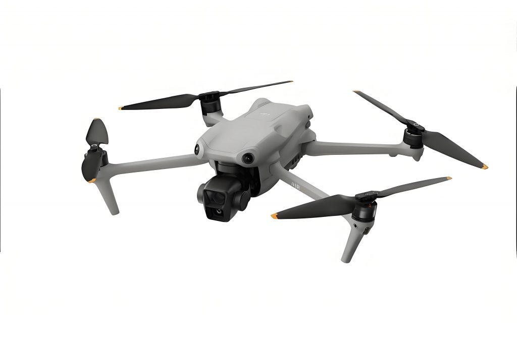
The DJI Avata drone is a specialized FPV drone released by DJI in 2022, designed for immersive flight experiences with enhanced safety features. Unlike conventional quadcopters used for aerial photography, this DJI drone prioritizes agility and durability, making it suitable for complex environments like forests. Key specifications include a weight of approximately 410 g, dimensions of 180 mm × 180 mm × 80 mm, and a maximum flight time of around 15 minutes. It features propeller guards for collision resistance, a 1/1.7-inch 48-megapixel sensor capable of 4K/60fps video recording, and DJI O3+ transmission system with a range up to 6 km. Compared to the DJI Phantom 4 multispectral drone—a workhorse in forestry remote sensing—the Avata offers distinct advantages for close-range, intra-canopy monitoring. The table below summarizes their parameters, highlighting how this DJI drone fills niche roles in forest pest and disease surveillance.
| Parameter | DJI Avata Drone | DJI Phantom 4 Multispectral Drone |
|---|---|---|
| Weight | ~410 g | ~1487 g |
| Dimensions | 180 mm × 180 mm × 80 mm | 485 mm × 485 mm × 220 mm |
| Max Horizontal Speed | 27 m/s (manual mode) | 16.1 m/s (attitude mode) |
| Max Vertical Speed | 6 m/s | 6 m/s (ascent), 3 m/s (descent) |
| Flight Time | ~15 minutes | ~25 minutes |
| Operating Temperature | -10°C to 40°C | 0°C to 40°C |
| Key Features | FPV capability, propeller guards, Turtle mode | Multispectral sensors, NDVI live view |
This DJI drone’s compact size enables it to weave through tree branches and gaps, providing close-up views of trunks, leaves, and branches—areas often obscured in top-down imagery from larger drones. Its durability, tested in various conditions, reduces the risk of damage during forest operations. However, the Avata’s shorter flight time and limited payload capacity necessitate a synergistic approach with other DJI drones. In my research, I combine the DJI Avata with the DJI Phantom 4 multispectral version to create a comprehensive monitoring pipeline. The Phantom 4 captures broad-scale multispectral data for initial anomaly detection, while the Avata conducts targeted, intra-canopy inspections for detailed analysis. This collaboration maximizes the strengths of each DJI drone, improving overall monitoring accuracy and efficiency.
The technical workflow for forest pest and disease monitoring using these DJI drones involves several stages, from pre-flight planning to data analysis. First, pre-flight preparations include reviewing forest maps, identifying target species (e.g., pine trees susceptible to pine wilt disease), and assessing weather conditions. Optimal flights require clear, calm days to minimize wind interference and ensure high-quality imagery. Next, site reconnaissance is conducted to select takeoff points free of obstacles like power lines or tall structures. For the DJI Phantom 4, flight parameters are set using software such as DJI Ground Station Pro. Key settings include flight altitude, overlap rates, and camera modes. The altitude affects ground sampling distance (GSD), which determines image resolution. A lower altitude yields finer details but increases flight time. I often use a formula to estimate GSD:
$$ GSD = \frac{H \times s}{f} $$
where \( H \) is flight height, \( s \) is sensor pixel size, and \( f \) is focal length. For forest monitoring, a GSD of 1-2 cm is typically adequate to detect pest-related symptoms. Overlap rates—recommended at 80% frontal and 70% lateral—ensure sufficient image coverage for photogrammetric processing. The Phantom 4’s multispectral sensors, including visible and near-infrared bands, allow for vegetation index calculations like the Normalized Difference Vegetation Index (NDVI), useful for stress detection:
$$ NDVI = \frac{(NIR – Red)}{(NIR + Red)} $$
Values below thresholds (e.g., NDVI < 0.3) may indicate diseased or stressed trees. After data acquisition, images are processed using software like Pix4Dmapper to generate orthomosaics and digital surface models. These outputs help identify suspect trees based on spectral anomalies or color changes—for instance, reddish-brown spots in pine canopies suggesting pine wilt disease.
Once potential hotspots are mapped, the DJI Avata drone is deployed for in-depth inspection. Its FPV capability, via DJI Goggles, allows real-time navigation through forest gaps to capture close-up imagery of tree components. This DJI drone’s agility is crucial for assessing trunk boreholes, leaf lesions, or insect activity that are invisible from above. I often employ image recognition algorithms to automate species and pest identification. For example, deep learning models like YOLOv4 or Faster R-CNN can be applied to Avata-captured images to classify pest damage. The loss function in YOLO involves terms for localization and confidence:
$$ \mathcal{L} = \lambda_{\text{coord}} \sum_{i=0}^{S^2} \sum_{j=0}^{B} \mathbb{1}_{ij}^{\text{obj}} \left[ (x_i – \hat{x}_i)^2 + (y_i – \hat{y}_i)^2 \right] + \lambda_{\text{noobj}} \sum_{i=0}^{S^2} \sum_{j=0}^{B} \mathbb{1}_{ij}^{\text{noobj}} (C_i – \hat{C}_i)^2 + \sum_{i=0}^{S^2} \mathbb{1}_{i}^{\text{obj}} \sum_{c \in \text{classes}} (p_i(c) – \hat{p}_i(c))^2 $$
where \( S^2 \) is grid cells, \( B \) is bounding boxes, and \( \mathbb{1} \) are indicator functions. Such models, trained on datasets of forest pests, can achieve accuracies above 70% in detecting specific symptoms. Additionally, the Avata’s footage enables severity grading using standardized scales. For defoliating insects, severity might be quantified as:
$$ \text{Severity Index} = \frac{\text{Number of damaged leaves}}{\text{Total leaves}} \times 100\% $$
This DJI drone thus facilitates not only detection but also quantitative assessment of pest impact, informing management decisions like targeted pesticide application.
Beyond detection, the DJI Avata drone excels in early-stage monitoring and post-treatment evaluation. In early stages, pests or diseases may cause subtle symptoms—e.g., minor leaf yellowing or small boreholes—that are missed by aerial surveys. The Avata’s ability to hover near tree crowns allows for meticulous inspection, catching issues before they escalate. For post-treatment assessment, this DJI drone can document recovery progress in hard-to-reach canopy layers, reducing the need for risky climbing. Its durability ensures reliable performance even in rugged forest interiors, though challenges remain. The table below summarizes key applications of the DJI Avata drone in forest pest and disease monitoring, illustrating its multifaceted role.
| Application Area | Description | Key Benefits |
|---|---|---|
| Species and Pest Identification | Close-up imaging of tree parts for automated or manual ID | Enables precise targeting of control measures |
| Severity Spatial Analysis | Quantifying damage extent using image analysis | Supports decision-making for intervention |
| Early Detection | Monitoring subtle symptoms in canopy layers | Reduces outbreak spread and management costs |
| Treatment Efficacy Evaluation | Assessing pesticide or biological control outcomes | Improves treatment strategies over time |
| High-Risk Zone Mapping | Documenting areas prone to infestations | Aids in preventive forestry practices |
Despite these advantages, the DJI Avata drone faces limitations in forest environments. High-density stands with intertwined branches restrict flight paths, increasing collision risks and requiring advanced piloting skills. Weather sensitivity is another concern; strong winds or rain can ground this DJI drone, limiting operational windows. Additionally, the short battery life—around 15 minutes—constrains coverage area, necessitating frequent battery swaps. Signal obstruction from foliage may reduce transmission range, complicating long-distance flights. These factors highlight the need for skilled operators and complementary tools. However, ongoing advancements in drone technology are addressing these gaps. For instance, improvements in battery chemistry could extend flight times, while enhanced obstacle avoidance systems might simplify navigation. The integration of additional sensors, such as thermal or hyperspectral cameras, could further expand the capabilities of this DJI drone for holistic forest health assessment.
Looking ahead, the future of DJI drones in forestry is promising. Research should focus on boosting the Avata’s endurance, perhaps through swappable battery packs or solar-assisted charging. Enhancing its obstacle avoidance with AI-driven algorithms would lower the skill barrier for pilots. Moreover, payload capacity could be increased to accommodate specialized sensors for multispectral or LiDAR data collection, enabling more comprehensive monitoring. Collaborative swarms of DJI drones, combining Avata’s agility with Phantom’s spectral analysis, could automate large-scale surveys. From my perspective, the key is to develop integrated platforms that leverage the strengths of various DJI drone models, supported by robust data analytics pipelines. As these technologies mature, they will democratize forest monitoring, making it more accessible and effective for conservationists and forest managers worldwide.
In conclusion, the DJI Avata drone represents a significant innovation in forest pest and disease monitoring. Its compact design, durability, and FPV functionality allow for detailed, intra-canopy inspections that complement broad-scale remote sensing. When used alongside other DJI drones like the Phantom 4, it forms a powerful toolkit for early detection, accurate identification, and severity assessment of forest health issues. While challenges such as flight time and operational complexity persist, ongoing technological progress promises to mitigate these limitations. As a researcher, I believe that embracing DJI drone technology can transform forestry practices, promoting proactive management and ecological sustainability. By continuing to explore and refine these applications, we can harness the full potential of drones to safeguard our forests for future generations.