In the realm of environmental remediation and land management, the accurate and efficient mapping of terrain is paramount. Traditional topographic surveying methods, while reliable, often involve significant time, labor, and financial costs. As a participant in a project focused on the ecological restoration of coal gangue piles, I sought to leverage modern technologies to streamline this process. Coal gangue piles, being massive accumulations of mining waste, pose severe environmental risks, including soil contamination, air pollution, and landscape degradation. Effective rehabilitation requires detailed topographic data for planning, design, and volume calculations. This led me to explore the integration of consumer-grade unmanned aerial vehicles (UAVs) and advanced photogrammetric software for real-scene 3D modeling. Specifically, I employed a DJI Phantom 4 Pro, a versatile DJI drone, and Context Capture software to generate high-resolution, georeferenced 3D models. The objective was to assess whether such a setup could produce models with sufficient accuracy for engineering applications, such as greening projects and utilization planning, while drastically reducing costs and manual effort.
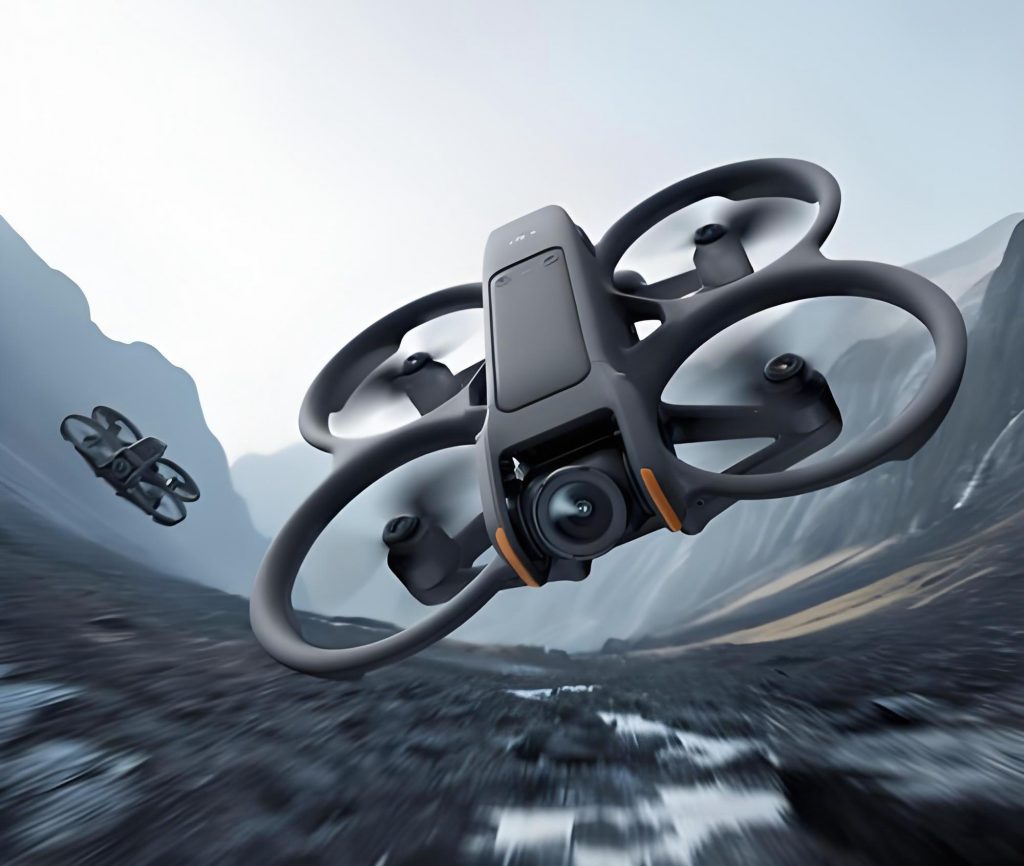
The advent of DJI drone technology has revolutionized aerial data acquisition. DJI drones, known for their accessibility and advanced features, offer a viable alternative to professional surveying equipment. In this project, the DJI Phantom 4 Pro was chosen for its balance of affordability and performance. Equipped with a 1-inch, 20-megapixel sensor, it captures high-quality imagery essential for photogrammetry. Its onboard GPS/GLONASS positioning, obstacle avoidance systems, and automated flight modes make it suitable for structured data collection. The use of a DJI drone in this context underscores the democratization of geospatial technology, allowing even small teams to undertake complex mapping tasks. The core methodology hinged on oblique photogrammetry, where images are taken from multiple angles to capture both top and side views of terrain features, thereby enabling the reconstruction of detailed 3D geometry.
Prior to flight operations, thorough preparation was essential. The study area, a coal gangue pile spanning approximately 144,000 square meters, was characterized by irregular boundaries, vegetation cover, and minor structures like pathways and small buildings. To ensure geospatial accuracy, ground control points (GCPs) were established. Using network RTK, four GCPs were surveyed with coordinates in the CGCS2000 coordinate system and heights relative to the 1985 national elevation benchmark. These points, marked with conspicuous targets, would later serve to geo-reference the aerial imagery. The planning of flight missions was conducted via DJI GS Pro, a ground station application. Parameters were set to achieve high overlap for robust photogrammetric processing: a flight altitude of under 100 meters, 70% forward overlap, and 70% side overlap. This configuration aimed for a ground sampling distance (GSD) of about 2.5 cm/pixel, balancing detail and coverage. The DJI drone was programmed to fly multiple passes at different headings to capture nadir (vertical) and oblique imagery (at 45-degree tilt angles). Over five automated sorties, the DJI Phantom 4 Pro acquired 791 usable images (156 nadir and 635 oblique), comprehensively covering the target area.
The heart of the 3D modeling process lies in photogrammetric computation, which transforms 2D images into 3D spatial data. For this, Context Capture software was utilized. This powerful tool employs structure-from-motion (SfM) and multi-view stereo (MVS) algorithms to reconstruct scenes. The workflow began with importing all images into Context Capture Master. Each image, enriched with metadata from the DJI drone (like GPS coordinates and orientation), was initially aligned. The GCPs were then identified in the imagery, and their known coordinates were assigned—a process known as photo-identification. This step ties the relative model to an absolute coordinate system. Subsequent aerial triangulation (AT) refined the camera positions and generated a sparse point cloud. The AT report indicated excellent convergence: all four GCPs were fully constrained, with reprojection errors minimal. The computation yielded over 129,000 tie points, forming a coherent network. The accuracy of the AT is critical, as it underpins all downstream modeling. The results confirmed that the DJI drone-derived data, when processed with Context Capture, could achieve submeter precision, laying a solid foundation for detailed modeling.
With a successful AT, the next phase was dense reconstruction and mesh generation. In Context Capture, a new production project was configured. The spatial reference was set to CGCS2000, and the output was defined as a 3D mesh in 3MX format. Given the area’s extent and available computational resources (a workstation with 16 GB RAM), the model was tessellated into 125 regular tiles to manage memory usage. The software’s engine then processed each tile, applying dense image matching to create a dense point cloud, which was subsequently meshed and textured using the original imagery. The entire process was automated, highlighting the efficiency of integrating a DJI drone with sophisticated software. The final model comprised millions of polygons with realistic textures, accurately depicting the undulating surface of the coal gangue pile, vegetation patches, paths, and structures. The visual fidelity was striking, offering an immersive view that traditional 2D maps cannot provide.
Quantitative assessment of the model’s accuracy is crucial for engineering applications. To evaluate this, coordinates of the GCPs were extracted from the 3D model and compared against their field-surveyed RTK values. The discrepancies, representing the model’s positional error, were computed. The results, summarized in Table 1, show that planar errors (in X and Y) are within centimeters. According to standards for 1:500 scale topographic mapping, the allowable horizontal error for well-defined points is typically 0.25 meters. The observed errors are far below this threshold, confirming that the DJI drone-based modeling meets the precision requirements for large-scale mapping. This level of accuracy suffices for tasks like slope analysis, volume calculation, and infrastructure planning on coal gangue piles.
| Control Point | Field X (m) | Model X (m) | ΔX (m) | Field Y (m) | Model Y (m) | ΔY (m) | Field Z (m) | Model Z (m) | ΔZ (m) | Horizontal Error (m) | Total Error (m) |
|---|---|---|---|---|---|---|---|---|---|---|---|
| GCP1 | 9173.341 | 9173.350 | -0.009 | 485.152 | 485.150 | 0.002 | 783.348 | 783.340 | 0.008 | 0.009 | 0.012 |
| GCP2 | 9246.398 | 9246.400 | -0.002 | 762.285 | 762.290 | -0.005 | 752.855 | 752.860 | -0.005 | 0.005 | 0.007 |
| GCP3 | 8961.778 | 8961.790 | -0.012 | 479.487 | 479.480 | 0.007 | 773.508 | 773.520 | -0.012 | 0.014 | 0.018 |
| GCP4 | 9023.850 | 9023.815 | 0.035 | 708.291 | 708.300 | -0.009 | 778.738 | 778.780 | -0.042 | 0.036 | 0.055 |
The photogrammetric principles underpinning this accuracy can be expressed mathematically. The fundamental equation in photogrammetry is the collinearity condition, which states that a point on the ground, its projection on the image, and the camera perspective center lie on a straight line. For a point \(i\) with object space coordinates \((X_i, Y_i, Z_i)\) and image coordinates \((x_i, y_i)\), the equations are:
$$ x_i – x_0 = -f \frac{m_{11}(X_i – X_c) + m_{12}(Y_i – Y_c) + m_{13}(Z_i – Z_c)}{m_{31}(X_i – X_c) + m_{32}(Y_i – Y_c) + m_{33}(Z_i – Z_c)} $$
$$ y_i – y_0 = -f \frac{m_{21}(X_i – X_c) + m_{22}(Y_i – Y_c) + m_{23}(Z_i – Z_c)}{m_{31}(X_i – X_c) + m_{32}(Y_i – Y_c) + m_{33}(Z_i – Z_c)} $$
where \((X_c, Y_c, Z_c)\) are the camera coordinates, \(f\) is the focal length, \((x_0, y_0)\) are the principal point offsets, and \(m_{jk}\) are elements of the rotation matrix derived from camera orientation angles \((\omega, \phi, \kappa)\). The DJI drone provides approximate exterior orientation parameters via its onboard GPS and IMU, which Context Capture refines through bundle adjustment. The bundle adjustment minimizes the sum of squared reprojection errors across all points and images, expressed as:
$$ \min \sum_{i=1}^{n} \sum_{j=1}^{m} v_{ij}^T v_{ij} $$
where \(v_{ij}\) is the residual vector for point \(i\) in image \(j\). The precision of the final coordinates depends on factors like image quality, GCP distribution, and network geometry. The success of this project demonstrates that even a consumer DJI drone can supply imagery of sufficient quality for rigorous bundle adjustment, yielding precise 3D models.
Beyond positional accuracy, the 3D model enables volumetric analysis, crucial for quantifying earthwork in remediation projects. The volume \(V\) of a region can be computed by integrating the difference between the terrain surface \(z(x,y)\) and a reference plane (e.g., a base level) over area \(A\):
$$ V = \iint_A [z(x,y) – z_{\text{base}}] \, dx \, dy $$
In practice, this is done by discretizing the mesh into triangles and summing prismatic volumes. Context Capture and other GIS software can automate such calculations. For the coal gangue pile, volume estimates aid in planning soil cover thickness or calculating gangue removal. Additionally, slope maps can be derived from the model to identify erosion-prone areas. The DJI drone-based model, with its high resolution, allows for detailed geomorphic characterization, supporting sustainable design.
The economic advantages of using a DJI drone for such mapping are substantial. Traditional topographic surveys using total stations or terrestrial laser scanners require crews to traverse difficult terrain, which is time-consuming and hazardous on unstable gangue piles. In contrast, a DJI drone can cover the area in a few hours of flight, with minimal ground personnel. Cost comparison can be summarized in Table 2, which outlines estimated expenses for different methods. While professional survey-grade UAV systems may cost tens of thousands of dollars, the DJI Phantom 4 Pro is an order of magnitude cheaper. Coupled with affordable software like Context Capture (which offers flexible licensing), the total investment is low. Moreover, the speed of data acquisition and processing means quicker project turnaround, enabling iterative monitoring throughout the rehabilitation process.
| Method | Equipment Cost | Field Time (days) | Processing Time (days) | Total Cost Estimate | Output Detail |
|---|---|---|---|---|---|
| Total Station Survey | Moderate | 5-7 | 2-3 | High | 2D points, limited coverage |
| Terrestrial Laser Scanning | High | 2-3 | 3-5 | Very High | Dense 3D point cloud |
| Professional UAV System | High | 1 | 2-4 | High | High-res 3D model |
| DJI Drone + Context Capture | Low | 0.5 | 1-2 | Low | High-res 3D model with texture |
Technical specifications of the DJI drone used are pivotal to its performance. Table 3 details key parameters of the DJI Phantom 4 Pro. Its sensor size and resolution directly influence the GSD and thus the level of detail in the model. The flight time per battery limits coverage per sortie, but with multiple batteries, large areas can be mapped incrementally. The obstacle sensing system enhances safety in complex environments. Notably, the DJI drone’s ability to execute precise automated flights ensures consistent image overlap, which is vital for photogrammetric quality. The integration of these features makes the DJI Phantom 4 Pro a robust tool for mapping tasks, even in challenging settings like coal gangue piles.
| Parameter | Value | Description |
|---|---|---|
| Sensor Type | 1-inch CMOS | Large sensor for better image quality |
| Effective Pixels | 20 MP | High resolution for fine details |
| Lens Focal Length | 8.8 mm (24 mm equivalent) | Wide-angle for broad coverage |
| Aperture | f/2.8 – f/11 | Adjustable for lighting conditions |
| Max Flight Time | ~30 minutes | Dictates mission planning |
| GPS/GLONASS | Dual-band | Accurate positioning |
| Obstacle Sensing | Multi-directional | Enables safe flight in complex terrain |
| Max Speed | 14 m/s (with sensors) | Affects coverage rate |
| Weight | 1380 g | Lightweight, easy to transport |
Error analysis in photogrammetric models involves understanding various sources of uncertainty. The total error \(\sigma_{\text{total}}\) in a derived 3D point can be modeled as a combination of errors from image measurement \(\sigma_{\text{image}}\), camera calibration \(\sigma_{\text{cal}}\), and exterior orientation \(\sigma_{\text{EO}}\):
$$ \sigma_{\text{total}}^2 = \sigma_{\text{image}}^2 + \sigma_{\text{cal}}^2 + \sigma_{\text{EO}}^2 $$
For a DJI drone, the built-in camera is factory-calibrated, but additional self-calibration during bundle adjustment can refine parameters. The image measurement error depends on factors like GSD and feature matching accuracy. With a GSD of 2.5 cm, the theoretical precision of image coordinates is about 1/2 to 1 pixel, i.e., 1.25 to 2.5 cm. Propagating this through the geometry, the expected ground precision is given by:
$$ \sigma_{\text{ground}} = \frac{H}{f} \cdot \sigma_{\text{pixel}} $$
where \(H\) is flying height and \(f\) is focal length. For \(H = 100\) m, \(f = 8.8\) mm, and \(\sigma_{\text{pixel}} = 2\) cm, \(\sigma_{\text{ground}} \approx 2.3\) cm horizontally. Vertical precision is typically worse by a factor of 2-3 due to the geometry of oblique imagery. The observed errors in Table 1 align with these estimates, validating the DJI drone’s capability. It’s noteworthy that the use of GCPs reduces systematic errors, ensuring the model’s absolute accuracy.
The processing workflow in Context Capture can be optimized for efficiency. Key steps include image alignment, point cloud generation, meshing, and texturing. Computational demands scale with the number of images and desired resolution. For this project, the 791 images were processed on a workstation with an Intel i7 processor and 16 GB RAM. The total processing time was approximately 12 hours for AT and 24 hours for dense reconstruction and texturing. This could be reduced with more powerful hardware or distributed processing via Context Capture Center. The software’s ability to handle oblique imagery from the DJI drone seamlessly is a major advantage, as it automates the fusion of nadir and side views, producing watertight models with realistic textures.
Applications of the generated 3D model extend beyond mere visualization. In the context of coal gangue pile rehabilitation, the model supports multiple phases: (1) Pre-planning: identifying stable areas for vegetation, designing drainage patterns, and calculating fill volumes. (2) Implementation: guiding earthmoving equipment via digital terrain models (DTMs). (3) Monitoring: comparing models over time to assess vegetation growth, erosion, or settlement. The DJI drone facilitates periodic re-surveying at low cost, enabling long-term monitoring. For instance, change detection can be quantified by differencing sequential DTMs:
$$ \Delta Z(x,y) = Z_{\text{time2}}(x,y) – Z_{\text{time1}}(x,y) $$
where positive \(\Delta Z\) indicates deposition and negative indicates erosion. Such analyses are vital for adaptive management of rehabilitation projects.
Challenges encountered during the project included weather constraints, as wind can affect DJI drone stability, and lighting conditions that influence image quality. Flights were scheduled during calm, overcast days to minimize shadows and glare. Another challenge was the vegetation on the gangue pile, which can cause errors in surface modeling due to occlusion and movement. However, the dense point cloud from oblique imagery helped penetrate some vegetation gaps. Future work could integrate multispectral sensors on DJI drones to assess vegetation health directly. The versatility of DJI drone platforms allows for such upgrades, expanding their utility in environmental monitoring.
In conclusion, the integration of a consumer-grade DJI drone like the Phantom 4 Pro with Context Capture software proves highly effective for real-scene 3D modeling of coal gangue piles. The method delivers high-resolution, textured 3D models with positional accuracy meeting 1:500 topographic map standards. The cost is a fraction of traditional surveying or professional UAV systems, and the process is faster and safer. The DJI drone’s automation and reliability make it accessible for routine mapping tasks. This approach not only aids in ecological restoration planning but also sets a precedent for using affordable technology in geospatial applications. As DJI drone technology continues to advance, with improvements in sensors, flight time, and AI capabilities, their role in precision mapping will only grow. For environmental engineers and land managers, embracing such tools can enhance project outcomes while optimizing resources. Ultimately, the success of this project underscores the transformative potential of democratized aerial imaging for sustainable land management.
To further illustrate the technical parameters, Table 4 summarizes the flight mission details for the DJI drone operations. These parameters were crucial in achieving the desired overlap and resolution, ensuring comprehensive coverage of the coal gangue pile area.
| Sortie | Camera Angle | Flight Altitude (m) | Overlap Forward/Side (%) | Number of Images | Coverage Area (m²) |
|---|---|---|---|---|---|
| 1 | Nadir (0°) | 95 | 70/70 | 156 | Full area |
| 2 | Oblique (-45°) | 95 | 70/70 | 158 | Northern sectors |
| 3 | Oblique (-45°) | 95 | 70/70 | 158 | Eastern sectors |
| 4 | Oblique (-45°) | 95 | 70/70 | 158 | Southern sectors |
| 5 | Oblique (-45°) | 95 | 70/70 | 161 | Western sectors |
The mathematical framework for error propagation in photogrammetry can be extended to assess the impact of various factors. For instance, the covariance matrix of ground coordinates \(\Sigma_X\) can be derived from the normal matrix of the bundle adjustment. If \(J\) is the Jacobian matrix of partial derivatives of collinearity equations with respect to parameters, and \(\Sigma_l\) is the covariance of observations, then:
$$ \Sigma_X = (J^T \Sigma_l^{-1} J)^{-1} $$
This matrix provides confidence intervals for each point. In practice, software like Context Capture computes these statistics internally, but understanding them helps in planning. For example, to achieve a specific precision, one can adjust flight altitude or overlap. The DJI drone’s programmability allows fine-tuning these parameters easily.
Another aspect is the texture quality of the 3D model, which depends on image resolution and lighting. The DJI drone’s camera, with its large sensor, captures detailed textures even in varying light. The model’s realism aids stakeholders in visualizing the site without physical visits, facilitating decision-making. Moreover, the 3D model can be exported to various formats (e.g., OBJ, FBX) for use in other software like CAD or GIS, enhancing interoperability.
In summary, this project demonstrates that a systematic approach combining a DJI drone for data acquisition and Context Capture for processing yields professional-grade 3D models. The methodology is reproducible for similar landscapes, such as landfills, quarries, or construction sites. The key takeaways are the importance of careful flight planning, ground control, and robust processing. As DJI drone models evolve, incorporating RTK modules for centimeter-level positioning without GCPs could further streamline the workflow. Nevertheless, the current setup offers an excellent balance of accuracy, cost, and ease of use. For environmental restoration projects, where budgets are often limited, such technologies empower teams to gather essential data efficiently, ultimately contributing to more effective and sustainable outcomes.