
In the critical “golden 72 hours” following a major earthquake, the ability to conduct rapid, precise, and efficient rescue operations is the ultimate test of a nation’s modern emergency management system. While traditional ground-based rescue methods remain indispensable, their inherent limitations—such as access blockage, information scarcity, and high-risk environments—become starkly evident in the face of extreme disaster complexity. The emergence of UAV drone technology has introduced a transformative paradigm for earthquake response. However, technological application is not instantaneous. In real-world rescue scenarios, UAV drone systems and ground rescue forces often belong to different departments and specialized fields. Without an effective collaborative mechanism, it is challenging to fully leverage their respective advantages. Therefore, researching and constructing a scientific, standardized, and efficient collaborative operation model between UAV drones and ground rescue forces has become an urgent priority for professionals in the field. This article, from my perspective as a researcher and practitioner, analyzes the complexities of earthquake disaster rescue, elaborates on the core value and application advantages of UAV drones, explores the main elements of collaborative operations, and investigates application strategies for synergistic models in various rescue phases, supported by analytical frameworks, tables, and formulas.
The operational environment after a catastrophic earthquake is characterized by extreme and unpredictable complexity. This complexity can be systematically broken down into several interrelated dimensions, as summarized in Table 1. Understanding these factors is fundamental to designing any effective response, especially one that integrates aerial and ground assets.
| Dimension | Description | Impact on Rescue Operations |
|---|---|---|
| Environmental Extreme Uncertainty | Drastic physical changes including building collapse, terrain deformation (landslides, fissures), and secondary disasters (fires, floods, chemical leaks, aftershocks). | Creates dynamic, hazardous conditions that impede access, increase risk for rescuers, and require constant re-assessment. |
| Severe Information Asymmetry | Widespread damage to communication infrastructure (cell towers, fiber optics) creates “information islands,” severing links between command, teams, and victims. | Hinders situational awareness, delays decision-making, and leads to inefficient or misdirected resource allocation. |
| Task Diversity and High Time-Criticality | Rescue encompasses search & rescue (SAR), medical aid, engineering, evacuation, logistics, and epidemic control. Life-saving SAR has an exponential decay in success probability over time. | Demands simultaneous execution of multiple, interdependent tasks under immense time pressure, maximizing operational tempo. |
| Multi-Force Participation Heterogeneity | Involves government agencies, professional emergency services, military units, NGOs, and volunteers with differing protocols, equipment, and communication styles. | Requires robust coordination and unified command to prevent confusion, duplication of effort, or operational conflicts. |
This multifaceted chaos is where UAV drones demonstrate their revolutionary core value. Their application advantages are not merely additive but multiplicative when integrated with ground forces. The core value proposition of UAV drones in this context can be quantified across several performance vectors. Let us define a general utility function for a UAV drone system in disaster response, \( U_{UAV} \), which is a function of several key parameters:
$$ U_{UAV} = f(S_c, R_d, T_r, C_b, L_a) $$
Where:
\( S_c \) = Situational Awareness Capacity (area coverage rate, data resolution)
\( R_d \) = Rapid Deployment factor (time from dispatch to on-station)
\( T_r \) = Task Range (number of distinct missions supported: reconnaissance, detection, relay, etc.)
\( C_b \) = Communication Bandwidth restoration capability
\( L_a \) = Logistical Access ability (payload for delivery)
A comparative analysis of these advantages against traditional ground-only approaches is stark, as shown in Table 2. The integration of UAV drones fundamentally alters the operational calculus.
| Operational Function | UAV Drone Capability | Traditional Ground-Only Limitation | Synergistic Enhancement |
|---|---|---|---|
| Situational Awareness & Reconnaissance | Rapid, wide-area aerial surveillance (orthomosaic maps, 3D models). “God’s-eye view” for macro-assessment. | Limited, ground-level perspective; slow, dangerous ground reconnaissance. | UAV drones provide overarching context; ground teams validate and provide micro-details. |
| Life Detection & Search | Equipped with thermal imaging (IR), LiDAR, gas sensors. Can cover large areas and penetrate certain obstacles. Search efficiency can be modeled. For instance, the effective search area \( A_{search} \) for a UAV drone with a sensor footprint width \( w \) flying at velocity \( v \) over time \( t \) with an overlap factor \( \phi \) is: $$ A_{search} = v \cdot t \cdot w \cdot (1 – \phi) $$ This far exceeds linear ground search patterns. | Relies on physical probing, acoustic devices, and canine teams. Slow, labor-intensive, and high-risk in unstable structures. | UAV drones cue ground teams to precise locations, drastically reducing blind search time and increasing survivor discovery rate. |
| Communication Relay & Restoration | Act as airborne communication nodes (cell-on-wings/light). Can establish a temporary network with coverage radius \( R_{cov} \approx \sqrt{2 \cdot h \cdot R_e} \) (simplified), where \( h \) is altitude and \( R_e \) is Earth’s radius, restoring vital data/voice links. | Reliant on fixed infrastructure, which is often destroyed. Limited-range ground radios are easily obstructed. | UAV drones create the “information lifeline” enabling seamless command & control between dispersed ground units and HQ. |
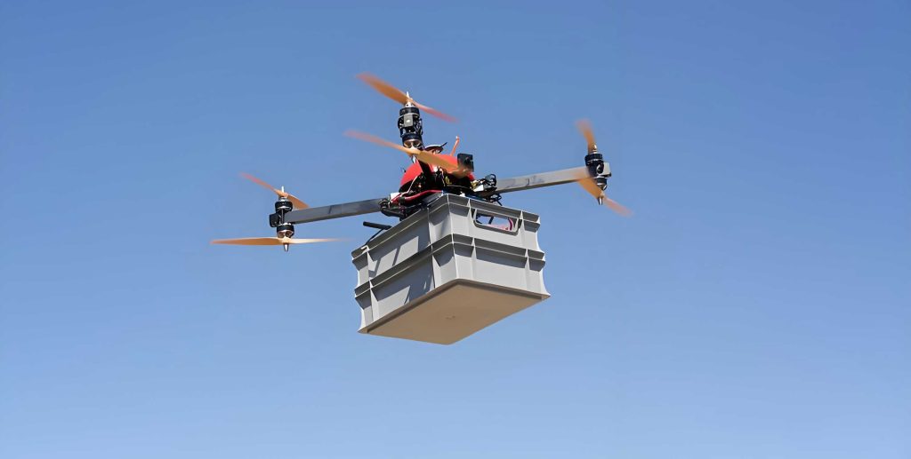
| Logistical Support & Delivery | Precision aerial delivery of critical supplies (medical kits, food, water) to isolated or inaccessible “island” areas. Payload capacity \( P_{max} \) is a key specification. | Constrained by destroyed road networks. Ground vehicle access is often impossible in the initial phases. | UAV drones sustain life in cutoff zones until ground routes can be established, bridging the critical survival gap. |
| Safety & Risk Assessment | Pre-entry assessment of structural stability (via LiDAR deformation analysis), hazardous gas detection, and safe route identification. | Requires personnel to enter potentially lethal environments for assessment, exposing them to collapse or toxic risks. | UAV drones act as force multipliers for safety, providing ground teams with pre-mission intelligence that minimizes exposure to danger. |
The true power, however, is unlocked not by UAV drones operating in isolation, but through deep, structured collaboration with ground rescue forces. This collaborative operation must be architected around four core pillars: objective, information, task, and command synergy. We can conceptualize the overall system effectiveness \( E_{sys} \) not as a simple sum but as a synergistic product influenced by these factors:
$$ E_{sys} = (O_c \cdot I_s \cdot T_a \cdot C_u)^\alpha $$
Where:
\( O_c \) = Objective Coherence factor (alignment on prime goal: saving lives)
\( I_s \) = Information Sharing efficiency (data latency, accuracy, fusion)
\( T_a \) = Task Alignment and sequencing quality
\( C_u \) = Unified Command and control effectiveness
\( \alpha \) > 1 is a synergy exponent, indicating that improvements in one area multiplicatively enhance others.
1. Objective Synergy: All entities—UAV drone teams and ground units—must share the unambiguous, paramount objective of maximizing life preservation and minimizing loss. Every action must be evaluated against this metric.
2. Information Synergy: This is the bedrock. Data from UAV drones (imagery, sensor feeds, models) must flow in real-time to ground command and teams. Conversely, ground observations, requests, and feedback must guide UAV drone tasking. This creates a unified “air-ground” information sphere, eliminating silos. The information flow rate \( F_{info} \) can be modeled as: $$ F_{info} = \frac{B \cdot \eta_{enc}}{L + \Delta t_{proc}} $$ where \( B \) is bandwidth, \( \eta_{enc} \) is encoding efficiency, \( L \) is latency, and \( \Delta t_{proc} \) is processing time. Minimizing latency and maximizing bandwidth are critical.
3. Task Synergy: Missions must be interdependently planned and dynamically adjusted. UAV drone reconnaissance directly dictates ground search vectors and priorities. Ground team needs (e.g., need for illumination, specific area scan) pull UAV drone support. This forms a closed-loop “Detect-Locate-Identify-Respond-Assess” (DLIRA) chain.
4. Command Synergy: A single, integrated command structure must exercise authority over both air and ground assets. Clear lines of authority, standardized communication protocols (e.g., using C2 software like ATAK integrated with UAV drone feeds), and joint planning cells are essential.
Translating this theoretical framework into practice requires a phased operational strategy. The collaboration model evolves through the disaster timeline, with distinct roles for UAV drones and ground forces in each phase. Table 3 outlines this phased application strategy, which I have developed and refined through analysis of past operations and simulations.
| Phase (Post-Earthquake) | Primary Goals | UAV Drone Core Tasks & Metrics | Ground Force Core Tasks | Synergistic Workflow & Enabling Tech/Formulas |
|---|---|---|---|---|
| Phase 1: Rapid Reconnaissance (0-6 hrs) | Obtain macro-situational awareness; identify primary access routes and large-scale casualty zones. | • Wide-area, grid-pattern aerial survey. • Key target imaging (roads, bridges, hospitals). • Metric: Area Coverage Rate \( ACR = \frac{A_{covered}}{A_{total}} \) per hour. • Real-time data downlink via satellite/4G/5G. |
• Mobilization and initial movement toward disaster zone. • Reporting initial observations via satellite phone. |
Workflow: UAV drones survey ahead. Data fused at command center to create initial damage assessment map and viable route network. This map guides ground convoy deployment, preventing them from entering blocked or hazardous routes. Tech: Rapid photogrammetry for 2D/3D mapping. Data fusion algorithms. |
| Phase 2: Precision Assessment & Search (6-24 hrs) | Fine-grained assessment of critical sites; detection and precise location of survivors. | • Low-altitude, multi-angle imaging of specific ruins. • LiDAR scanning for structural deformation. Deformation index \( D_I = \frac{\Delta x}{L} \) where \( \Delta x \) is displacement, \( L \) is original length. • IR-based life detection. Probability of Detection \( P_d \) as function of temperature contrast \( \Delta T \) and obscurance: $$ P_d \approx 1 – e^{-k \cdot \Delta T \cdot \sigma^{-1}} $$ (simplified model). • Generation of high-resolution 3D reality models. |
• Focused search and rescue in prioritized zones. • Structural assessment by engineers. • Medical triage and extraction. |
Workflow: UAV drone 3D models and thermal “hot spots” are streamed to ground team tablets/AR glasses. Rescuers see virtual overlay of rubble interior, plan breaching points. Upon IR detection, precise GPS coordinates (\( X_t, Y_t, Z_t \)) are sent to nearest ground team for confirmation and extraction. Tech: AR integration, GIS platforms, real-time coordinate transmission. |
| Phase 3: Communication Sustenance & Guided Action (24-72 hrs) | Maintain robust C2; guide complex rescues; sustain isolated survivors. | • Deployment as airborne communication relay (Cell-on-Light). Coverage area: \( Area_{cov} = \pi \cdot (R_{cov})^2 \). • Aerial illumination for night ops. • Loudspeaker broadcast for victim guidance. • Precision cargo delivery. Required delivery success rate can be modeled considering wind drift \( \delta_w \): $$ P_{deliver} = f( GPS_{acc}, \delta_w, P_{max}) $$ |
• Complex technical rescue operations. • Victim medical stabilization and transport. • Coordination of aid distribution. |
Workflow: UAV drone relay node ensures continuous comms for all ground teams. During night ops, UAV drone-mounted lights illuminate worksites. For isolated survivors, UAV drones first establish comms, then airdrop supplies. Ground teams request specific UAV drone support via the restored network. Tech: Tethered UAV drones for persistent station-keeping, AI-optimized drop trajectory calculation. |
| Phase 4: Dynamic Monitoring & Recovery Support (72+ hrs) | Monitor secondary hazards; assess long-term damage for reconstruction. | • Periodic monitoring of landslides, dam cracks, chemical plumes using multi-spectral sensors. • Change detection analysis using image differencing: $$ \Delta I(x,y) = I_{t2}(x,y) – I_{t1}(x,y) $$ • Creation of digital twin models for reconstruction planning. |
• Clearing operations and infrastructure repair. • Public health and sanitation efforts. • Community support and recovery logistics. |
Workflow: UAV drones conduct scheduled flights over high-risk areas. AI analyzes sequential imagery for changes (new cracks, water accumulation). Alerts are generated and sent to ground engineering teams for inspection or pre-emptive action. Data contributes to recovery master plans. Tech: Automated change detection algorithms, cloud-based digital twin platforms. |
The implementation of this collaborative model faces significant challenges. Interoperability between different UAV drone platforms and ground communication systems is a major hurdle. The cost-benefit analysis for large-scale UAV drone deployment must be formalized. Furthermore, the human factor—training both UAV operators and ground rescuers in joint procedures—is paramount. We can define a readiness metric \( R_{joint} \) for a rescue unit:
$$ R_{joint} = \frac{1}{N} \sum_{i=1}^{N} (T_{proficiency}^i \cdot E_{familiarity}^i) $$
Where \( N \) is the number of personnel, \( T_{proficiency} \) is individual technical skill, and \( E_{familiarity} \) is familiarity with joint UAV-ground protocols. Regular, realistic joint exercises are essential to maximize \( R_{joint} \).
In conclusion, the integration of UAV drones with ground rescue forces represents a quantum leap in earthquake disaster response capability. It transforms the operation from a sequential, ground-bound struggle into a simultaneous, multi-domain campaign. The synergy, as modeled, produces effectiveness greater than the sum of its parts. Moving forward, the focus must be on strengthening top-level design to establish unified command architectures, accelerating core technological breakthroughs in UAV drone endurance, sensor fusion, and AI-powered analytics, and rigorously standardizing collaborative workflows through doctrine and training. By doing so, we can construct a resilient and intelligent “air-ground” integrated defense line that stands ready to mitigate the devastating impact of earthquakes and save more lives in the unforgiving window of the golden hours.