
Accurately estimating the biomass of individual trees is a fundamental task in forest ecology and carbon cycle research. Traditional field-based methods are accurate but labor-intensive, time-consuming, and difficult to apply over large areas. The advent of Light Detection and Ranging (LiDAR) technology, particularly when mounted on Unmanned Aerial Vehicles (UAV drones), has revolutionized forest inventory by providing detailed, three-dimensional structural information rapidly and non-destructively. UAV drones equipped with LiDAR sensors can efficiently cover extensive and often inaccessible terrain, capturing high-density point clouds that describe the forest canopy’s exterior and interior structure with unprecedented detail. This data is a treasure trove for extracting key tree parameters, such as height and crown dimensions, which are strongly correlated with tree biomass.
However, a significant challenge remains in translating these detailed structural point clouds into accurate, tree-level biomass estimates. The process typically involves two main, often sequential, steps: individual tree segmentation and biomass model development. The first step, Individual Tree Detection (ITD), aims to correctly identify and isolate the point cloud belonging to a single tree from its neighbors. The accuracy of this segmentation directly limits the accuracy of the subsequent step—extracting structural metrics (predictor variables like tree height and crown diameter) and using them in allometric or statistical models to predict biomass. Errors in segmentation, such as under-segmentation (multiple trees grouped as one) or over-segmentation (one tree split into parts), propagate into erroneous feature extraction, leading to poor biomass estimation performance. Therefore, developing robust ITD algorithms is paramount for leveraging the full potential of UAV drones LiDAR for precise forest carbon accounting.
Numerous ITD algorithms have been developed, often categorized into raster-based (working on Canopy Height Models – CHMs) and point cloud-based methods. Raster-based methods, like local maximum filtering and watershed segmentation, are computationally efficient but can struggle in complex, multi-layered forests. Point cloud-based methods, such as spatial clustering, can better handle canopy overlap but may be computationally heavier. Recently, deep learning approaches have shown promise but require large, labeled datasets for training. Among traditional methods, the variable window filtering technique, which adapts the search window size based on local tree height, has been widely used due to its simplicity and effectiveness. However, its performance is highly dependent on the empirically defined height-to-crown-width relationship, which may not hold across different forest structures or species.
This study proposes a novel, two-stage methodology to enhance individual tree biomass estimation from UAV drones LiDAR data. The core innovation lies in synergistically combining a point cloud-based Canopy Convexity Extraction (CCE) algorithm for initial tree detection with a raster-based Multi-feature Crown Weighting (MCW) algorithm for refining crown delineation and feature extraction. The CCE algorithm operates directly on the normalized point cloud to identify potential tree apexes by detecting local maxima in three-dimensional convex hull structures, providing a robust initial treetop list. Subsequently, the MCW algorithm uses this list to guide a refined crown delineation process on a smoothed CHM. Instead of using a single, fixed relationship, MCW employs a weighting scheme that integrates multiple crown morphological features (e.g., local curvature, point density variance) to dynamically define the optimal crown boundary for each detected tree. This hybrid approach aims to improve segmentation accuracy in both simple and complex stands. The accurately segmented crowns then serve as the basis for extracting predictor variables. We further integrate these high-fidelity structural metrics into established biomass allometric models to generate individual tree biomass estimates. We hypothesize that this combined CCE-MCW framework will yield more accurate tree structural parameters and, consequently, more reliable biomass estimates compared to using either a standalone point-cloud method or a conventional CHM-based watershed approach.
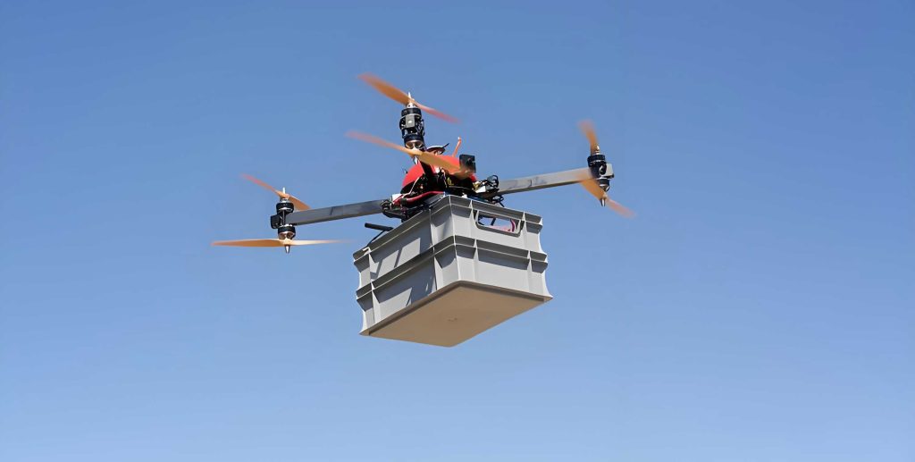
Methodological Framework: CCE and MCW Algorithms
Stage 1: Canopy Convexity Extraction (CCE) for Treetop Detection
The CCE algorithm is designed to identify tree apexes from the classified vegetation point cloud. The process begins with data normalization to create a Digital Terrain Model (DTM) and subsequently a normalized point cloud where the z-coordinate represents height above ground. The core of CCE involves analyzing the local spatial distribution of points to find convex “peaks” indicative of treetops.
For each point \(P_i(x_i, y_i, z_i)\) in the normalized cloud, we define a local spherical neighborhood with a search radius \(R_s\). Within this neighborhood, we calculate a 3D convex hull. The key metric for treetop detection is the “local convexity score” \(LCS_i\), which measures how much the point \(P_i\) protrudes relative to its neighbors within the hull. A simplified form of this score can be expressed as:
$$ LCS_i = z_i – \bar{z}_{hull} $$
where \(\bar{z}_{hull}\) is the average height of all points forming the convex hull facets that are below \(P_i\). A high \(LCS_i\) suggests \(P_i\) is a local peak. However, to avoid noise, we implement a normalized score \(NCS_i\):
$$ NCS_i = \frac{LCS_i}{\sigma_z} $$
where \(\sigma_z\) is the standard deviation of heights within the neighborhood. Candidate treetops are points where \(NCS_i\) exceeds a threshold \(T_{conv}\) and \(z_i\) is the maximum within a horizontal distance \(D_{min}\) (the minimum expected crown diameter). This process generates an initial set of potential tree locations \(\mathbf{T}_{CCE} = \{T_1, T_2, …, T_n\}\).
Stage 2: Multi-feature Crown Weighting (MCW) for Crown Delineation
The MCW algorithm uses the treetop list \(\mathbf{T}_{CCE}\) from CCE as seed points for crown segmentation on a smoothed Canopy Height Model (CHM). The CHM is generated by interpolating the highest points within grid cells. Unlike standard marker-controlled watershed segmentation, MCW does not assume a universal height-to-crown-width relationship. Instead, for each seed point \(T_k\), it evaluates candidate crown boundaries based on a weighted combination of features.
From the seed point, the algorithm explores outward in concentric rings. For each radial distance \(r\), it calculates a composite weight \(W_k(r)\) that determines the likelihood of \(r\) being the true crown radius. The weight integrates multiple features:
$$ W_k(r) = \alpha \cdot F_{height}(r) + \beta \cdot F_{gradient}(r) + \gamma \cdot F_{curvature}(r) + \delta \cdot F_{density}(r) $$
where:
- \(F_{height}(r)\): Normalized function of the CHM value at radius \(r\). It decreases as the height drops significantly from the treetop.
- \(F_{gradient}(r)\): Based on the average gradient of the CHM along the radial direction. A sharp negative gradient indicates a likely crown edge.
- \(F_{curvature}(r)\): Derived from the local surface curvature of the point cloud around the perimeter at \(r\). High curvature may indicate a boundary between crowns.
- \(F_{density}(r)\): Related to the variance in point density. A drop in density often signifies the transition from crown to gap.
- \(\alpha, \beta, \gamma, \delta\): Weighting coefficients that sum to 1, calibrated for the specific forest type.
The optimal crown radius \(R_k^{opt}\) for tree \(k\) is selected where \(W_k(r)\) is minimized (indicating the strongest combined evidence of a boundary):
$$ R_k^{opt} = \arg \min_{r} W_k(r) $$
The final crown polygon is then generated by applying a region-growing algorithm constrained by this optimal radius and the weighted feature map, leading to more accurate and adaptive crown delineations compared to fixed-window methods.
Biomass Estimation Workflow
Once individual trees are segmented using the CCE-MCW framework, key biometric parameters are extracted for each crown:
- Tree Height (\(H\)): The maximum height value within the delineated crown polygon.
- Crown Diameter (\(CD\)): Calculated as \(2 \times \sqrt{A_{crown}/\pi}\), where \(A_{crown}\) is the crown projection area.
- Crown Projection Area (\(CPA\)): The area of the delineated crown polygon.
These LiDAR-derived metrics serve as predictor variables in species-specific or generalized allometric models. A common power-law model form is:
$$ AGB = a \cdot (D^2H)^b $$
where \(AGB\) is the Above Ground Biomass, \(D\) is the diameter at breast height (DBH). Since DBH is not directly measurable from typical UAV drones LiDAR, it is often estimated from other metrics like \(CD\) or \(H\) using prior relationships. In this study, we use a model that directly incorporates LiDAR-measurable features:
$$ AGB_{est} = c \cdot H^{\gamma} \cdot CPA^{\lambda} $$
The coefficients \(c, \gamma, \lambda\) are derived from regression analysis using a sample of field-measured trees. The accuracy of the biomass estimates from the CCE-MCW method is compared against estimates derived from trees segmented using a standard Watershed algorithm and a point-cloud-only Clustering method.
Experimental Design and Results
Study Area and Data Acquisition
The study was conducted in a mixed temperate forest. Field data was collected for a sample of trees, including species, DBH, height, and biomass (calculated using destructive or standard allometric equations). LiDAR data was acquired using a UAV drones platform equipped with a high-precision LiDAR sensor. Flight parameters were set to ensure a high point density (>200 pts/m²). The raw point cloud was classified into ground and vegetation points, and a DTM and CHM were generated.
Performance of Individual Tree Detection
The accuracy of the CCE-MCW algorithm for tree detection and crown delineation was evaluated using standard metrics: Detection Rate (DR), Commission Error (CE), and Overall Accuracy (OA). The results were benchmarked against a standard Watershed (WS) algorithm and a point-cloud-based Clustering (PC) method.
| Forest Type | Method | Detection Rate (%) | Commission Error (%) | Overall Accuracy (%) |
|---|---|---|---|---|
| Simple Stand | Watershed (WS) | 92.3 | 8.1 | 85.2 |
| Simple Stand | Clustering (PC) | 88.7 | 12.5 | 78.2 |
| Simple Stand | CCE-MCW (Proposed) | 94.5 | 6.2 | 89.0 |
| Complex Stand | Watershed (WS) | 78.5 | 25.3 | 59.8 |
| Complex Stand | Clustering (PC) | 83.2 | 19.8 | 67.1 |
| Complex Stand | CCE-MCW (Proposed) | 86.7 | 14.5 | 74.8 |
The CCE-MCW method consistently outperformed the others, particularly in the complex stand where the adaptive multi-feature weighting of MCW proved crucial for separating overlapping crowns.
Accuracy of Extracted Tree Structural Parameters
The accuracy of height and crown diameter extraction directly impacts biomass models. The root mean square error (RMSE) and bias were calculated for these parameters against field measurements.
| Parameter | Method | RMSE | Bias |
|---|---|---|---|
| Tree Height (m) | Watershed (WS) | 1.23 | -0.32 |
| Tree Height (m) | Clustering (PC) | 1.15 | +0.18 |
| Tree Height (m) | CCE-MCW | 0.98 | +0.05 |
| Crown Diameter (m) | Watershed (WS) | 1.45 | +0.41 |
| Crown Diameter (m) | Clustering (PC) | 1.32 | -0.25 |
| Crown Diameter (m) | CCE-MCW | 1.08 | -0.09 |
The superior segmentation of CCE-MCW led to more accurate estimation of both height and crown dimensions, with lower RMSE and minimal bias.
Accuracy of Individual Tree Biomass Estimation
Finally, the extracted parameters (\(H\) and \(CPA\)) from each ITD method were fed into the biomass allometric model \(AGB_{est} = c \cdot H^{\gamma} \cdot CPA^{\lambda}\). The estimated biomass was compared to the reference field-based biomass. The performance was assessed using RMSE, relative RMSE (rRMSE), and the coefficient of determination (R²).
| Forest Type / Method | AGB RMSE (kg) | AGB rRMSE (%) | R² |
|---|---|---|---|
| Simple Stand | |||
| Watershed (WS) | 45.2 | 28.5 | 0.79 |
| Clustering (PC) | 48.7 | 30.1 | 0.75 |
| CCE-MCW | 38.1 | 24.0 | 0.85 |
| Complex Stand | |||
| Watershed (WS) | 68.9 | 41.3 | 0.62 |
| Clustering (PC) | 59.5 | 36.8 | 0.71 |
| CCE-MCW | 52.8 | 32.5 | 0.78 |
The CCE-MCW method achieved the highest biomass estimation accuracy (lowest RMSE/rRMSE, highest R²) in both forest types. The improvement was most pronounced in the complex stand, where the limitations of the other methods were more severe. This clearly demonstrates that the accuracy gain from improved segmentation directly translates into more reliable biomass estimates.
Discussion and Conclusion
The integration of Canopy Convexity Extraction (CCE) and Multi-feature Crown Weighting (MCW) presents a significant advance in processing UAV drones LiDAR data for forestry applications. The CCE algorithm’s strength lies in its ability to reliably identify tree apexes even in dense or irregular canopies by operating on the 3D geometry of the point cloud, reducing initial missed detections. The subsequent MCW algorithm effectively leverages this robust seed list, moving beyond the simplistic assumptions of traditional raster-based methods. By dynamically weighting multiple crown morphological features—height, gradient, curvature, and density—the MCW framework adapts to the local context of each tree. This allows for more precise crown boundary delineation in both isolated and interlocking crowns, which is the primary source of error in downstream metric extraction.
The experimental results validate the effectiveness of this hybrid approach. The CCE-MCW method consistently outperformed standard Watershed and point-cloud Clustering methods in Individual Tree Detection accuracy, especially in structurally complex stands. This superior segmentation fidelity directly resulted in the extraction of more accurate tree heights and crown diameters, as shown by lower RMSE values. Ultimately, these high-fidelity structural parameters fed into allometric models yielded individual tree biomass estimates with significantly improved accuracy (up to ~23% reduction in RMSE compared to Watershed in complex stands). This confirms our hypothesis that enhancing the ITD step through a sophisticated, adaptive algorithm has a profound positive impact on the final biomass estimation product.
The practical implications are substantial for forest management and carbon monitoring. UAV drones LiDAR surveys are becoming increasingly routine. The proposed CCE-MCW pipeline offers a robust, automated solution to convert these rich datasets into accurate tree-level inventories and carbon stock maps. While the method requires calibration of the weighting coefficients (\(\alpha, \beta, \gamma, \delta\)), this is a one-time process for a given forest type or ecozone. Future work could explore automating this calibration using machine learning or extending the feature set in the MCW algorithm to include spectral information from fused hyperspectral or multispectral data from UAV drones. In conclusion, the synergy of CCE and MCW algorithms provides a powerful and reliable methodological framework for advancing precise, individual tree-scale forest biomass estimation using ubiquitous UAV drones LiDAR technology.