With the rapid increase in the number of high-rise buildings, firefighting and rescue operations face unprecedented challenges. Traditional firefighting equipment, such as fire trucks and aerial ladders, often fail to perform quickly and effectively when dealing with fires in super-tall structures. Therefore, exploring new methods for fire rescue in high-rise buildings to improve efficiency and reduce casualties and property losses has become a critical issue. In response, I have conducted a series of studies on fire rescue in high-rise buildings, focusing on the application of multirotor drones. Multirotor drones, as emerging aerial vehicles, offer advantages such as low cost, minimal risk, ease of operation, rapid response, multifunctionality, and wide applicability, enabling them to complete tasks quickly and accurately in complex and changing environments. Specifically, in high-rise building fire rescue, multirotor drones can overcome the limitations of traditional equipment by reaching great heights and navigating complex environments. By carrying various firefighting devices and equipment, they achieve rapid and effective fire suppression and rescue.
In this article, I propose a fire rescue method for high-rise buildings based on multirotor drones. The approach involves using multirotor drones to scout fire conditions in high-rise structures. I select a multirotor drone platform with strong stability, long endurance, and high payload capacity to ensure stable flight and effective task execution in complex high-altitude environments. The multirotor drone is equipped with a high-resolution infrared thermal imager, which can accurately locate fire sources by detecting thermal radiation in smoke-filled environments, supplemented by a high-definition visible-light camera to provide real-time, clear images of the fire scene to the ground control station. Additionally, the multirotor drone integrates a GPS navigation module, an inertial navigation system, and obstacle avoidance radar to ensure safety and accuracy during flight. For communication, a high-bandwidth, low-latency wireless system is used to enable real-time data transmission and command control between the multirotor drone and the ground station. The specific rescue process is illustrated in the following sections.
The rescue process begins with navigation control of the multirotor drone to define the fire reconnaissance route. The infrared thermal imager mounted on the multirotor drone captures infrared thermal images of the fire, which are then processed to identify and locate the fire source. Based on this localization, the multirotor drone precisely targets and deploys fire extinguishing agents until the fire is extinguished, thereby achieving fire rescue in high-rise buildings using multirotor drones.
Fire Image Perception Using Multirotor Drones
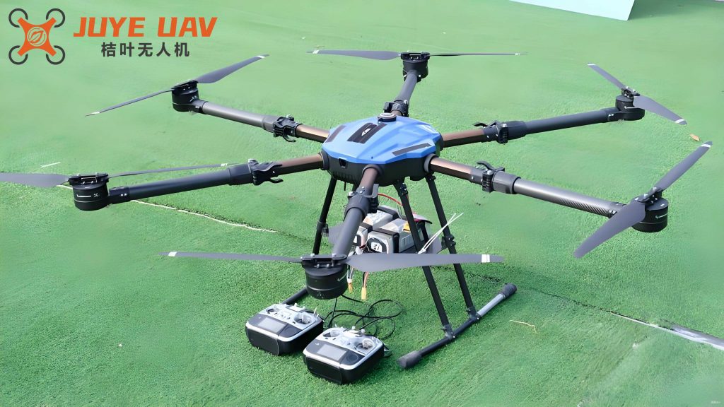
In high-rise building fire rescue scenarios, I employ multirotor drones to scout fire conditions, primarily by using the multirotor drone-mounted infrared thermal imager to collect and process on-site infrared thermal images, providing a basis for fire source localization. Given the complex internal spaces of high-rise buildings, including narrow local areas, high flexibility is required for the multirotor drone. Therefore, I select a six-rotor multirotor drone model KJHFA-A5F5A as the task execution platform. This multirotor drone offers exceptional stability, long endurance, and high payload capacity, maintaining stable flight attitudes in complex environments to ensure continuous and effective task execution. Simultaneously, the UJHFA-A4F45 infrared thermal imager is chosen for its high resolution, sensitivity, and wide temperature measurement range, enabling it to penetrate smoke and accurately capture infrared radiation from fire sources for precise localization. The infrared thermal imager is fixed to the multirotor drone body using a bracket, with the lens facing forward. During image acquisition, multirotor drone path navigation control is critical; since temperatures near the fire source are high, flying too close may cause the multirotor drone and imager to catch fire, hindering continued image perception. Thus, in multirotor drone navigation control, I treat signal strength as a key factor for assessing the multirotor drone state. When signal interruption occurs, it is considered a negative reward mechanism, encouraging the multirotor drone to prioritize areas with strong and stable signal coverage during path planning. Additionally, heat flow intensity serves as a penalty basis for multirotor drone path selection, designed as a negative reward mechanism to penalize behaviors that approach the fire source too closely. Based on this, I design an action selection strategy for the multirotor drone in high-rise building fire image perception. At time \( t \), the multirotor drone calculates the suggested action based on the current signal state and heat flow state, as shown in the following equation:
$$ s(t+1) = (\epsilon \cdot r | \eta \cdot v) + \gamma $$
where \( s(t+1) \) is the updated action of the multirotor drone at the next moment, \( \epsilon \) is the current signal strength, \( r \) is the immediate reward after executing the action, \( \eta \) is the current heat flow intensity, \( v \) is the immediate penalty after executing the action, and \( \gamma \) is the discount factor that measures the importance of future rewards for current decision-making. The value of \( \gamma \) is strictly limited between 0 and 1. When \( \gamma \) approaches 1, it gives higher weight to future rewards, meaning that decisions consider potential future rewards more than immediate gains, favoring long-term cumulative reward maximization, which is particularly effective for tasks requiring long-term planning. Conversely, when \( \gamma \) approaches 0, it focuses more on immediate rewards, meaning that actions yielding immediate benefits are preferred over potentially higher but delayed rewards. Thus, by adjusting \( \gamma \), I control the consideration of future rewards to adapt to different task requirements and environmental conditions. Through this control of the multirotor drone flight path, image information perceived by the infrared thermal imager along the path is uploaded to a computer via a USB network interface for subsequent fire source localization.
Fire Image Preprocessing
When using an infrared thermal imager to scan indoor fire environments, ambient temperature significantly affects the quality of infrared thermal images. Due to the highly uneven temperature distribution in indoor fire scenes, often accompanied by complex changes in media such as smoke and water vapor, these factors collectively impact the detection process of the infrared thermal imager, resulting in various noise components inevitably mixed into the captured images. These noise components may originate from multiple sources, including but not limited to fluctuations in ambient temperature, inherent detector noise, and interference during signal transmission. They appear as random distributions in the infrared thermal images, manifesting as minor fluctuations in image brightness or temperature values, thereby interfering with the accurate representation of the true thermal state of the indoor environment. To effectively enhance the quality of infrared thermal images and reduce the adverse effects of noise interference on subsequent analysis and judgment, I employ advanced nonlinear smoothing filter technology for processing. Specifically, nonlinear smoothing filter technology defines a nonlinear filter function or criterion to perform weighted processing on each pixel point in the image and its neighboring pixel values. During processing, the filter function dynamically adjusts the weights of different pixel points based on features such as differences or gradients between pixel values, thereby achieving effective noise suppression and preservation of image details. Assuming the obtained fire infrared thermal image is \( Y \), its probability density function can be expressed as \( f(Y) \), which describes the probability of occurrence of each gray value in the image. In this function, I focus on the probabilities corresponding to black noise points (representing darker, lower-temperature noise points) and white noise points (representing brighter, higher-temperature noise points), as shown in the following equation:
$$ f(Y) = \begin{cases} H & \text{for } e = w \\ K & \text{for } e = u \\ 0 & \text{otherwise} \end{cases} $$
where \( H \) is the distribution probability of black noise points in the image, \( K \) is the distribution probability of white noise points, \( e \) is the gray value of the fire infrared thermal image, \( w \) is the gray value of black noise points, and \( u \) is the gray value of white noise points. The gray median of the infrared thermal image represents the overall brightness level of the image, so I replace the gray values of black noise points in the image with the gray median of the infrared thermal image, while retaining white noise points in the image, to achieve the filtering function for fire infrared thermal images.
Targeted Fire Rescue Using Multirotor Drones
Building on the above, I use the relative temperature difference method to identify the fire source. In fire scenarios, objects undergo heat exchange, causing their temperatures to change. This change can be rapid or gradual, depending on the heat absorbed or released by the object and its physical characteristics. To quantify this change, I apply a specific temperature rise calculation formula, as shown in the following equation:
$$ c(i,j) = \rho(i,j) – g $$
where \( c(i,j) \) is the temperature rise at pixel \( (i,j) \) in the high-rise building fire image, \( \rho(i,j) \) is the temperature at pixel \( (i,j) \) in the high-rise building fire image, and \( g \) is the temperature of the environmental reference object in the fire image. Based on the temperature rise, I calculate the relative temperature difference for each pixel point in the fire infrared thermal image, as shown in the following equation:
$$ M(i,j) = \frac{c(i,j)}{v(i,j)} $$
where \( M(i,j) \) is the relative temperature difference at pixel \( (i,j) \) in the high-rise building fire image, and \( v(i,j) \) is the temperature difference at pixel \( (i,j) \) in the high-rise building fire image (temperature difference describes the physical quantity of temperature variation between two different objects or different parts of the same object). In heat transfer processes, heat always flows from higher-temperature objects or parts to lower-temperature ones until thermal equilibrium is reached. The magnitude of the temperature difference directly affects the rate and direction of heat transfer. A larger relative temperature difference indicates a greater temperature variation from the surrounding environment. Therefore, using equations (3) and (4), I calculate the relative temperature differences for all infrared thermal images, and the point with the highest relative temperature is identified as the fire source point. This point is designated as the multirotor drone fire extinguishing agent deployment point. Considering that the located fire source is in the image coordinate system, I convert coordinates to locate the fire extinguishing agent deployment point, as shown in the following equation:
$$ W(x,y) = [i,j] \cdot R + [i,j] \cdot T $$
where \( W(x,y) \) is the multirotor drone fire extinguishing agent deployment point, \( x \) and \( y \) are the horizontal and vertical coordinates of the deployment point, respectively, \( R \) is the rotation factor, and \( T \) is the translation factor. Based on this localization, the multirotor drone targets and deploys fire extinguishing agents until the fire is extinguished, thereby achieving targeted fire rescue in high-rise buildings using multirotor drones.
Experimental Validation
Experimental Preparation and Design
I conduct experiments to evaluate the performance of the proposed multirotor drone-based fire rescue method for high-rise buildings. Using a high-rise building as the test environment, the structure has 8 floors, a height of 36.14 meters, and 3 units per floor. I simulate fire rescue drills in this building, setting one fire source on each floor, and apply the proposed method for fire rescue. Based on practical considerations, the experiment utilizes one six-rotor multirotor drone and one infrared thermal imager. I configure the parameters of the multirotor drone and infrared thermal imager according to actual conditions, as summarized in the table below.
| Six-Rotor Multirotor Drone | Value | Infrared Thermal Imager | Value |
|---|---|---|---|
| Level Flight Speed (km/h) | 10 | Exposure Time (s) | 0.1 |
| Endurance Time (min) | 120 | Photography Mode | Timed Shooting |
| Flight Distance (km) | Radius 1.5 | Temperature Range (°C) | -20 to 200 |
| Positioning Mode | GPS | Image Resolution | 1080 |
| Flight Height (m) | 0-100 | Temperature Measurement Accuracy (°C) | ±1.5 |
| Flight Angle (°) | 0-360 | Pixel Size (μm) | 17.5 |
The six-rotor multirotor drone equipped with the infrared thermal imager collects fire images from the building, totaling 1200 images. These images are processed and analyzed to locate fire sources, and the multirotor drone carries fire extinguishing agents for targeted fire rescue.
Experimental Results and Discussion
Speed is a crucial evaluation metric for fire rescue effectiveness; faster rescue rates lead to reduced losses in high-rise building fires, lower harm to occupants, and better rescue outcomes. Therefore, I record the time consumed for fire rescue in high-rise buildings at different fire source locations. To ensure the reference value and academic significance of this experiment, I compare the proposed method with those from literature [1] and literature [2]. The table below presents the fire rescue time data for high-rise buildings using the three methods.
| Fire Source Location | Proposed Method | Literature [1] Method | Literature [2] Method |
|---|---|---|---|
| First Floor | 16.25 | 32.14 | 27.15 |
| Second Floor | 24.17 | 41.52 | 34.68 |
| Third Floor | 29.48 | 52.46 | 41.29 |
| Fourth Floor | 32.42 | 63.41 | 52.42 |
| Fifth Floor | 36.58 | 74.15 | 63.46 |
| Sixth Floor | 41.25 | 82.53 | 74.15 |
| Seventh Floor | 46.25 | 96.42 | 82.64 |
| Eighth Floor | 48.42 | 112.42 | 96.47 |
From the data in the table, it is evident that as the fire source location rises, rescue difficulty increases, and fire rescue time also increases. However, the proposed method results in relatively shorter rescue times. When rescuing fires on the eighth floor of the building, the time consumed is less than half that of the literature [1] and literature [2] methods, indicating the fastest rescue rate. The reason is that in high-rise building fire scenarios, the multirotor drone can quickly reach the fire scene and provide timely and accurate fire information to firefighters through various mounted equipment, assisting them in making more scientific rescue decisions. Simultaneously, the multirotor drone carries firefighting equipment, directly participating in fire suppression, effectively reducing the burden on firefighters and improving firefighting efficiency. Through this comparison and analysis, I demonstrate that the proposed method is more suitable for high-rise building fire rescue, and multirotor drones have excellent application effects in such scenarios.
Conclusion
In this article, I combine relevant literature to study the application of multirotor drones in high-rise building fire rescue, proposing a new rescue approach that effectively improves rescue efficiency and reduces the hazards of high-rise building fires, providing a reference for urban firefighting. However, I must also clearly recognize that the application of multirotor drones in high-rise building fire rescue still faces many challenges and limitations. For example, limited endurance, relatively small payload capacity, and the need to improve stability and anti-interference capabilities in complex environments all restrict the in-depth application of multirotor drones in high-rise building fire rescue. In the future, I will further strengthen research and innovation in multirotor drone technology, continuously enhancing its endurance, payload capacity, and stability to meet the higher demands of high-rise building fire rescue.