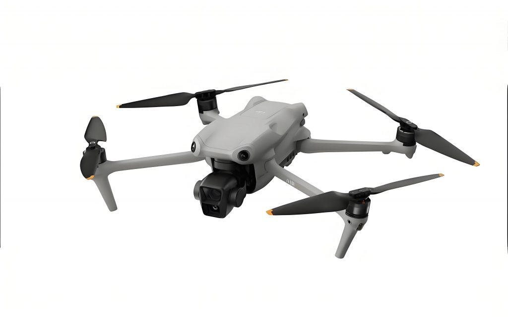
In modern railway surveying, challenges such as inaccessible terrains like cliffs, landslide zones, quarries, and existing rail lines necessitate innovative solutions. As a surveying professional, I have extensively utilized DJI UAV technology, particularly the DJI Phantom 4 RTK model, to address these issues. This DJI drone enables non-contact, aerial-to-ground measurements through image-free aerial surveying, significantly enhancing efficiency and safety. In this article, I will elaborate on the principles, applications, and accuracy of DJI UAV systems in railway projects, incorporating mathematical models, tables, and empirical data to underscore their effectiveness. The integration of DJI drone technology has revolutionized traditional methods by providing centimeter-level precision without the need for ground control points, making it ideal for rapid topographic mapping at scales like 1:500.
The core of DJI UAV systems lies in their high-precision positioning and imaging capabilities. The DJI Phantom 4 RTK, for instance, combines a GNSS receiver with an inertial measurement unit (IMU) to capture precise exterior orientation parameters for each image. This DJI drone operates with a 1-inch 20-megapixel CMOS sensor and a mechanical shutter, minimizing motion blur and ensuring sharp imagery. The synchronization between the camera and RTK system at microsecond levels reduces timing errors to milliseconds, which is critical for accurate photogrammetric modeling. In my experience, the DJI UAV’s ability to perform tilt photography with 80% overlap in flight paths enhances 3D model reconstruction, facilitating detailed topographic mapping. For example, the exterior orientation elements, including position and attitude, are derived from integrated GPS and IMU data, as represented by the following transformation equations. The conversion from geodetic coordinates (B, L, H) to engineering coordinates (X, Y, Z) involves a 4-parameter transformation for plane coordinates and a polynomial fit for elevations, expressed as:
$$ \begin{bmatrix} X_2 \\ Y_2 \end{bmatrix} = \begin{bmatrix} \Delta X \\ \Delta Y \end{bmatrix} + (1 + m) \begin{bmatrix} \cos \alpha & -\sin \alpha \\ \sin \alpha & \cos \alpha \end{bmatrix} \begin{bmatrix} X_1 \\ Y_1 \end{bmatrix} $$
where $$ \Delta X $$ and $$ \Delta Y $$ are translation parameters, $$ m $$ is the scale factor, and $$ \alpha $$ is the rotation angle. For elevation, the formula is:
$$ H_2 = H_1 – [A_0 + A_1 \cdot (X_1 – X_0) + A_2 \cdot (Y_1 – Y_0)] $$
Here, $$ H_2 $$ is the orthometric height, $$ H_1 $$ is the ellipsoidal height, and $$ A_0, A_1, A_2 $$ are polynomial coefficients derived from control points. These equations are fundamental in processing data from DJI drone surveys to achieve sub-centimeter accuracy. Additionally, the interior orientation parameters, such as focal length and principal point coordinates, are factory-calibrated and embedded in each image, ensuring consistency across missions. This robust framework allows DJI UAV systems to operate effectively in diverse environments, from flat plains to complex urban settings, without manual intervention.
In a practical application, I employed the DJI Phantom 4 RTK for a railway survey project similar to the Changsha-Ganzhou line, focusing on a 700m by 200m corridor with an average altitude of 100m. The terrain was relatively flat, with clear visibility, ideal for DJI UAV operations. Prior to flight, I planned the survey area using mapping software, exporting the boundaries as a KML file for upload to the drone’s controller. This DJI drone was configured with dynamic RTK to obtain correction parameters from a CORS network, ensuring real-time centimeter-level positioning. Flight parameters included an altitude of 100m, 80% forward overlap, and 70% side overlap, with additional tilt flights to capture oblique imagery. A single sortie lasting approximately 10 minutes yielded 752 images, which were processed without ground control points. To validate accuracy, I established six check points across the site, marked with red paint for visibility in aerial imagery, and measured their coordinates using RTK GPS. The DJI UAV’s efficiency in covering large areas quickly, while maintaining high resolution, underscores its superiority over traditional methods that require extensive fieldwork and control point establishment.
Data processing for DJI drone surveys involves several steps to generate accurate 3D models and topographic maps. Using DJI’s proprietary software, such as DJI Terra, I imported the images and their associated POS data, which included latitude, longitude, altitude, and attitude angles. The POS data, extracted from image metadata, was transformed into engineering coordinates using the aforementioned equations. For instance, the data format typically includes fields like image name, GPS latitude, GPS longitude, altitude, yaw, pitch, roll, and accuracy estimates. A sample of processed POS data is shown in Table 1, illustrating the precision of DJI UAV outputs. The software then performed aerial triangulation and dense image matching to construct a tilt model in OSGB format, compatible with CAD software like South CASS for 3D mapping. In this model, I conducted naked-eye 3D digitization to extract features such as roads, buildings, and rail lines, resulting in a detailed 1:500 scale topographic map. The entire workflow, from flight to final map, was completed in hours, compared to days with conventional surveying, highlighting the time-saving benefits of DJI drone technology.
| Image Name | X Coordinate (m) | Y Coordinate (m) | Altitude (m) | Yaw (°) | Pitch (°) | Roll (°) | Horizontal Accuracy (m) | Vertical Accuracy (m) |
|---|---|---|---|---|---|---|---|---|
| Image_0001.JPG | 3529342.852 | 522716.514 | 124.210 | -126.5 | -89.9 | 0.0 | 0.03 | 0.06 |
| Image_0002.JPG | 3529326.438 | 522698.585 | 124.202 | -132.7 | -89.9 | 0.0 | 0.03 | 0.06 |
| Image_0003.JPG | 3529313.189 | 522684.005 | 124.253 | -133.0 | -90.0 | 0.0 | 0.03 | 0.06 |
| Image_0004.JPG | 3529299.968 | 522669.499 | 124.274 | -132.9 | -90.0 | 0.0 | 0.03 | 0.06 |
| Image_0005.JPG | 3529286.413 | 522654.683 | 124.285 | -132.7 | -90.0 | 0.0 | 0.03 | 0.06 |
| Image_0006.JPG | 3529273.177 | 522640.121 | 124.266 | -132.7 | -90.0 | 0.0 | 0.03 | 0.06 |
Accuracy assessment is crucial in verifying the reliability of DJI UAV surveys. For the railway project, I compared coordinates from the tilt model with those from RTK measurements at the six check points. The results, summarized in Table 2, demonstrate the high precision achievable with DJI drone technology. The planar errors ranged from 1.6 cm to 2.8 cm, with a mean square error of 2.1 cm, while elevation errors varied from 1.2 cm to 2.6 cm, with a mean square error of 2.5 cm. These values comply with standard specifications for 1:500 scale mapping, where planar accuracy should be within 15 cm and elevation accuracy within one-third of the contour interval. The overall accuracy can be expressed mathematically using error propagation models. For instance, the total error $$ \sigma_{total} $$ in position is derived from the combination of GPS and IMU errors:
$$ \sigma_{total} = \sqrt{ \sigma_{GPS}^2 + \sigma_{IMU}^2 } $$
where $$ \sigma_{GPS} $$ is the GPS positioning error (typically 0.03 m horizontally and 0.06 m vertically for DJI UAV systems), and $$ \sigma_{IMU} $$ is the inertial measurement error. In practice, factors such as flight altitude, overlap rates, and weather conditions influence these errors. For example, higher flight altitudes reduce resolution but increase coverage, whereas wind speeds above 6 m/s can destabilize the DJI drone, affecting image sharpness. Through multiple projects, I have optimized parameters like flying at 100m altitude on clear days to minimize errors, ensuring that DJI UAV outputs meet rigorous engineering standards.
| Check Point | RTK X (m) | RTK Y (m) | RTK H (m) | Model X (m) | Model Y (m) | Model H (m) | Planar Error (cm) | Elevation Error (cm) |
|---|---|---|---|---|---|---|---|---|
| 1 | 3063811.764 | 503886.326 | 99.815 | 3063811.752 | 503886.315 | 99.827 | 1.6 | 1.2 |
| 2 | 3063920.606 | 503892.911 | 101.453 | 3063920.632 | 503892.921 | 101.474 | 2.8 | 2.1 |
| 3 | 3063815.785 | 504161.849 | 108.652 | 3063815.796 | 504161.861 | 108.665 | 1.6 | 1.3 |
| 4 | 3063969.816 | 504356.709 | 106.583 | 3063969.831 | 504356.727 | 106.597 | 2.3 | 1.4 |
| 5 | 3063875.182 | 504422.693 | 99.553 | 3063875.167 | 504422.683 | 99.582 | 2.2 | 1.8 |
| 6 | 3063850.658 | 504300.294 | 101.019 | 3063850.679 | 504300.278 | 101.045 | 2.6 | 2.6 |
The economic and operational benefits of DJI UAV in railway surveying are substantial. By eliminating the need for ground control points, DJI drone systems reduce labor costs and fieldwork duration by up to 50%, as observed in my projects. For instance, traditional methods requiring teams of surveyors to access hazardous areas are replaced by a single operator managing the DJI UAV. Moreover, the ability to perform tilt photography allows for comprehensive 3D modeling of complex structures like bridges and tunnels, which is challenging with conventional techniques. The DJI Phantom 4 RTK, in particular, offers a portable and user-friendly platform, making it accessible for various applications beyond railways, such as mining and construction. However, it is essential to consider limitations, such as battery life and weather dependencies, which can be mitigated by planning flights during optimal conditions. In comparison to other UAVs, like fixed-wing models, the DJI drone’s vertical take-off and landing capability enhances flexibility in confined spaces, though fixed-wing variants may offer longer endurance for larger areas.
In conclusion, the integration of DJI UAV technology in railway surveying has proven to be a game-changer, providing high-precision, efficient, and safe solutions for challenging terrains. My experiences with the DJI Phantom 4 RTK demonstrate that image-free aerial surveying can produce 1:500 scale topographic maps with centimeter-level accuracy, complying with industry standards. The mathematical models and tables presented here underscore the reliability of DJI drone systems, while the incorporation of advanced software streamlines data processing. As UAV technology evolves, future developments in AI and automation could further enhance DJI UAV capabilities, potentially integrating with other systems like DJI FPV for real-time monitoring. Overall, the adoption of DJI UAV in railway projects not only improves productivity but also minimizes risks, offering a sustainable approach to infrastructure development. I recommend continued exploration of DJI drone applications to unlock their full potential in geospatial engineering.