As a dedicated radio security specialist, I have witnessed firsthand the critical role that electromagnetic spectrum management plays in ensuring the success of large-scale public events, particularly drone shows and drone performances. These spectacular displays, which involve hundreds or even thousands of unmanned aerial vehicles operating in synchronized patterns, rely entirely on robust and interference-free radio communications. A single disruption in the command and control links or navigation signals could lead to catastrophic failures, turning a mesmerizing drone performance into a hazardous situation. My experiences in coordinating and executing radio security protocols for such events have underscored the necessity of meticulous planning, advanced technological deployment, and continuous real-time monitoring.
The fundamental challenge in safeguarding a drone show stems from the densely packed radio frequency environment. Each drone in a drone performance typically operates on specific frequencies for communication, GPS navigation, and sometimes live video feeds. When thousands of drones are airborne simultaneously, the electromagnetic spectrum becomes incredibly congested. My team and I must account for various potential sources of interference, including other licensed services, unlicensed devices, and even malicious jamming attempts. To systematically address these challenges, we employ a multi-faceted approach that includes pre-event electromagnetic surveys, dynamic frequency allocation, and persistent on-site surveillance. The goal is always to achieve zero-interference conditions, ensuring that every drone show proceeds flawlessly.
In my work, I often begin by conducting a thorough analysis of the radio frequency requirements for a planned drone performance. This involves collaborating with event organizers to understand the number of drones, their operational frequencies, and the geographic scope of the show. We then develop a comprehensive radio security plan that outlines monitoring strategies, contingency measures, and response protocols. A key component is the use of predictive modeling to assess potential interference scenarios. For instance, we might use formulas to estimate the probability of interference based on signal-to-interference ratios. One commonly applied model is the interference probability function: $$P_i = 1 – e^{-\lambda \cdot A \cdot T}$$ where \(P_i\) is the probability of interference, \(\lambda\) is the arrival rate of interfering signals, \(A\) is the affected area, and \(T\) is the duration of the drone performance. This helps us prioritize monitoring efforts in high-risk zones.
To illustrate the scale and complexity of our operations, I often refer to data from past drone shows. The following table summarizes key metrics from a series of drone performances we secured over a three-month period, highlighting the extensive resources deployed to maintain radio security:
| Drone Performance Event | Number of Drones | Monitoring Hours | Frequency Bands Monitored | Interference Incidents Resolved |
|---|---|---|---|---|
| Urban Night Show | 5,000 | 750 | UHF, GPS L1, 2.4 GHz | 3 |
| Record-Breaking Display | 11,787 | 1,200 | VHF, 5.8 GHz, GSM | 5 |
| Seasonal Festival | 4,500 | 600 | UHF, Wi-Fi, GLONASS | 2 |
| Cultural Celebration | 3,200 | 450 | VHF, LTE, 2.4 GHz | 1 |
As evident from the table, the record-breaking drone performance involving nearly 12,000 drones required the most intensive monitoring, with over 1,200 hours dedicated to ensuring radio security. This level of commitment is essential for managing the inherent risks of such a large-scale drone show. In addition to quantitative metrics, we also focus on qualitative aspects, such as the skill development of our team members. Through hands-on training and simulation exercises, we enhance our ability to quickly identify and mitigate radio frequency threats during a live drone performance.
One of the most effective strategies we employ is the establishment of a dedicated radio monitoring center that operates in tandem with mobile field units. This dual approach allows us to cover both the core area of the drone show and its periphery. The central monitoring station uses high-gain antennas and software-defined radios to scan a wide range of frequencies, while mobile teams conduct ground-level measurements to detect localized interference. The coordination between these units is governed by a real-time data sharing protocol, which ensures that any anomaly is promptly addressed. For example, during a major drone performance, we might detect an unauthorized transmission on a frequency critical for drone navigation. Using direction-finding techniques, the mobile team can locate the source within minutes and take corrective action, such as requesting the operator to cease transmission or applying filtering techniques.
The technical aspects of radio security for drone performances often involve complex signal processing algorithms. We frequently rely on mathematical models to optimize our monitoring efforts. For instance, the capacity of a radio channel in a congested environment can be approximated using Shannon’s theorem, adapted for drone communications: $$C = B \log_2 \left(1 + \frac{S}{N + I}\right)$$ where \(C\) is the channel capacity in bits per second, \(B\) is the bandwidth, \(S\) is the signal power from the drones, \(N\) is the noise power, and \(I\) is the interference power from other sources. This formula helps us determine the maximum data rate that can be reliably sustained during a drone show, guiding our frequency allocation decisions.
Moreover, we utilize statistical methods to predict and prevent interference. A Poisson distribution is often applied to model the occurrence of random interference events in a given time frame during a drone performance: $$P(k) = \frac{(\mu t)^k e^{-\mu t}}{k!}$$ where \(P(k)\) is the probability of \(k\) interference events occurring in time \(t\), and \(\mu\) is the average rate of interference. By estimating \(\mu\) from historical data, we can allocate resources more efficiently, ensuring that high-probability scenarios are covered proactively. This mathematical rigor is complemented by practical experience, as we continuously refine our models based on real-world observations from each drone show we secure.
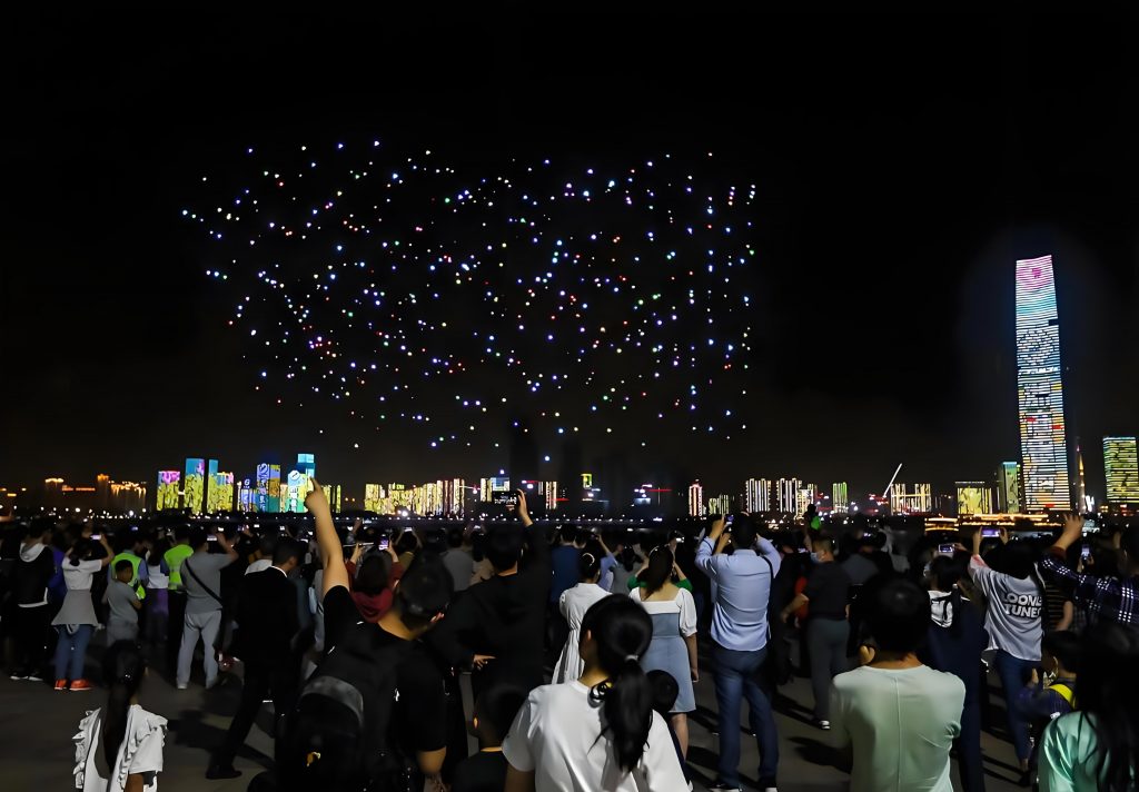
Visualizing the grandeur of a drone performance, such as the one depicted, reinforces the importance of our work. The intricate light patterns and precise formations are only possible through flawless radio communication. Any disruption could cause drones to collide or deviate from their programmed paths, posing safety risks to spectators and property. Therefore, our radio security measures extend beyond mere frequency monitoring to include comprehensive electromagnetic compatibility assessments. We evaluate all electronic devices used in the vicinity of the drone show, from public address systems to mobile network base stations, to ensure they do not emit spurious signals that could interfere with the drone performance.
In addition to technical measures, human factors play a crucial role in securing a drone show. My team comprises individuals with diverse expertise in radio engineering, network security, and emergency response. We conduct regular drills and tabletop exercises to simulate various interference scenarios, from accidental frequency overlaps to deliberate jamming attacks. These exercises follow a “practice-drill-improvement” cycle, where we identify gaps in our protocols and implement enhancements. For instance, we might discover that our response time to a certain type of interference is too slow, leading us to develop automated detection algorithms that trigger immediate countermeasures. This iterative process ensures that we are always prepared for the dynamic challenges of a live drone performance.
The economic and cultural significance of drone shows cannot be overstated. They attract large audiences, boost local tourism, and serve as platforms for artistic expression. As such, the demand for such events is growing, and with it, the complexity of radio security. My team has been involved in securing drone performances in diverse settings, from urban centers with dense radio traffic to remote areas with unique propagation characteristics. Each environment presents its own set of challenges. In cities, we must coordinate with numerous stakeholders, including broadcasters, emergency services, and telecommunications providers, to manage spectrum sharing. In contrast, rural drone shows might involve dealing with longer-range interference from distant transmitters, requiring us to deploy additional monitoring stations.
To manage the spectrum efficiently during a drone performance, we often use frequency planning tools that incorporate terrain data and propagation models. The Okumura-Hata model is one example we adapt for predicting path loss in urban and suburban areas: $$L_{urban} = 69.55 + 26.16 \log_{10}(f) – 13.82 \log_{10}(h_b) – a(h_m) + (44.9 – 6.55 \log_{10}(h_b)) \log_{10}(d)$$ where \(L_{urban}\) is the path loss in dB, \(f\) is the frequency in MHz, \(h_b\) is the base station antenna height, \(h_m\) is the mobile antenna height, \(a(h_m)\) is a correction factor, and \(d\) is the distance in km. By applying such models, we can identify potential dead zones or interference hotspots and adjust our monitoring strategy accordingly. This proactive approach is vital for maintaining uninterrupted communications during a critical drone show.
Another aspect of our work involves public education and awareness. Many interference incidents during drone performances stem from uninformed individuals using unauthorized devices, such as personal drones or wireless cameras, in the restricted area. To mitigate this, we engage in outreach campaigns before major events, informing the public about the importance of radio security and the legal consequences of causing interference. We also work closely with law enforcement to enforce no-fly zones and other restrictions around the drone performance venue. These efforts have proven effective in reducing accidental disruptions and enhancing overall safety.
Looking ahead, the evolution of drone technology promises even more ambitious drone shows, with larger formations, longer durations, and more complex choreography. This will inevitably place greater demands on radio security. My team is already exploring next-generation solutions, such as artificial intelligence-driven spectrum analysis and cognitive radio systems that can dynamically adapt to changing electromagnetic conditions. These technologies could autonomously detect and mitigate interference in real-time, reducing the reliance on human intervention. However, they also introduce new challenges, such as the need for robust cybersecurity measures to prevent hacking of the drone control systems. As we innovate, our core mission remains unchanged: to ensure that every drone performance is a safe and spectacular success.
In conclusion, the radio security of drone shows is a multifaceted discipline that blends advanced technology, rigorous planning, and skilled personnel. Through my experiences, I have seen how a systematic approach—rooted in mathematical modeling, real-time monitoring, and continuous improvement—can overcome the inherent risks of large-scale drone performances. The satisfaction of watching a flawless drone show, knowing that our efforts have contributed to its success, is a powerful motivator. As the popularity of these events continues to rise, I am committed to advancing the field of radio security, ensuring that the skies remain a canvas for breathtaking drone performances, free from the specter of electromagnetic interference.