
In recent years, the rapid development of smart grids has placed higher demands on the efficient operation and maintenance of distribution networks. As a key measure to improve power supply reliability, autonomous inspection using China UAV drone technology has attracted extensive attention. Although manual inspection is being gradually replaced by drone-based methods due to their flexibility and wide field of view, the high density of distribution lines and severe occlusion in complex environments still challenge the precision, stability, and real-time performance of current positioning and navigation systems. To address these issues, we propose an integrated optimization framework based on simultaneous localization and mapping (SLAM), deep learning, and advanced path planning, aiming to enhance the autonomous inspection capability and operational efficiency of China UAV drone in complex distribution line environments.
Task Analysis for China UAV Drone Distribution Inspection
Complexity of Distribution Line Environment and Flight Challenges
Distribution lines are widely deployed in diverse geographic settings such as urban areas, mountainous regions, and forests. The complex terrain and variable climate pose severe challenges for China UAV drone operations. In mountainous environments, the elevation of overhead lines changes significantly, and mountain occlusion often causes GPS signal loss. Rapid air currents in these areas make dynamic stability control difficult. In dense urban areas, tall buildings and concentrated power lines create strong electromagnetic interference that affects data link communication and navigation accuracy. Under extreme weather conditions (heavy rain, fog, haze), camera imaging quality degrades, reducing the effectiveness of visual positioning. Moreover, rapid changes in ambient lighting (direct sunlight, backlight, clouds, day/night transitions) cause feature detection algorithms to fail, leading to significant positioning errors and endangering flight safety. Path planning must therefore integrate localization, obstacle avoidance, and dynamic route adjustment, placing higher demands on algorithm robustness.
Comparison of Traditional Inspection and Vision-Based Systems
Traditional manual inspection relies on foot patrol or pole climbing, which suffers from low efficiency, missed detections, and personal safety risks. Helicopter inspection offers higher efficiency but is costly and restricted by airspace regulations. In contrast, vision-based China UAV drone inspection can perform millimeter-level measurements of line equipment accurately. By using visual positioning methods, the drone can perceive the environment in real time without relying solely on GPS. Combined with navigation algorithms that utilize visual information for dynamic path selection and obstacle avoidance, the system can adapt to complex environments. Furthermore, the vision system supports real-time data transmission and intelligent analysis, significantly improving defect identification efficiency and providing reliable data for smart grid operation.
Optimized Design of Visual Localization Algorithm
Improved Local Mapping Mechanism Based on ORB-SLAM
To overcome the limitations of conventional ORB-SLAM in distribution line inspection scenarios, we propose a hierarchical optimization framework. The front-end processing layer improves the FAST corner detection algorithm by adaptively adjusting the threshold: in regions with rich texture, a higher threshold is set to reduce feature point redundancy; in low-texture regions, a lower threshold ensures sufficient feature points. The BRIEF descriptor is enhanced by computing the main direction of feature points and rotating the coordinate system to achieve rotation invariance, thereby improving robustness against illumination and viewpoint changes. The local mapping layer avoids frequently inserting key frames when there is no feature motion or environmental structure change by considering regional complexity and designing adaptive key frame insertion frequency and selection criteria. The back-end optimization layer uses a sliding window to delete old key frames while retaining their constraint information through marginalization, and employs robust kernel functions to suppress the influence of outliers, thereby improving local map consistency and real-time performance.
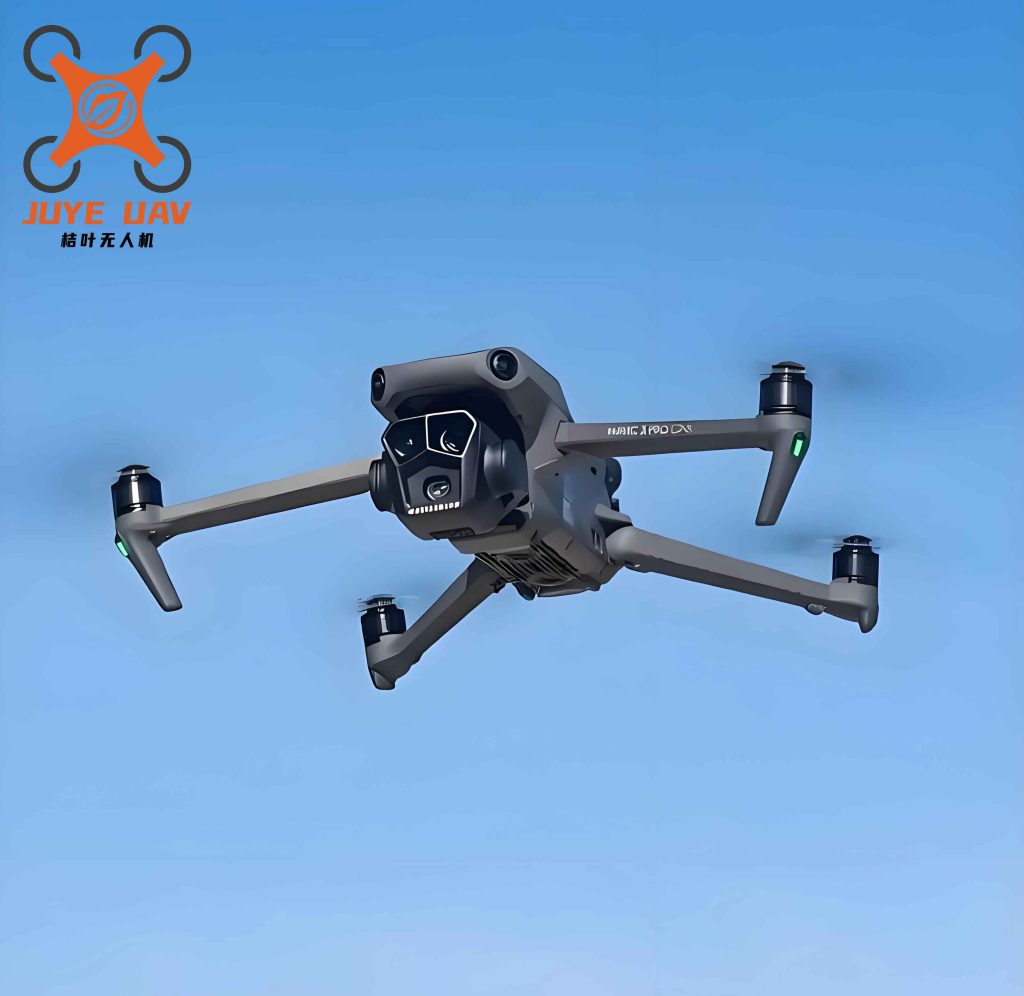
Multi-Source Visual Localization Model Combining Optical Flow and Feature Points
In complex distribution line inspection scenarios, a single visual localization method often fails to balance real-time performance and robustness. We therefore propose a multi-source visual localization model that combines optical flow and feature point methods. The Lucas-Kanade pyramid optical flow method tracks feature points in consecutive frames at high frame rate, providing dense motion estimation. It removes point pairs with large optical flow residuals to limit error accumulation. ORB feature matching between adjacent frames, constrained by the essential matrix computed via RANSAC, eliminates outliers and supplements points lost due to occlusion or motion blur. Finally, a weighted fusion model calculates the fused pose estimate as:
$$ T_{\text{fused}} = \alpha T_{\text{optical}} + (1 – \alpha) T_{\text{feature}} $$
where \( T_{\text{optical}} \) is the pose estimate from optical flow, \( T_{\text{feature}} \) is the pose from feature matching, and \( \alpha \) is dynamically adjusted based on the inter-frame texture richness to ensure robustness and stability.
Deep Learning Based Semantic Enhancement for Localization
To further improve anti-interference ability and environmental adaptability of visual localization for China UAV drone, we integrate deep learning based semantic enhancement into the traditional vision-based localization model. The system identifies semantic features related to the inspection targets (e.g., poles, insulators) and uses them to assist feature matching and loop closure detection. We construct a semantic consistency matrix \( S \in \mathbb{R}^{n \times m} \) defined as:
$$ S_{ij} = \frac{|C_i \cap C_j|}{|C_i \cup C_j|} $$
where \( C_i \) and \( C_j \) represent the sets of semantic regions in frames \( i \) and \( j \) respectively. A value close to 1 indicates high semantic similarity. This semantic assistance mechanism significantly enhances localization robustness under illumination changes, occlusion, and repetitive structures.
GPS and Visual Data Fusion Strategy
To overcome GPS signal degradation due to building occlusion and multipath effects in distribution line environments, we adopt a federated Kalman filter (FKF) framework. Two parallel filters process GPS observations (pseudo-range and Doppler) and visual observations (feature reprojection residuals). An information allocation strategy adaptively adjusts the weights based on the GPS geometric dilution of precision (GDOP) and visual localization residuals. When GPS accuracy deteriorates, visual weight increases; when GPS recovers, a map alignment algorithm quickly reinitializes the global position. If GPS fails completely, the system switches to pure visual SLAM with sliding window optimization to maintain historical trajectory constraints. To unify the asynchronous sensor timestamps, we use time-stamp interpolation and preintegration techniques. A re-initialization mechanism uses feature matching and pose graph optimization to align the visual map with the GPS coordinate system when GPS signals return, ensuring continuous state estimation. This FKF-based joint optimization achieves global consistency from GPS and local high-precision positioning from vision, effectively improving robustness in distribution line environments.
Optimized Path Planning for Inspection Navigation
Dynamic Task Node Generation Based on Topological Graph
In distribution line inspection missions, targets such as poles, insulators, joints, and tower bases are distributed irregularly over large and complex geographic areas. We construct a task topological graph using inspection target positions as nodes and spatial/functional relationships as edges. The mechanism for dynamic task node generation includes: data acquisition and target localization using high-resolution aerial images and GIS data; analysis of environmental factors (airflow, interference, terrain) to assign node weights; dynamic priority sorting considering task urgency, mission time window, and drone battery life; flexible flight plan adjustment; and incremental update capability for adding/removing nodes or modifying edges during execution. This structure enables the China UAV drone to adapt to real-time changes, such as newly discovered fault points or canceled tasks, thereby improving system reliability and efficiency.
Hybrid Path Planning Algorithm Combining A* and Improved RRT
To achieve efficient global path generation and flexible local obstacle avoidance, we adopt a hybrid architecture combining the A* algorithm and an improved rapid exploring random tree (RRT) algorithm. The global path planning module uses heuristic A* on the task topological graph to quickly generate an initial path with good completeness and controllability. For local optimization in complex environments with narrow spaces or temporary obstacles, the improved RRT algorithm enhances sampling density and direction guidance by introducing a directional vector that biases the tree growth toward the target. A path contraction mechanism removes redundant branches to avoid superfluous detours. The sampling process integrates energy consumption models, flight stability, and spatial reachability to ensure smooth and flyable paths. Finally, Bezier curves smooth the combined A*-RRT path into a dynamically executable trajectory that respects flight control constraints.
Real-Time Obstacle Avoidance Strategy Using Depth Maps and Point Clouds
During flight, sudden obstacles such as construction vehicles, temporary cranes, or birds must be detected and avoided rapidly. We develop a real-time obstacle avoidance module that fuses depth images and point cloud data. Depth cameras provide forward depth maps for obstacle modeling, and inter-frame optical flow changes identify potential dynamic obstacles. An onboard LiDAR generates point clouds for high-quality 3D reconstruction. After spatial registration, a local 3D grid map is built for obstacle avoidance planning. The dynamic window approach (DWA) evaluates all feasible velocity and acceleration combinations, considering obstacle avoidance cost, energy consumption, and path smoothness as multi-objective optimization criteria. The algorithm updates the path in real time to achieve rapid avoidance while respecting flight constraints. To reduce false alarms due to perception uncertainty, a Kalman filter predicts obstacle trajectories, and IMU/visual state fusion maintains effective and responsive avoidance behavior.
System Experimental Validation
Experimental Platform Setup
To validate the feasibility and operability of the proposed visual localization and navigation algorithms for China UAV drone, we built a complete experimental platform consisting of: a multi-sensor drone equipped with camera, LiDAR, GPS module, and IMU; a ground control station (GCS) for remote monitoring; and a data processing server for real-time computation of visual data and environment information. The flight control system executes the custom navigation algorithm, and the processing server computes drone position and waypoints in real time. Accurate working space topology is built from aerial survey maps and GIS data, ensuring precise, relevant, and continuous image information for stable system operation.
Experimental Design
We designed both indoor and outdoor tests. Indoor experiments simulated distribution line environments under controlled conditions (varying lighting, occlusion, and other factors) to test the stability of the visual localization algorithm and path planning performance, evaluating adaptability to complex environments. Outdoor experiments were conducted in typical distribution line settings with real targets (lines, poles, insulators, joints) under variable terrain and wind conditions. The China UAV drone followed the task topological graph to perform inspection, collecting navigation and localization data to assess path planning efficiency, accuracy, energy consumption, and obstacle avoidance performance. Key metrics included localization accuracy, path planning efficiency, and obstacle response time.
Field Test Results Analysis
Field test results demonstrated that the optimized visual localization algorithm achieved high precision in complex environments, as shown in Table 1. From the data, the average localization error was below 5 cm, which is more stable than traditional ORB-SLAM. The hybrid A* and improved RRT algorithm reduced average path length by 12% and flight time by 10%, improving endurance efficiency. Real-time obstacle avoidance using depth maps and point clouds achieved a response time of 0.28 s, ensuring flight safety.
| Metric | Optimized Algorithm | Traditional Algorithm |
|---|---|---|
| Average Localization Error | 4.8 cm | 9.5 cm |
| Average Path Length | 450 m | 510 m |
| Average Flight Time | 18 min | 20 min |
| Obstacle Avoidance Response Time | 0.28 s | 0.5 s |
The optimized algorithm not only improved localization precision but also enhanced the overall inspection efficiency of the China UAV drone. The reduction in path length and flight time directly contributes to extended battery life and higher coverage per mission. The faster obstacle response time significantly reduces collision risk, especially in cluttered distribution line corridors.
Conclusion and Future Work
In this paper, we systematically optimized visual localization and navigation algorithms for China UAV drone inspection of distribution lines. By improving the ORB-SLAM mechanism and fusing multi-source information, we achieved higher positioning accuracy under challenging conditions. The innovative topological graph and hybrid path planning algorithm, combined with depth-based dynamic obstacle avoidance, significantly enhanced the drone’s adaptability and inspection efficiency in complex environments. Experimental results confirm that the optimized algorithm reduces localization error, shortens flight paths, and improves real-time obstacle response. Future work will focus on multi-modal sensor fusion (e.g., thermal imaging, LiDAR reflectivity) and edge computing deployment to further enhance the intelligence and lightweight nature of the China UAV drone inspection system, making it more suitable for large-scale smart grid operation and maintenance.