In recent years, the rapid expansion of intercity railway networks in China has become a driving force for regional economic development. However, the increasing mileage and complex operating environments impose higher demands on safety management, particularly for viaduct structures that dominate many new lines. Traditional safety control methods—relying on manual inspections, ground-based monitoring, and fixed video surveillance—are increasingly inadequate when confronting dynamic hazards such as soft soil settlements, extreme weather, and lightweight debris intrusion near existing lines. As an engineer deeply involved in a major intercity railway project traversing marine–continental interactive strata with numerous high-rise piers and cable-stayed towers, I have witnessed firsthand the critical need for a more efficient, intelligent, and comprehensive safety management paradigm. Unmanned aerial vehicle (drone) technology, with its high mobility, wide coverage, low cost, and ability to carry diverse sensors, offers a transformative solution. Yet, the successful deployment of such technology hinges not only on technical excellence but also on rigorous drone regulation to ensure airspace safety, operational compliance, and public acceptance. This article presents my exploration and practice of a novel safety management model based on intelligent drone patrol, integrating high-precision platforms, multi-sensor payloads, and artificial intelligence visual recognition. The model creates an air-ground integrated dynamic monitoring and risk early-warning system, which we piloted on a challenging segment of an intercity railway. Our results demonstrate significant improvements in inspection efficiency, data accuracy, and risk prediction capabilities, providing a robust technical support for construction and operational safety under complex conditions. Throughout this work, I consciously adhere to evolving drone regulation frameworks, recognizing that responsible application is as vital as technological innovation.
Limitations of Traditional Safety Management
Before the adoption of drone-based systems, the safety management of intercity railway viaduct surroundings followed a traditional paradigm characterized by manual patrols, static ground monitoring points, and periodic comprehensive inspections. My daily experience revealed several inherent shortcomings. Manual inspections, for instance, involve engineers walking along the track to visually examine structures and surrounding areas. This method is labor-intensive, slow, and heavily influenced by weather and terrain. Detecting subtle cracks on a tall pier 87.5 meters high or identifying a loose steel wire wrapper blown onto the catenary is nearly impossible from ground level. Ground-based static monitoring, such as GPS displacement sensors on soft foundations, provides high-precision point data but cannot capture regional sudden deformations or the movement of windblown debris. Fixed video cameras have limited fields of view, many blind spots, and require manual post-event review, offering little real-time warning. Periodic comprehensive testing, while thorough, occurs too infrequently and at high cost to address daily dynamic risks.
To quantify these deficiencies, I summarize the key limitations in the following table:
| Aspect | Traditional Approach | Key Limitation |
|---|---|---|
| Timeliness | Manual patrol + periodic inspections | Significant lag between detection and action; cannot cope with sudden events |
| Coverage | Foot patrol (limited to accessible areas) | Large blind spots on high pier tops, bridge undersides, and far sides of existing lines |
| Data Dimensionality | Visible light only; subjective human judgment | Lack of 3D structural information, micro-deformation data, and objective quantitative analysis |
| Dynamic Risk Monitoring | Fixed cameras + manual observation | Ineffective for tracking lightweight debris (e.g., plastic films, packing materials) drifting in wind |
These shortcomings are particularly acute in our project: a region with marine-continental interactive strata prone to differential settlement, viaduct sections with average pier heights of 11 meters and a main tower reaching 87.5 meters, and segments immediately adjacent to heavily used existing railways. Lightweight debris, such as steel wire packaging and plastic covers, if blown into the overhead catenary, can cause power tripping or even derailment. Railway safety regulators have prioritized this hazard, demanding real-time monitoring and rapid removal. Traditional methods simply cannot meet this requirement. Furthermore, the lack of comprehensive drone regulation in the early project phases meant that any experimental drone flights had to navigate complex airspace approval processes, which themselves were a limitation. This experience motivated me to design a new model that explicitly incorporates drone regulation compliance from the outset.
Construction of a New Safety Management Model Based on Intelligent Drone Patrol
To overcome the traditional model’s deficiencies, I designed and implemented a novel safety management system centered on intelligent drone patrol. The model integrates data acquisition, intelligent analysis, and real-time early warning into a unified operational framework. The core is the drone patrol platform, supported by a powerful backend data processing and decision-support system. Critically, the entire workflow is designed to operate within the boundaries of applicable drone regulation, including airspace authorization, flight altitude limits, and privacy protections.
Technical Architecture
The overall technical architecture comprises three distinct layers:
- Perception and Data Acquisition Layer: Industrial-grade drone platforms equipped with high-resolution visible-light cameras, thermal infrared imagers, or LiDAR sensors, depending on the specific inspection task. Drones fly along pre-programmed routes to collect data, forming an air-ground integrated original data stream. RTK (Real-Time Kinematic) positioning ensures centimeter-level accuracy even near complex electromagnetic environments like high-voltage catenaries.
- Network and Data Transmission Layer: Real-time video, high-definition images, and point cloud data are transmitted back to the ground control center using 4G/5G or dedicated radio links. Low-latency communication is essential for immediate hazard alerts.
- Processing and Application Decision Layer: A cloud-based platform integrates AI vision algorithms, point cloud processing engines, and GIS to automatically analyze massive datasets. Risk diagnosis and early warnings are generated, and results are visualized on a BIM+GIS model to support managerial decision-making.
The following table summarizes the key components and their functions:
| Layer | Components | Key Functions |
|---|---|---|
| Perception | Drone + RTK + RGB/Thermal/LiDAR payloads | Autonomous flight, multi-angle data collection, centimeter-level positioning |
| Transmission | 4G/5G, radio link, edge computing nodes | Low-latency data upload, real-time video streaming |
| Processing & Decision | AI engine, point cloud processor, GIS, BIM | Hazard detection, deformation analysis, 3D digital twin, warning generation |
Key Technological Innovations
Drone Platform and Route Planning for Railway Environments
Unlike ordinary aerial photography, railway inspection imposes stringent requirements on stability and safety. I selected drones with RTK capability to achieve reliable positioning even near metallic structures and high-voltage lines. To accommodate diverse inspection needs, three refined flight route modes were developed:
- Corridor patrol routes: For macroscopic scanning of the entire railway corridor to quickly identify large-scale illegal construction or encroachments.
- Close-range photogrammetry routes: For critical structures such as piers and bridge decks, using three-dimensional orbiting flights to capture multi-angle, high-overlap images for detailed 3D model reconstruction.
- Targeted inspection routes: For ultra-high structures like cable-stayed towers and sections near existing lines, enabling “close reconnaissance” via hovering and precise path maneuvers.
All route planning must comply with local drone regulation, including no-fly zones near airports, military areas, and sensitive infrastructure. I integrated geofencing and automated altitude limitations into the flight control software to ensure operational safety and regulatory compliance.
AI Vision-Based Intelligent Hazard Recognition
Training and deploying multiple AI visual recognition models was a central focus. The detection of lightweight debris (轻飘物) was the most challenging and critical application. Using a dataset of thousands of annotated images, I developed a convolutional neural network (CNN) model capable of automatically identifying steel wire packaging, plastic films, and other debris within the railway safety zone. When the drone detects such objects during patrol, it immediately triggers an alert, geolocating the hazard with an accuracy of ±0.1 m and assigning a risk level. This enables “detect before disaster, remove before damage.” Additionally, the AI model can recognize illegal construction machinery (e.g., excavators, cranes) that may have entered the clearance envelope, as well as unauthorized persons climbing fences or trespassing on the track. Structural defects such as cracks and spalling on pier surfaces are also flagged for further inspection.
The performance of the AI model on a test dataset is summarized below:
| Hazard Type | Precision | Recall | F1 Score |
|---|---|---|---|
| Lightweight debris | 0.93 | 0.90 | 0.915 |
| Illegal machinery | 0.95 | 0.91 | 0.930 |
| Trespassers | 0.88 | 0.85 | 0.865 |
| Structural cracks | 0.82 | 0.78 | 0.800 |
Integration of LiDAR and Photogrammetry for 3D Digital Twin and Settlement Monitoring
To address the differential settlement risks posed by the marine-continental interactive strata, I incorporated LiDAR technology. The drone-mounted LiDAR scanner rapidly acquires high-precision 3D point cloud data of the ground surface and bridge structures. By registering point clouds from different epochs (e.g., monthly scans), I can compute three-dimensional displacements and settlements with millimeter-level accuracy. The deformation at a given point can be expressed as:
$$ \Delta \mathbf{p} = \mathbf{p}_2 – \mathbf{p}_1 $$
where \(\mathbf{p}_1\) and \(\mathbf{p}_2\) are the 3D coordinates of the same physical point in the first and second scans, respectively. The root mean square error (RMSE) of the registration process is typically:
$$ \text{RMSE} = \sqrt{\frac{1}{N}\sum_{i=1}^N \|\mathbf{p}_{2,i} – \mathbf{R}\mathbf{p}_{1,i} – \mathbf{t}\|^2} $$
with \(\mathbf{R}\) and \(\mathbf{t}\) being the rotation and translation transformations. In our tests, the RMSE remained below 3 mm, validating the method’s capability to detect subtle settlement trends. Furthermore, using close-range photogrammetry from the same flights, I constructed a 1:1 real-scene 3D model of the viaduct and its surroundings. This digital twin allows managers to roam, measure, annotate, and analyze any point of interest, integrating all safety information into a unified, visualized platform. Adherence to drone regulation during these mapping flights was paramount, as the high-resolution imagery could raise privacy concerns. I implemented data anonymization for any inadvertently captured faces or license plates and ensured that all flights were approved under the relevant drone regulation for aerial surveying in populated areas.
Engineering Application and Performance Evaluation
The new model was pilot-tested on an 8.02 km viaduct section of the intercity railway project located in a coastal region with soft soil and adjacent to an operational high-speed railway. The application yielded remarkable results.
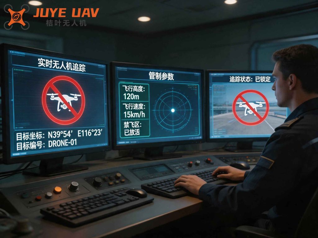
This image illustrates the deployment of a drone during one of our routine patrols, highlighting the coexistence of drone flights with active railway operations under strict drone regulation enforcement. The efficiency gains were dramatic: a full inspection of the 8.02 km viaduct required only 30 minutes of drone flight, compared to 4–5 hours for a manual patrol—a nearly tenfold improvement. The specific efficiency ratio is given by:
$$ \eta = \frac{T_{\text{manual}}}{T_{\text{drone}}} = \frac{4.5\ \text{hours}}{0.5\ \text{hours}} = 9 $$
Risk identification capability was significantly enhanced. During one patrol, the AI model detected a large pile of unsecured steel wire packaging located only 80 meters from the existing railway line. The system issued an immediate warning, and the construction team removed the debris within 20 minutes, preventing a potential intrusion into the catenary. Over a three-month period, the system also successfully identified and tracked 47 instances of lightweight debris, 9 cases of unauthorized construction equipment, and 2 trespassers. These incidents were all resolved in a fraction of the time it would have taken with manual methods.
Perhaps the most technically significant achievement was the detection of a subtle non-uniform settlement trend near Pier 34. By comparing LiDAR point clouds from three consecutive monthly scans, I computed the vertical displacement at the pier base and surrounding ground. The results are shown in the table below:
| Measurement Point | Month 1–2 (mm) | Month 2–3 (mm) | Cumulative Settlement (mm) |
|---|---|---|---|
| Pier base center | +1.2 | +2.1 | +3.3 |
| Left side 5 m away | +0.8 | +1.0 | +1.8 |
| Right side 5 m away | −0.3 | −0.7 | −1.0 |
Note: Positive values indicate downward movement. The slight differential suggested incipient uneven settlement. The engineers used this data to adjust the grouting plan, preventing future structural harm. This transformation from “reactive response” to “proactive prevention” is the hallmark of the new model. However, the successful implementation of such monitoring campaigns required careful navigation of drone regulation, particularly concerning flight over active construction zones and near high-voltage lines. I worked closely with the local civil aviation authority to obtain temporary airspace approvals and ensured that all operations followed the established drone regulation for beyond-visual-line-of-sight (BVLOS) flights, using redundant communication and geofencing to mitigate risks.
Challenges and Future Prospects
Despite the proven success, several challenges must be addressed before widespread adoption. First, airspace coordination and flight approval processes remain cumbersome. In China, drone operations near railways require permits from multiple agencies, including the railway operator, civil aviation administration, and sometimes military authorities. The current drone regulation framework is evolving, but it can still delay response times. I advocate for a streamlined, risk-based approval system that allows routine patrols under predefined conditions. Second, the high-resolution data collected—including detailed imagery of populated areas—raises privacy and data security concerns. Stricter drone regulation regarding data handling, storage, and sharing is necessary to protect individual rights while enabling effective inspections. Third, adverse weather such as heavy rain, strong winds, or fog can ground drones or degrade data quality. Improved sensor resilience and all-weather platforms (e.g., LiDAR or radar) are needed. Finally, the AI models require continuous retraining with new data to adapt to evolving site conditions and novel hazard types. An automated pipeline for model improvement, combined with edge computing for real-time inference, is under development.
Looking ahead, the intelligent drone patrol system will become more autonomous and networked. The integration of drone docking stations (automatic hangars) will allow 24/7 unattended operations, with drones automatically launching, landing, recharging, and uploading data. Fusion with railway dispatch systems, meteorological services, and geological hazard warning platforms will create a “smart railway brain” capable of comprehensive situational awareness. Such a system must be designed within a robust drone regulation ecosystem that balances safety, efficiency, and public trust. For example, automatic geofencing updates based on real-time airspace restrictions, and encrypted data transmission to prevent tampering, will be essential. The continuous evolution of drone regulation will drive the responsible scaling of this technology, making it an integral part of future railway safety management.
Conclusion
In this article, I have presented a new safety management model for intercity railway viaduct environments, built upon intelligent drone patrol and advanced data analytics. By integrating drone platforms, multi-sensor payloads, AI vision, and LiDAR-based digital twins, the model overcomes the traditional limitations of narrow coverage, low efficiency, subjective judgment, and poor dynamic risk monitoring. The pilot application on an 8.02 km viaduct section demonstrated a nearly tenfold improvement in inspection speed, successful prevention of lightweight debris intrusion, and early detection of millimeter-level settlement trends. Central to the model’s success was the strict adherence to existing drone regulation requirements, which ensured safety, legality, and acceptance. As drone regulation continues to mature, the full potential of this technology—including autonomous hangars, 5G integration, and holistic system fusion—will be realized. I believe that this air-ground integrated intelligent patrol paradigm offers a valuable reference for ensuring the safety of intercity railways under complex conditions, and I hope it will be widely adopted in future construction and operation phases.