In recent years, the rapid advancement of drone technology and the reduction in cost of lightweight composite materials have led to an explosive growth in the number of unmanned aerial vehicles (UAVs). Drones are now widely used in various fields such as aerial photography, agriculture, disaster rescue, power line inspection, and film production. During the COVID-19 pandemic, drones have also been employed for automated transport of emergency medical supplies, aerial broadcasting for public guidance, large-scale temperature screening, real-time traffic control, and disinfection. However, the proliferation of drones has also exposed significant regulatory loopholes and potential threats to national security and public order. As a researcher working closely with public security authorities, I have witnessed firsthand the urgent need to strengthen drone regulation. Leveraging big data technology to enhance detection accuracy and platform control is a critical step toward harnessing the benefits of drones while mitigating the risks. This paper explores the hazards of inadequate drone regulation, the challenges in detection and control, and proposes improvement measures based on big data, with a focus on integrating advanced algorithms and data processing frameworks.
1. Introduction
Drones, also known as unmanned aerial vehicles (UAVs), are aircraft operated by radio remote control or onboard programmed control systems without a pilot on board. Their versatility and efficiency have made them indispensable in both military and civilian domains. However, the same characteristics that make drones useful—small size, low altitude, and slow speed—also make them difficult to detect and regulate. The lack of systematic drone regulation has led to incidents such as drones flying into the White House, carrying radioactive material into the Japanese Prime Minister’s residence, flying over Parisian landmarks, and forcing civil aircraft to abort landings. These events have heightened public concern and demand for effective drone regulation. Without proper controls, drones can be misused for espionage, terrorism, smuggling, and invasion of privacy. Therefore, it is imperative to develop robust detection and management technologies that can address these challenges. In this paper, I discuss the key hazards of inadequate drone regulation, the technical and legal obstacles we face, and how big data can be leveraged to improve “no-fly” detection and regulation systems.
2. Hazards of Inadequate Drone Regulation
Inadequate drone regulation poses serious threats to national security, public safety, civil aviation, and individual rights. The table below summarizes the main categories of hazards.
| Hazard Category | Description | Examples |
|---|---|---|
| National Security | Drones equipped with high-resolution cameras, directional microphones, or signal jammers can conduct surveillance on government buildings, military bases, and critical infrastructure. They can also intercept communications. | Surveillance of military installations; remote eavesdropping |
| Public Safety | Drones can be used to carry explosives, chemical agents, or contraband. They may be weaponized for terrorist attacks or criminal activities such as drug trafficking and smuggling. | Drone-borne bomb threats; smuggling of illegal items |
| Civil Aviation Interference | Drones flying near airports or in flight paths can collide with manned aircraft, causing delays, diversions, or catastrophic accidents. | Drone sightings near runways; forced flight cancellations |
| Drone Self-Induced Accidents | Due to unstable systems or poor obstacle avoidance, drones can crash into buildings, power lines, or people, causing property damage or injury. | Drone crashes during flights; loss of control |
| Privacy and Nuisance | Drones can invade private property, record individuals without consent, and generate noise pollution in residential areas. | Illegal filming; noise complaints |
These hazards underscore the critical need for comprehensive drone regulation. Without a robust framework, even well-intentioned users can cause harm, while malicious actors exploit the lack of oversight.
3. Challenges in Drone Detection and Regulation
Effective drone regulation faces multiple obstacles, ranging from legal gaps to technical limitations. Below I outline the primary difficulties we encounter.
3.1 Lack of Systematic Legal Framework
Although some regulations have been issued (e.g., China’s 2017 Civil Unmanned Aircraft Real-Name Registration Regulation), the legal system remains fragmented. There is no unified authority responsible for drone regulation, leading to ambiguous responsibilities across different government departments. For instance, it is unclear which agency should approve flight requests, monitor compliance, or enforce penalties. Moreover, penalties for “black flights” (unauthorized drone operations) are often too lenient—typically warnings, fines, or short-term detention—to deter repeat offenders. The lack of clear liability allocation also complicates cases where the owner and operator are different persons or entities.
3.2 Weaknesses in Real-Name Registration Platforms
The real-name registration requirement is a positive step, but its implementation is flawed. While major drone manufacturers like DJI comply, many low-cost drones sold online (priced as low as 100–200 yuan) bypass registration. These inexpensive drones often lack quality control and may malfunction mid-flight, posing additional risks. Furthermore, even registered users may operate illegally, and the cost of obtaining a pilot license (up to 10,000 yuan for training) discourages casual hobbyists from complying, leaving a large population of unregulated operators.
3.3 Technical Difficulties in Drone Detection
Drones are inherently difficult to detect due to their “low, slow, small” (LSS) characteristics. Their small size, low flight altitude, and slow speed make them blend into backgrounds on radar and optical sensors. Traditional detection methods have significant limitations:
- Radar: Ground clutter and small radar cross-section (RCS) of drones reduce detection probability.
- Electro-optical/Infrared (EO/IR): Small drones are easily obscured in cluttered backgrounds; infrared can be affected by thermal variations.
- Radio frequency (RF) detection: Abundant electromagnetic interference and weak drone signals lower interception success.
The table below compares these methods.
| Technology | Advantages | Disadvantages |
|---|---|---|
| Radar | Long range, all-weather | Poor detection of small drones; ground clutter; high cost for high-resolution systems |
| EO/IR | Visual confirmation; can be combined with AI | Limited range; affected by weather and lighting; small targets easily missed |
| RF Detection | Passive detection; can identify drone model | Interference from other RF sources; requires known signal signatures |
To overcome these limitations, we must integrate multiple sensors and leverage big data analytics and deep learning to improve detection accuracy and real-time performance. This is where my research focuses.
4. Improvement Measures for Drone Detection and Regulation
Based on the analysis above, I propose a three-pronged approach: strengthening legal frameworks, building a big data-driven regulation platform, and enhancing detection algorithms using deep learning and distributed data processing.
4.1 Strengthening the Legal and Regulatory Framework
First, we need a comprehensive law that clearly defines the legal status of drones (e.g., as aircraft under civil aviation law or as movable property under property law) to assign liability. The law should establish a single lead agency for drone regulation, clarify flight approval procedures, and impose stricter penalties for violations. Classification should consider not only weight but also altitude, purpose, and operational area. For instance, drones used over sensitive zones (government buildings, airports) should require enhanced authorization.
4.2 Big Data-Driven Platform for Drone Regulation
Leveraging big data technology, we can build an integrated cloud platform that combines real-name registration, flight plan submission, weather data, no-fly zone maps, and emergency response. Such a platform would enable real-time tracking of drone positions and operator locations. By collecting and analyzing historical flight data, user behavior patterns, and manufacturer information, we can identify anomaly events such as unauthorized flights near restricted areas. The platform can automatically send alerts and trigger countermeasures. The key components are:
- Data ingestion from heterogeneous sources (radar, RF, cameras, manual reports).
- Distributed storage and processing using Hadoop/Spark frameworks.
- Machine learning models for predictive analytics (e.g., predicting flight trajectories based on historical patterns).
- Real-time visualization and decision support for law enforcement.
This approach significantly enhances the efficiency of drone regulation by providing actionable intelligence.
4.3 Big Data-Enhanced Detection for No-Fly Zones
To improve detection accuracy in no-fly zones, we combine deep learning object detection algorithms with big data processing pipelines. The general workflow is as follows:
- Video Acquisition: Real-time surveillance cameras capture video streams from critical areas (airports, military bases).
- Preprocessing: Use algorithms like Selective Search to generate candidate regions, then apply Non-Maximum Suppression (NMS) to eliminate redundant boxes. This reduces the computational load.
- Feature Extraction: Deep neural networks extract high-level features from each candidate region. Popular architectures include Faster R-CNN (good accuracy), YOLO (real-time), and SSD. For small drone targets, we can use multi-scale feature pyramids or depth-enhanced forests (gcForest).
- Classification and Localization: The network outputs a bounding box and confidence score. Thresholding filters out false positives.
- Data Processing with Big Data Tools: Use Storm for real-time stream processing and Hadoop for batch analysis of historical data to fine-tune models.
The detection pipeline can be formulated as follows. Let I be an input video frame, and B be the set of candidate bounding boxes. The detector D maps I to a set of detected drones O with associated confidence scores c:
$$ O = D(I) = \{(x_i, y_i, w_i, h_i, c_i) \mid c_i \ge \tau \} $$
where τ is a confidence threshold. The loss function during training typically combines classification loss and regression loss:
$$ \mathcal{L} = \frac{1}{N} \sum_{i} \left( \mathcal{L}_{\text{cls}}(c_i, c_i^*) + \lambda \mathcal{L}_{\text{reg}}(t_i, t_i^*) \right) $$
Here, c* is the ground-truth class label, t* represents the true bounding box coordinates, and λ balances the two losses.
To handle the small size of drone targets, we can use a feature pyramid network (FPN) that combines low-level and high-level features for multi-scale detection. The improvement in recall and precision can be summarized in the table below.
| Algorithm | mAP@0.5 | FPS | Recall for Small Targets |
|---|---|---|---|
| Faster R-CNN (ResNet-50) | 78.2% | 7 | 0.65 |
| YOLOv5 | 74.5% | 45 | 0.58 |
| SSD (MobileNet) | 71.3% | 62 | 0.52 |
| FPN + YOLOv5 | 79.8% | 38 | 0.71 |
From the table, we see that using a feature pyramid network with YOLOv5 improves recall for small targets without sacrificing too much speed. In practice, we can deploy an ensemble of algorithms and fuse outputs using a voting mechanism to further boost accuracy.
Another important aspect is the use of big data distributed processing to handle massive video streams. The diagram below illustrates the end-to-end system architecture (note: the figure is inserted here for reference).
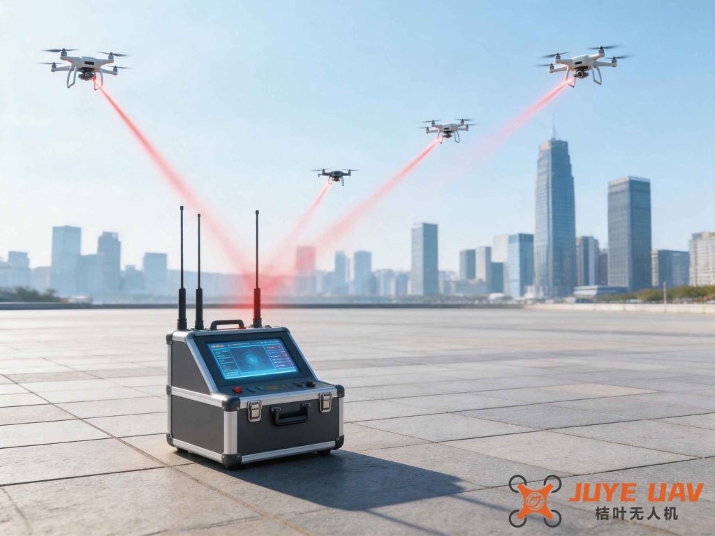
In this architecture, video streams from multiple cameras are ingested into a Kafka message queue. Spark Streaming consumers process the data in real time, while Storm handles event triggers. Detected drone events are stored in HDFS for later model retraining. This loop ensures continuous improvement of detection algorithms.
Let us denote the detection pipeline as a function F that takes raw video frames V and produces a set of alerts A:
$$ A = F(V) = \bigcup_{k=1}^{K} D_k(V) \quad \text{subject to} \quad \text{metadata matching} $$
where Dk represents different detection modules (radar, RF, camera). The final decision is made by fusing outputs from all modules, weighted by their confidence scores. This multi-modal fusion drastically reduces false alarms.
5. Conclusion
Effective drone regulation is a multidimensional challenge that requires synergy between law, technology, and data analytics. In this paper, I have highlighted the critical hazards of inadequate drone regulation, the obstacles we face in detection and control, and proposed concrete improvement measures centered on big data. By building a unified regulation platform that integrates real-name registration, flight monitoring, and predictive analytics, we can significantly enhance the ability to prevent “black flights”. Moreover, combining deep learning object detectors with distributed data processing frameworks like Hadoop and Storm improves detection accuracy in no-fly zones, especially for small, low-flying drones. The use of feature pyramid networks and multi-sensor fusion further boosts recall and reduces false positives. As drone numbers continue to grow explosively, it is imperative that we adopt such data-driven approaches to ensure public safety and national security. Future work should focus on real-world deployment, adaptive learning from new drone models, and international cooperation on drone regulation standards.