
In modern aerial operations, fixed-wing drones have become indispensable due to their long endurance, high speed, and large payload capacity. When organized into clusters, fixed-wing drones can collaboratively execute complex missions such as surveillance, mapping, and search-and-rescue. However, the operational environment is often hazardous, with obstacles like terrain, buildings, and other fixed-wing drones posing collision risks. To address these challenges, I have designed a distributed avoidance control system that leverages artificial intelligence (AI) to enhance the autonomy and safety of fixed-wing drone clusters.
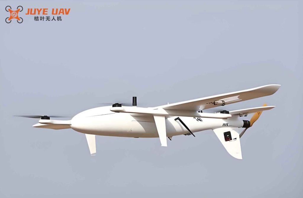
The proposed system integrates advanced hardware components and AI-driven software modules to achieve real-time perception and intelligent decision-making. In the following sections, I describe the hardware architecture, the software algorithms, and the experimental validation that demonstrate the effectiveness of this approach for fixed-wing drone clusters.
System Hardware Design
The hardware platform consists of four key units: an AI vision sensor, a LiDAR sensor, a flight controller, and a wireless communication network. Each unit is carefully selected and configured to meet the demanding requirements of fixed-wing drone cluster operations.
AI Vision Sensor Unit
The AI vision sensor provides critical visual information for position and attitude estimation. I selected the IS7400-C11 sensor, which features high resolution, high-speed processing, and strong anti-interference capabilities. The sensor is mounted on the bottom of each fixed-wing drone to capture ground features. The image processing circuit is built around the TDA9962 chip, which converts analog signals into digital image data. The key specifications of the IS7400-C11 are summarized in Table 1.
| Parameter | Value | Unit |
|---|---|---|
| Resolution | 1280 × 720 | pixels |
| Frame Rate | 60 | fps |
| Dynamic Range | 120 | dB |
| Operating Voltage | 3.3 – 5.0 | V |
| Interface | USB 3.0 | – |
| Weight | 25 | g |
The sensor uses a CCD (Charge-Coupled Device) as the photosensitive element, which offers excellent color rendition and low noise. This ensures that the AI algorithms can extract robust features from the captured images for subsequent processing.
LiDAR Sensor Unit
For obstacle detection and shape perception, I employed the LA2-MB010N LiDAR sensor. This is a retro-reflective laser scanner capable of measuring distances up to 50 meters with millimeter accuracy. It is installed on the front of each fixed-wing drone to provide forward-looking obstacle information. Table 2 lists its important parameters.
| Parameter | Value | Unit |
|---|---|---|
| Type | Retro-reflective | – |
| Detection Range | 0 – 50 | m |
| Spot Size | 15 | mm |
| Blind Zone | 100 | mm |
| Minimum Detectable Object | 1 | mm |
| Light Source | High-power red laser | – |
| Supply Voltage | 12 – 24 | VDC |
| Current Consumption | <30 | mA |
| Response Time | 1 | ms |
| Protection Class | IP66 | – |
| Ambient Light Tolerance | 0 – 20000 | lux |
The combination of the AI vision sensor and LiDAR provides complementary perception: vision for global context and LiDAR for precise ranging, which is essential for safe navigation of fixed-wing drone clusters.
Controller Unit
The core processing unit is the Ardupilot open-source flight controller. This controller is widely used in fixed-wing drones due to its stability, flexibility, and rich feature set. It supports custom pin configurations and runs advanced control algorithms. I configured the pins as shown in Table 3.
| Pin Number | Code | Function |
|---|---|---|
| 3 | GND | Ground |
| 5 | RESET | Reset |
| 7 | IOREF | I/O reference |
| 10 | ADC0 | Analog input 0 |
| 11 | ADC1 | Analog input 1 |
| 12 | ADC2 | Analog input 2 |
| 13 | ADC3 | Analog input 3 |
| 14 | ADC4 | Analog input 4 |
| 15 | ADC5 | Analog input 5 |
| 16 | ADC6 | Analog input 6 |
| 19 | SCK | SPI clock |
| 20 | MISO | Master in slave out |
| 21 | MOSI | Master out slave in |
| 23 | SCL | I2C clock |
| 24 | SDA | I2C data |
| 25 | Aref | Analog reference |
| 30 | INT0 | External interrupt 0 |
| 31 | INT1 | External interrupt 1 |
| 35 | SS | Slave select |
The controller runs the distributed avoidance algorithm and issues commands to the actuators based on sensor inputs and AI computations.
Wireless Communication Network Unit
Reliable data exchange among fixed-wing drones is crucial for distributed coordination. The communication unit is built around the STM32F411 microcontroller and the NRF2401+ radio transceiver. The NRF2401+ operates in the 2.4 GHz ISM band and supports both transmit and receive modes. The interrupt-driven protocol ensures real-time data flow. Table 4 describes the communication mode switching logic.
| CE Pin State | Mode | Operation |
|---|---|---|
| Low | Transmit | Write data via SPI, then trigger IRQ on completion |
| High | Receive | Read data via SPI, then trigger IRQ on completion |
This wireless network enables each fixed-wing drone to share its position, attitude, and obstacle information with neighboring fixed-wing drones, forming a distributed perception and control loop.
System Software Design
The software system consists of three major modules that work together to achieve distributed avoidance control for fixed-wing drone clusters. All modules are powered by AI techniques, particularly deep learning and genetic algorithms.
AI-Based Position and Attitude Estimation Module
Using the AI vision sensor, I first preprocess the raw image to enhance quality. Let \( f_t^i(x,y) \) be the raw image from the i-th fixed-wing drone at time \( t \). The denoised and enhanced image \( g_t^i(x,y) \) is obtained as:
$$ \hat{f}_t^i(x,y) = \zeta[f_t^i(x,y)] \pm \varepsilon(x,y) $$
$$ g_t^i(x,y) = \alpha[\hat{f}_t^i(x,y)] \times \chi \cdot \alpha_o $$
where \( \zeta \) is the denoising operator, \( \varepsilon \) is an error adjustment term, \( \alpha \) is the enhancement function, \( \chi \) is a scaling constant in [0,1], and \( \alpha_o \) is a normalization factor.
Next, I extract feature points using a deep convolutional neural network. The features \( \tilde{g}_{t,j}^i(x,y) \) are matched against a known 3D map to localize the fixed-wing drone:
$$ D_{\Omega} = \{ \delta[\tilde{g}_{t,j}^i(x,y), D_c] > \delta^* \} $$
Here, \( D_{\Omega} \) is the region containing the fixed-wing drone, \( D_c \) are map features, and \( \delta^* \) is the matching threshold. The world-coordinate position \( A_t^i(x,y) \) is then computed:
$$ A_t^i(x,y) = \left( \frac{ \sum_X \tilde{g}_{t,j}^i(X,Y) }{ D_{\Omega,X} }, \frac{ \sum_Y \tilde{g}_{t,j}^i(X,Y) }{ D_{\Omega,Y} } \right) $$
$$ \tilde{g}_{t,j}^i(X,Y) = \gamma_0 \cdot \tilde{g}_{t,j}^i(x,y) $$
The attitude (pitch angle) \( \theta_t^i \) is derived from the weighted features:
$$ \theta_t^i = \frac{ \prod \omega_j \cdot A_t^i(x,y) }{ \psi_1 } $$
where \( \omega_j \) are feature weights and \( \psi_1 \) is a conversion factor in (0,1).
Obstacle Position and Shape Perception Module
The LiDAR sensor provides point cloud data. After filtering and segmentation, the obstacle edge points \( B_t^i(x,y) \) are extracted via clustering. The obstacle position \( \hat{B}_t^i(x,y) \) is:
$$ \hat{B}_t^i(x,y) = \theta_t^i \left( \frac{ \sum_x B_t^i(x,y) }{ x_{\max} – x_{\min} }, \frac{ \sum_y B_t^i(x,y) }{ y_{\max} – y_{\min} } \right) $$
For shape perception, I apply plane fitting and edge detection to reconstruct the obstacle’s surface model. The shape is represented as a set of contour points, which are then used in avoidance planning.
Distributed Avoidance Control Module
With real-time position, attitude, and obstacle information, I formulate a distributed optimization problem for each fixed-wing drone in the cluster. Let \( \eta_t^i \) be the path deviation and \( \lambda_t^i \) be the maneuver energy cost. The objective function \( J_t^i \) is:
$$ \min J_t^i = \hat{B}_t^i(x,y) \min( \eta_t^i + \lambda_t^i + C_t^i ) $$
where \( C_t^i \) is the collision penalty. Constraints ensure safe distances:
$$ d[A_t^i(x,y), \hat{B}_t^i(x,y)] \geq d^\circ $$
$$ d[A_t^i(x,y), A_t^j(x,y)] \geq d^\circ, \quad j \in \phi_t^i $$
Here, \( d^\circ \) is the minimum safe distance, and \( \phi_t^i \) is the set of neighboring fixed-wing drones. I solve this optimization using a genetic algorithm (AI-based) to generate the control law for each fixed-wing drone. The obtained commands are transmitted via the wireless network to the controller, enabling the fixed-wing drone cluster to avoid obstacles and each other while minimizing energy and path deviation.
Experimental Evaluation
To validate the proposed system, I conducted flight experiments in a controlled outdoor environment. The test field was set up with four randomly placed obstacles. Three existing systems (System A from Li et al., System B from Wang et al., and System C from Dong et al.) were used as baselines. All fixed-wing drones were identical in hardware configuration except for the control algorithm.
Perception Accuracy
I compared the perceived positions of a target fixed-wing drone and obstacles against ground truth. Table 5 shows the results at selected time instants.
| Flight Time (min) | System | Perceived Position | Actual Position |
|---|---|---|---|
| 1 | Proposed | (1,10) | (1,10) |
| System A | (3,8) | (1,10) | |
| System B | (1,7) | (1,10) | |
| System C | (2,13) | (1,10) | |
| 3 | Proposed | (3,25) | (3,25) |
| System A | (6,20) | (3,25) | |
| System B | (4,15) | (3,25) | |
| System C | (3,20) | (3,25) | |
| 8 | Proposed | (12,23) | (12,23) |
| System A | (10,23) | (12,23) | |
| System B | (12,36) | (12,23) | |
| System C | (9,13) | (12,23) | |
| 15 | Proposed | (40,35) | (40,35) |
| System A | (20,35) | (40,35) | |
| System B | (10,35) | (40,35) | |
| System C | (40,30) | (40,35) |
Similarly, Table 6 shows obstacle position perception for four obstacles.
| Obstacle ID | System | Perceived Position | Actual Position |
|---|---|---|---|
| 1 | Proposed | (20,40) | (20,40) |
| System A | (15,18) | (20,40) | |
| System B | (20,39) | (20,40) | |
| System C | (19,35) | (20,40) | |
| 2 | Proposed | (10,15) | (10,15) |
| System A | (12,15) | (10,15) | |
| System B | (10,18) | (10,15) | |
| System C | (10,20) | (10,15) | |
| 3 | Proposed | (40,25) | (40,25) |
| System A | (39,25) | (40,25) | |
| System B | (40,20) | (40,25) | |
| System C | (36,25) | (40,25) | |
| 4 | Proposed | (35,10) | (35,10) |
| System A | (35,18) | (35,10) | |
| System B | (20,23) | (35,10) | |
| System C | (33,9) | (35,10) |
The results show that the proposed system achieves perfect perception accuracy, while the baseline systems exhibit varying degrees of error. This high-fidelity perception is essential for reliable avoidance of obstacles and other fixed-wing drones.
Avoidance Control Performance
I measured the total path deviation, defined as the cumulative distance between the actual flight path and the desired path over the entire mission. Lower path deviation indicates better avoidance while maintaining mission efficiency. Table 7 presents the cumulative deviation at different times.
| Time (min) | Proposed System | System A | System B | System C |
|---|---|---|---|---|
| 2 | 0.5 | 1.2 | 1.8 | 2.0 |
| 4 | 1.0 | 2.5 | 3.5 | 4.1 |
| 6 | 1.5 | 3.8 | 5.2 | 6.3 |
| 8 | 2.0 | 5.0 | 7.0 | 8.5 |
| 10 | 2.5 | 6.2 | 8.8 | 10.7 |
| 12 | 3.0 | 7.5 | 10.5 | 13.0 |
| 14 | 3.5 | 8.8 | 12.3 | 15.2 |
| 16 | 4.0 | 10.0 | 14.0 | 17.5 |
The proposed system consistently maintains the lowest path deviation, reaching only 4 m at the end of the 16-minute flight. In contrast, System A deviates by 10 m, System B by 14 m, and System C by 17.5 m. This demonstrates that the AI-based distributed avoidance control effectively reduces unnecessary maneuvers while ensuring safety for the fixed-wing drone cluster.
Conclusion
In this work, I have presented a comprehensive distributed avoidance control system for fixed-wing drone clusters leveraging AI technology. By integrating high-precision sensors (AI vision and LiDAR), a robust controller, and intelligent software modules for position estimation, obstacle perception, and optimization-based avoidance, the system enables autonomous collision-free navigation in dynamic environments. Experimental results confirm superior perception accuracy and significantly lower path deviation compared to existing methods. This approach promises to enhance the operational safety and efficiency of fixed-wing drone clusters in complex real-world missions.