
In accordance with the development laws of modern industrial systems, intelligent equipment and digital industrialization will be the key areas of scientific research in the next stage. Currently, intelligent logistics has achieved relatively mature flight control systems, hardware manufacturing processes, and satellite-based navigation functions. However, research on the safe operation and flight conflict early warning technology of large fixed-wing drones remains blank, failing to meet the construction requirements of intelligent equipment and their application standards, and unable to satisfy the infrastructure requirements of the digital industry for big data and Internet of Things applications. Through our preliminary analysis and research accumulation, we summarize the current operational situation, flight methods, and verification conclusions, providing a direction for application exploration.
At present, the safe operation research of drones can be roughly divided into three categories. One is to optimize airborne navigation equipment, study the types and performance of airborne equipment, and collate navigation data and flight unsafe events to obtain the environment, causes, and improvement methods of unsafe accidents caused by navigation factors, thereby improving detection sensitivity. Combined with the analysis of relative motion between static and dynamic objects, flight conflict avoidance measures are completed. Another is to improve algorithms or introduce coordinate axes to implement target tracking and trajectory analysis of drones, check the correlation between flight trajectory and planned trajectory one by one, and use the optimal solution of relative distance to complete flight path planning. The third is to study the safe operation of aircraft within a unit airspace, establish risk assessment parameters and evaluation indicators at various levels, and find the distortion points, continuous points, and separation distances of navigation data and flight data through accident factor classification management methods. Using simulation experiments, the relative position relationship between aircraft is elevated to the evaluation stage, thereby improving airspace operational efficiency and safety margins.
The above studies further ensure flight safety, but they have not yet designed a set of quantitative evaluation results that can be used for guidance, comprehensively considering factors such as other flight participants in the airspace, air traffic service rules, and airborne navigation equipment performance, to display the airspace operational environment and flight safety status. The main problems are that the processing methods of flight data and navigation data are numerous but none can form a mathematical description of performance characteristics, and data correlation cannot be effectively used for effective evaluation. In addition, there is a lack of convergence between drone flight data and civil aviation transport aircraft flight data, leading to the inability of manned transport aircraft to conduct joint flights with drones, and a lack of safe operation specifications and conflict warning methods.
Therefore, focusing on flight data and navigation parameters, integrating various practical conditions, we optimize the phased trajectory deviation (PTD) evaluation model, establish drone navigation specifications and flight rules, and use the characteristics of on-board performance monitoring and alerting (OPMA) to establish actual navigation performance (ANP) monitoring standards, enabling drone flight to have the capability of safe operation and flight conflict early warning, promoting the development and application of intelligent logistics technology.
Public data shows that the drone market size reached 40.1 billion yuan in 2021, as shown in the table below. Rapid development has occurred in agriculture, meteorology, surveying and mapping, disaster relief, logistics distribution, and other fields. According to the technical characteristics, flight safety standards, and operational layout of drones, the development trends are summarized as follows.
| Year | 2016 | 2017 | 2018 | 2019 | 2020 | 2021 |
|---|---|---|---|---|---|---|
| Market Size | 104 | 152 | 218 | 290 | 345 | 401 |
1) System technology trend: Intelligent logistics fixed-wing drones are moving toward large-scale, extended endurance, and network clustering. Due to payload and range requirements, in October 2017, the Institute of Engineering Thermophysics of the Chinese Academy of Sciences, together with other organizations, developed the world’s first ton-class cargo drone. Since then, the manufacture of large cargo drones has emerged both domestically and internationally. At the same time, due to their larger fuselage size, they are suitable for installing various airborne navigation and artificial intelligence equipment, giving them the conditions for precise flight and network clustering intelligent flight.
2) Low-altitude flight safety standard setting trend: Although the concept of low-altitude flight first appeared in Germany, it is expected to be first realized by China’s EHang. As of 2019, EHang has released a concept machine with a payload of 26 tons, capable of low-altitude manned and cargo flights. In 2019, the German company Volocopter received investment from Micron Technology and began to establish low-altitude flight aviation traffic safety standards, which are expected to be stricter than helicopter operation safety standards. Volocopter is seeking to commercialize autonomous and on-demand air taxi and cargo services.
3) High operational complexity: As early as 2013, Amazon proposed the concept of using drones for delivery. Since then, companies such as SF Express, JD, Alibaba Cainiao, and Hangzhou Xunyi have laid out drone express delivery. It can be seen that there are many participating enterprises in drone logistics transportation, with different operational natures, and it requires coordination and support from military and civil aviation personnel to fully leverage the advantages of large fixed-wing drones in payload, range, safety, etc.
Overall, the current development trend of drones at home and abroad mainly focuses on two aspects: first, the improvement of enterprise management methods and the clarification of industry supervision models; second, the establishment of flight safety standards and artificial intelligence operation. Through project implementation, we can effectively carry out the construction of navigation work efficiency standards and safe operation mechanisms, and provide early warning for flight conflicts, realizing safe and intelligent flight, and further promoting the development of intelligent logistics technology.
Current Technical Research Results
To promote the development and application of intelligent logistics technology based on large fixed-wing drones, and to build a safe operation mechanism and key technical theory of flight conflict warning for joint flights of drones and manned transport aircraft in mixed airspace, according to the design principle of Performance Based Navigation (PBN) for large transport aircraft by the International Civil Aviation Organization (ICAO), our research team has initially established a method for analyzing the airborne navigation work efficiency and accuracy of large fixed-wing drones using machine learning. We have obtained the OPMA characteristics and required core functions of drones, improved and optimized the flight conflict concept and PTD model in civil aviation airspace, and formed a safe operation mechanism for joint flights in mixed airspace. At the same time, using OPMA characteristics, combined with airborne and ground surveillance equipment, we established the key technical theory of conflict warning, established navigation specifications and ANP monitoring to construct risk identification strategies, formed multi-level avoidance zones for transport aircraft flight procedure protection zones and drone flight buffer zones, achieved the goal of joint flight in mixed airspace, and effectively guided the research and development of key intelligent logistics technologies. The specific results are as follows.
The overall plan is divided into four parts: data processing and mining, safety mechanism establishment, conflict and decision-making establishment, protection zone delineation and flight verification.
Drone Flight Data Preprocessing and OPMA Feature Mining
Taking large fixed-wing drones as the research object, we preprocess historical flight trajectories, deviation influencing factors and deviation amounts, trajectory defects, as well as the working efficiency of existing airborne navigation equipment and multi-source data compliance. We sort out the types, degrees, and match environmental data for comprehensive analysis, providing reliability assurance for later machine learning and feature mining.
Due to differences in working principles and surveillance positioning methods of drone airborne navigation equipment, the OPMA data samples collect various situations that can cause warnings, and they are sampled from multiple types of equipment. Without classifying the principles that cause trajectory deviations and assigning weights, the data samples exhibit characteristics of openness, multi-source, and non-uniformity. By using machine learning algorithms such as Support Vector Machine (SVM) and K-Means clustering, we can analyze the above data types one by one according to data quality, improving the accuracy of OPMA performance feature mining and the conciseness of required core functions.
The following table shows the classification of trajectory deviation types based on historical flight data of a large fixed-wing drone.
| Deviation Type | Frequency (per hour) | Primary Cause | Severity Level |
|---|---|---|---|
| Lateral Deviation | 3.2 | Navigation accuracy degradation | Medium |
| Vertical Deviation | 1.8 | Atmospheric disturbance | High |
| Longitudinal Deviation | 2.5 | Speed control error | Low |
| Combined Deviation | 0.7 | Multiple factors | Critical |
Establishment of Safe Operation Mechanism
The operation of a fixed-wing drone involves multiple flight phases (takeoff, departure climb, cruise, approach descent, final approach landing). It is necessary to distinguish the deviations of the flight path from the planned path, and then optimize the PTD evaluation model so that its evaluation results include classification of deviation degree and consideration of deviation forming factors. Through calculation, we obtain correctable deviation data, form deviation value measurement standards, correlate them with navigation accuracy, and combine the requirements of ICAO for total system error and collision probability. Initially, we completed the establishment of drone navigation specifications.
The fact that drone flight risks are uncontrollable is the main obstacle to joint flights in mixed airspace. By assigning weights to factors such as flight trajectory control, navigation accuracy correlation, deviation warning classification, and required core functions, risks can be mitigated. Using a multi-level model to extract data at specific levels, we identify and control risk points from the source, formulate joint flight rules, and thus construct a safe operation mechanism combined with navigation specifications.
The following table presents the key parameters of the PTD evaluation model we developed.
| Parameter | Symbol | Description | Typical Value |
|---|---|---|---|
| Deviation Magnitude | $$d$$ | Lateral offset from planned path | $$0-50 m$$ |
| Deviation Rate | $$\dot{d}$$ | Rate of change of deviation | $$0-2 m/s$$ |
| Required Navigation Performance | $$RNP$$ | 95% containment bound | $$0.3 NM$$ |
| Total System Error | $$TSE$$ | Combined error from all sources | $$0.1 NM$$ |
| Collision Probability | $$P_c$$ | Target level of safety | $$1 \times 10^{-7} /hr$$ |
Formation of Key Technical Theory for Flight Conflict Warning
During flight execution, the actual navigation accuracy is in a continuously changing interval, making it difficult to preprocess data such as surveillance equipment work efficiency and trajectory identification. By using Artificial Neural Networks (ANNs) and the theoretical accuracy interval of main navigation equipment, combined with flight templates and the required navigation accuracy in navigation specifications, we can obtain extreme deviation values, thereby forming a reference standard that allows all major navigation equipment to perform flight tasks. Because ANNs calculation has convergence, the actual flight navigation accuracy can be controlled within an acceptable range, and it can ensure that the extreme value of this controllable range is not weaker than the reference value of the required navigation accuracy in drone navigation specifications, thus ensuring the trajectory deviation is relatively stable and small. This provides a discrimination standard for possible flight conflicts and a theoretical basis for the key technology of flight conflict warning.
The flight template we used includes three axes as defined by the following coordinate system:
$$ W_x, W_y, W_z $$
where $$W_x$$ is the longitudinal axis, $$W_y$$ is the lateral axis, and $$W_z$$ is the vertical axis. The template defines the allowable deviation envelope around the planned trajectory.
ANP monitoring relies on the integrity, continuity, and accuracy of drone navigation equipment precision data. By using fuzzy theory and grey system theory to normalize navigation data, combined with the classification of theoretical accuracy in navigation specifications, we achieve pre-judgment of the deviation trend. Through the drone ANP monitoring function, we compare with the safe operation mechanism to effectively monitor the deviation formation trend, monitor the flight trajectory, provide an implementation method for the key technology of flight conflict warning, and realize intelligent joint flight.
Construction of Conflict Warning Risk Identification Strategy and Intelligent Joint Flight Verification
Since deviation accumulation will lead to the occurrence of yaw facts and induce flight conflicts, it is one of the main indicators for early warning. Because deviation accumulation is a process quantity, the weight setting of influencing factors is complex. According to the global optimization theory, we establish a Deep Belief Networks (DBNs) risk identification strategy. By continuously adjusting its own weights to capture data association relationships and patterns, we achieve clustering optimization and decision tree establishment. Combined with the design specifications of transport aircraft flight procedure protection zones and buffer zones, we design multi-level avoidance zones for drone navigation specifications, construct yaw trigger conditions, and achieve intelligent joint flight with deviation accumulation monitorable, yaw facts predictable, and flight conflicts warnable.
The following table shows the radii of multi-level avoidance zones derived from our PTD evaluation and GBAS evaluation.
| Zone Level | PTD Evaluation Radius (km) | GBAS Evaluation Radius (km) | Protection Purpose |
|---|---|---|---|
| Level 1 (Inner Buffer) | 3.762 | 3.116 | Immediate conflict prevention |
| Level 2 (Warning Zone) | 7.524 | 4.607 | Early warning and maneuvering |
| Level 3 (Alert Zone) | 15.000 | 15.000 | Tactical avoidance preparation |
The reference point (ARP) for these zones is the drone’s current position. The values are derived from simulation and flight verification.
Application of Current Research Results
Based on simulation experiments and flight verification conclusions, the main application areas are as follows.
Application Based on Drone Intelligent Logistics
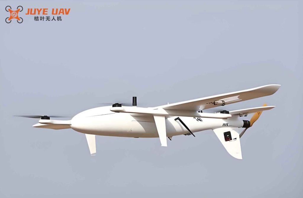
According to the established navigation specifications and safe operation mechanism for large fixed-wing drones to conduct joint flights in mixed airspace, relying on the constructed multi-level avoidance zones, we have formed key technologies for monitoring, predicting, and warning flight conflicts, reducing the uncontrollable risk of drone flight safety during joint flights, leveraging the advantages of large fixed-wing drones in high payload and long range, and promoting the research and development of intelligent logistics technology.
Application Based on Drone Emergency Rescue
According to the constructed navigation specifications and spatial position monitoring methods suitable for large fixed-wing drones to safely implement emergency rescue, we can alleviate the operational impact and coordination difficulties with other flight participants in the relevant airspace, solve problems such as poor communication and slow conventional logistics during emergency rescue implementation, leverage the advantages of large fixed-wing drones in high payload and long endurance, and reduce the implementation risk and loss of emergency rescue.
Innovation Points
Based on the application situations, we summarize the innovation points as follows.
- Scientific processing of big data characteristics to establish drone navigation specifications. The flight data and navigation positioning data of fixed-wing drones are huge in volume and complex in correlation. By combining machine learning algorithms such as SVM and K-Means with the PTD evaluation model, we can classify and statistically analyze open, multi-source, and non-uniform data, thereby obtaining their mathematical descriptions and achieving quantitative analysis conclusions of drone OPMA performance characteristics and required core functions. On this basis, we use a multi-level model to assign weights to relevant flight data, evaluate phased flight trajectories, and realize the formulation of the basic structure of drone navigation specifications and basic flight rules. Through the innovation of calculation methods, new approaches are provided for the analysis of large-volume and scattered characteristic data. From two aspects—flight implementation prerequisites and coordination rules among flight participants—a safe operation mechanism for drones is formed to ensure flight safety.
- Innovative establishment of navigation deviation calculation methods and accuracy classification standards. Drone navigation data and flight trajectory data are mostly expressed in interval form, making it difficult to directly use as operational standards. By combining ANNs with flight templates, we establish analysis and calculation methods for spatial position interval data such as navigation equipment work efficiency and flight trajectory identification. Relying on the convergence function of ANNs, the data intervals can be effectively delineated and classified, and satisfy the correlation with required navigation accuracy in navigation specifications, thereby establishing accuracy classification standards. Through the innovation of calculation methods, new ideas are provided for the analysis and identification of spatial position data characteristics, and quantifiable conclusions and reference standards are provided for subsequent intelligent conflict prediction research.
- Design and implementation of intelligent conflict warning method for joint flight. Since flight trajectories have a deviation accumulation effect, there exist facts such as uncontrollable accumulation process and difficult screening of accumulated data features. To enable deviation data to reasonably and effectively participate in safety evaluation, we use fuzzy theory and grey system theory to normalize navigation data and trajectory data. Combined with theoretical accuracy classification in navigation specifications and ANP monitoring, we can achieve pre-judgment of yaw trends. Through the innovation of calculation methods, new approaches are provided for classification and feature capture of data with cumulative characteristics, and provide drones with conflict warning capability, realizing intelligent conflict warning for joint flight.
Conclusion
Large fixed-wing drones converted from manned transport aircraft exhibit excellent performance in terms of payload, airworthiness, and performance. At takeoff, the maximum weight can reach 3 to 10 tons or more, and with full fuel and payload, the endurance can be up to 8 hours with a range of about 2,500 km. At the same time, the comprehensive promotion of the BeiDou satellite system and 5G communication technology can already support most areas, providing reliable support for the flight of large fixed-wing drones.
Currently, due to the rigorous civil aviation airspace flight standards and air traffic service requirements, and because drones lack safe and reliable navigation specifications and lack digital intelligent flight participation methods, the development of intelligent logistics transportation based on drone platforms is slow. Through project implementation, focusing on trajectory data and navigation data, using the optimized PTD evaluation model and navigation accuracy classification standards, and using methods such as data preprocessing, feature screening, data quality control, and usage classification, the flight trajectory deviation of fixed-wing drones has obtained data monitoring, cumulative identification, and trend prediction, providing a safe operation mechanism and flight conflict warning method for drones to conduct joint flights in mixed airspace, effectively controlling safety risks and improving the feasibility of drone joint flight.
In summary, by establishing navigation specifications and ANP monitoring means for fixed-wing drones, we fully utilize active flight monitoring and risk identification capabilities, provide basic safe operation guarantees for drone flight, promote the implementation progress of joint flights in mixed airspace, highlight the advantages of fast, convenient, and accurate delivery of aviation logistics transportation in medium and low altitude airspace, and promote the development of intelligent logistics technology.