With the rapid advancement of drone technology, the application of unmanned aerial vehicles in river surveillance and topographic mapping has become widespread in the water conservancy sector. Among various platforms, the fixed-wing drone stands out due to its high speed, long endurance, suitability for high-altitude long-distance flights, and capability to carry multiple mission payloads. In this paper, I present a comprehensive study based on a real-world project: the 1:1,000 scale topographic mapping of a typical section of the Huai River using a fixed-wing drone system. The primary objective is to evaluate the feasibility and accuracy of fixed-wing drone aerial survey methods for river channel mapping. I discuss the deployment of ground control points, the processing of 2D image data, and the key techniques for 3D modeling. Through rigorous accuracy analysis, I demonstrate that the fixed-wing drone technology meets the stringent requirements of large-scale topographic mapping, offering significant operational advantages over traditional surveying methods.
Introduction
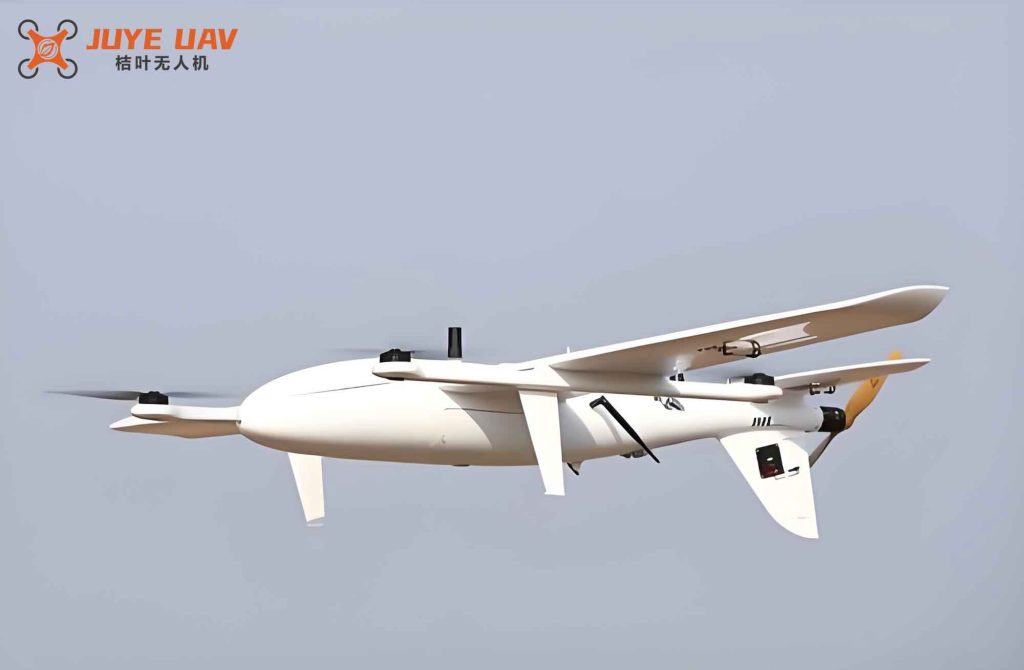
The rapid evolution of drone technology has revolutionized the field of geomatics. Fixed-wing drones, in particular, have gained prominence because of their aerodynamic efficiency and extended flight endurance. Unlike multi-rotor drones, fixed-wing drones can cover large areas in a single sortie, making them ideal for mapping extensive linear features such as river channels. In our project, we utilized a Zongheng CW-15II vertical take-off and landing fixed-wing drone equipped with a CA103+ oblique stabilized camera. The mission area covers approximately 11.71 km² along the Huai River in Anhui Province, characterized by flat floodplains, hardened river embankments, and scattered anthropogenic features such as roads, power lines, and buildings. The goal was to produce high-precision digital orthophoto maps (DOM), digital surface models (DSM), and 3D models at a 1:1,000 scale. The following sections detail the methodology, data processing, and accuracy assessment, thereby validating the efficacy of the fixed-wing drone for river topographic mapping.
Overview of Fixed-Wing Drone Technology
Fixed-wing drones generate lift through fixed wings, enabling them to fly faster and farther than rotary-wing counterparts. Modern fixed-wing drones benefit from advances in composite materials, miniaturized sensors, and intelligent flight controllers. They can operate autonomously following pre-planned flight routes while transmitting real-time telemetry. The integration of artificial intelligence and big data analytics has further enhanced their capabilities for automated feature extraction and terrain reconstruction. In our project, the fixed-wing drone served as the primary data acquisition platform, offering a payload capacity that accommodated a high-resolution 42.4-megapixel full-frame camera. The fixed-wing drone’s ability to maintain stable flight at an altitude of 300 m with 70% forward overlap and 65% side overlap ensured that the ground sampling distance (GSD) was as fine as 0.032 m. Such parameters are essential for generating high-fidelity 3D models and accurate topographic maps. The use of a fixed-wing drone not only expedites the data collection process but also significantly reduces field labor and safety risks associated with manual surveying in floodplains and riverbanks.
Case Study: Huai River Channel Mapping
To evaluate the practical performance of the fixed-wing drone, we selected a representative reach of the Huai River. The study area features a gentle topography with numerous lakes and tributaries, typical of the middle reaches of this major waterway. The section is about 418 km long in Anhui Province, covering a drainage area of 66,900 km². The terrain includes hardened road surfaces on embankments, scattered vegetation, and sparse man-made structures, making it suitable for aerial photogrammetry.
Survey Workflow
The overall workflow of our fixed-wing drone survey comprised the following stages: ground control point (GCP) layout and measurement, flight route planning, image acquisition, post-processed kinematic (PPK) data processing, aerial triangulation, DOM and 3D model generation, digital line graphic (DLG) plotting, and final accuracy assessment. The entire process was carried out using integrated hardware and software solutions to ensure efficiency and reliability.
Ground Control Point Layout
Given the linear shape of the river channel, we adopted a zigzag GCP distribution pattern. Each pair of GCPs was placed perpendicular to the channel axis, with an additional control point located in the middle of the strip. Supplementary GCPs were added at turning points and wider floodplain areas. The spacing between adjacent GCPs was kept between 0.8 km and 1.0 km to guarantee model accuracy. Each GCP was selected at distinct features such as road intersections or building corners. In areas lacking natural features, we used artificial targets painted on hard surfaces or fixed cross-marks on soft ground. The size of each target was at least 70 cm to ensure visibility in the imagery. A total of 27 GCPs were measured using GNSS RTK with figure-ground accuracy, capturing both planimetric coordinates and elevation. The following table summarizes the GCP configuration parameters used in the project.
| Parameter | Value |
|---|---|
| Pattern | Zigzag (staggered) |
| Spacing | 0.8 – 1.0 km |
| Total number | 27 |
| Measurement method | GNSS RTK (figure-ground accuracy) |
| Target size | ≥ 70 cm |
Flight Mission and Image Acquisition
The flight mission was executed using a Zongheng CW-15II fixed-wing drone paired with its ground base station. The camera was a CA103 full-frame unit with 42.4 effective megapixels, a sensor size of 35.9 mm × 24.0 mm, and a fixed focal length of 35 mm. To meet the 1:1,000 scale mapping requirement while completing the entire area in two sorties, a relative flight altitude of 300 m was chosen. The forward overlap was set to 70%, side overlap to 65%, resulting in a GSD of 0.032 m. The flight parameters are listed in the table below.
| Parameter | Value |
|---|---|
| Flight altitude (relative) | 300 m |
| Forward overlap | 70% |
| Side overlap | 65% |
| Ground sampling distance (GSD) | 0.032 m |
| Number of sorties | 2 |
DOM and 3D Model Production
After the flight, base station data, POS data, and mobile station data were downloaded. The PPK solution was computed using the drone manufacturer’s JOPPS software. Once the POS data were processed, we employed DJI Terra software for aerial triangulation. After quality checks, the GCPs were imported, and parameters for 2D and 3D models were set. The final 2D DOM was generated in TIFF format, while the 3D model was output as OSGB tiles. The aerial triangulation report indicated no voids or missing regions in the model; textures were clear. The root mean square errors (RMSE) of the GCPs after adjustment were:
- dx = 0.008699 m
- dy = 0.012098 m
- dz = 0.007295 m
These values confirm that the aerial triangulation met the required tolerances for 1:1,000 mapping.
DLG Plotting
The DLG was generated using Cass_3D software, a plugin for the domestic CASS platform. After loading the 3D model in OSGB format, we directly digitized planimetric and elevation information of all terrain features. The resulting line map conformed to the specifications for 1:1,000 scale topographic mapping.
Accuracy Analysis
To quantitatively evaluate the positional accuracy of the final products, we collected independent check points in the field using GNSS RTK. For each point, five measurements were taken and averaged in fixed-solution mode. The measured coordinates were then compared with their corresponding coordinates extracted from the stereo model or DLG. A statistical analysis of the discrepancies is presented in the table below.
| Point ID | Measured Coordinates (m) | Model Coordinates (m) | Discrepancies (m) | ||||||
|---|---|---|---|---|---|---|---|---|---|
| x | y | h | x | y | h | Δx | Δy | Δh | |
| 1 | 3603515.40 | 463567.61 | 21.29 | 3603515.40 | 463567.60 | 21.31 | 0.00 | 0.00 | −0.02 |
| 2 | 3603546.08 | 463808.42 | 21.68 | 3603546.08 | 463808.42 | 21.73 | 0.00 | 0.00 | −0.05 |
| 3 | 3603430.08 | 464014.67 | 29.40 | 3603430.07 | 464014.68 | 29.41 | 0.01 | −0.01 | −0.01 |
| 4 | 3603604.71 | 464231.05 | 21.68 | 3603604.73 | 464231.03 | 21.69 | −0.02 | 0.02 | −0.01 |
| 5 | 3605138.79 | 468264.57 | 21.47 | 3605138.79 | 468264.57 | 21.42 | 0.00 | 0.00 | 0.05 |
| 6 | 3602803.36 | 464993.36 | 22.31 | 3602803.37 | 464993.38 | 22.30 | −0.01 | −0.02 | 0.01 |
| 7 | 3603328.45 | 466820.05 | 28.00 | 3603328.44 | 466820.06 | 28.03 | −0.01 | −0.01 | −0.03 |
From the table, we see that planimetric discrepancies (Δx, Δy) are within ±0.02 m, and vertical discrepancies (Δh) are within ±0.05 m for all check points. The root mean square error (RMSE) for planimetric and vertical components can be computed as:
$$
RMSE_{xy} = \sqrt{\frac{1}{n}\sum_{i=1}^{n}\left( \Delta x_i^2 + \Delta y_i^2 \right)} \approx 0.015\, \text{m}
$$
$$
RMSE_h = \sqrt{\frac{1}{n}\sum_{i=1}^{n} \Delta h_i^2} \approx 0.032\, \text{m}
$$
Both values are well within the tolerance for 1:1,000 scale topographic mapping. The high accuracy demonstrates that the fixed-wing drone aerial survey, combined with proper GCP control and advanced photogrammetric processing, is fully capable of producing reliable river channel maps.
Conclusion
In this paper, I have systematically analyzed the application of fixed-wing drone aerial survey technology in the topographic mapping of the Huai River channel. The project successfully generated 1:1,000 scale DOM, 3D models, and DLGs. The accuracy assessment, based on independent check points, confirms that planimetric errors remain below 0.02 m and elevation errors below 0.05 m, satisfying national mapping standards. The fixed-wing drone technology offers substantial improvements in efficiency, reducing field labor and production time. It provides comprehensive, intuitive data collection with minimal environmental interference. However, limitations exist: in densely vegetated areas along riverbanks, manual field complement and editing are still required. Future research should focus on integrating fixed-wing drones with oblique photography, multispectral sensors, and LiDAR to enhance data diversity and accuracy. Additionally, the establishment of unified regulations and standards will further promote the widespread adoption of fixed-wing drone technology in riverine and water conservancy surveying. Our findings confirm that the fixed-wing drone is a reliable and superior tool for large-scale river topographic mapping, and I encourage its broader implementation in similar projects worldwide.