
Aerial perspectives fundamentally transform visual storytelling by capturing otherwise inaccessible viewpoints. Traditional ground-based filming equipment—tripods, cranes, or dollies—cannot replicate the sweeping panoramas achieved through elevated platforms. While manned helicopters offer superior stability and payload capacity, their operational costs and logistical constraints limit accessibility. In contrast, modern multi-rotor camera drones provide unprecedented flexibility at a fraction of the expense. These compact camera UAV systems deliver exceptional agility in confined spaces while minimizing human risk, despite inherent limitations in flight duration and signal obstruction susceptibility. Rapid technological advancements continuously enhance their endurance and altitude capabilities, cementing their role in professional cinematography.
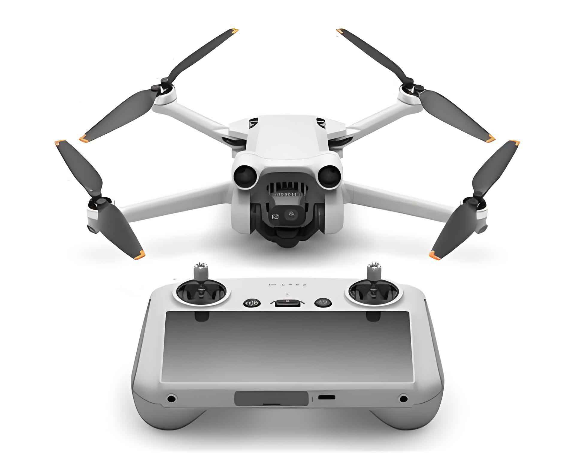
The structural anatomy of a multi-rotor camera drone comprises four integrated subsystems: the airframe, flight controller, ground station, and gimbal. Each component synergistically ensures stable flight and cinematic output. The airframe’s lightweight carbon-fiber skeleton houses the propulsion system, where brushless motors paired with high-discharge lithium-polymer (LiPo) batteries generate lift. Battery performance directly dictates operational longevity, governed by the energy equation:
$$ t = \frac{C \times V \times \eta}{P} $$
where \( t \) = flight time (minutes), \( C \) = battery capacity (Ah), \( V \) = voltage (V), \( \eta \) = efficiency coefficient (≈0.8), and \( P \) = power consumption (W). LiPo dominance stems from exceptional energy density (>200 Wh/kg) and discharge rates (>15C).
| Subsystem | Components | Function |
|---|---|---|
| Airframe | Carbon-fiber frame, brushless motors, LiPo battery | Structural integrity and propulsion |
| Flight Controller | IMU, GPS, barometer, magnetometer, PID controllers | Stabilization and navigation |
| Ground Station | Transmitter, telemetry link, FPV monitor | Real-time control and data transmission |
| Gimbal | 3-axis stabilizer, gyroscopic sensors | Vibration damping and horizon leveling |
Flight stability relies on the controller’s sensor fusion algorithms. The PID (Proportional-Integral-Derivative) control loop continuously corrects deviations from desired attitudes. For a quadcopter, thrust distribution follows:
$$
\begin{cases}
T_{total} = K(\omega_1^2 + \omega_2^2 + \omega_3^2 + \omega_4^2) \\
\tau_x = lK(\omega_4^2 – \omega_2^2) \\
\tau_y = lK(\omega_3^2 – \omega_1^2) \\
\tau_z = C(\omega_1^2 – \omega_2^2 + \omega_3^2 – \omega_4^2)
\end{cases} $$
where \( T \) = total thrust, \( \tau \) = torques along axes, \( \omega_n \) = rotor angular velocities, \( K \) = thrust coefficient, \( C \) = drag coefficient, and \( l \) = arm length.
Cinematic techniques define the camera UAV‘s creative utility. Five core maneuvers dominate professional workflows:
| Maneuver | Trajectory | Visual Effect | Physics Considerations |
|---|---|---|---|
| Flyover | Vertical transit over subject | Reveals scale/dominance (e.g., skyscrapers) | Climb rate > 2m/s; altitude > safety margin |
| Threading | Lateral passage through gaps | Spatial context (e.g., bridges, arches) | Collision avoidance radius: \( r > \frac{v^2}{2a} \) |
| Terrain Hugging | Low-altitude translation | High-velocity immersion (e.g., forests) | Ground effect lift: \( L_{ge} = L_0 \times \frac{1}{1 – (h/b)^2} \) |
| Subject Tracking | Parallel motion match | Dynamic focus (e.g., vehicles) | Velocity vector alignment: \( \Delta v < 15\% \) |
| Orbiting | Circular path around target | 360° perspective (e.g., monuments) | Centripetal force: \( F_c = \frac{mv^2}{r} \) |
Operational safety mandates strict compliance with meteorological and regulatory protocols. Wind tolerance thresholds vary by camera drone mass:
$$ V_{max} = k \sqrt{\frac{m}{A}} $$
where \( V_{max} \) = maximum wind speed (m/s), \( m \) = mass (kg), \( A \) = frontal area (m²), and \( k \) = stability factor (≈3.5 for cine-class UAVs). Precipitation and temperatures below 0°C require battery preheating and derated performance expectations. Regulatory no-fly zones include:
- Airport exclusion radii (≥5km from runways)
- Government/military installations (dynamic geofencing)
- Crowded venues (>1000 people without waiver)
Pre-flight protocols must verify:
- LiPo cell voltages > 3.7V/cell
- GPS satellite lock > 12
- Propeller structural integrity
- Emergency return-to-home altitude setting
Future advancements will integrate AI-driven obstacle avoidance using convolutional neural networks (CNNs):
$$ y = f\left( \sum_{i=1}^k w_i x_i + b \right) $$
where \( y \) = evasion command, \( w_i \) = sensor weighting, \( x_i \) = LiDAR/visual inputs, and \( b \) = bias term. Such innovations will enable autonomous complex shot execution while enhancing camera UAV safety in urban environments.