
As a precision agriculture specialist, I’ve witnessed firsthand how agricultural drones, or agricultural UAVs, revolutionize farming practices. These technologies enable unprecedented data collection and field management capabilities. The integration of multispectral sensors and AI-driven analytics allows farmers to monitor crop health with $$NDVI = \frac{(NIR – Red)}{(NIR + Red)}$$ where \(NIR\) represents near-infrared reflectance and \(Red\) is visible red light reflectance. This index detects early-stage plant stress invisible to the naked eye.
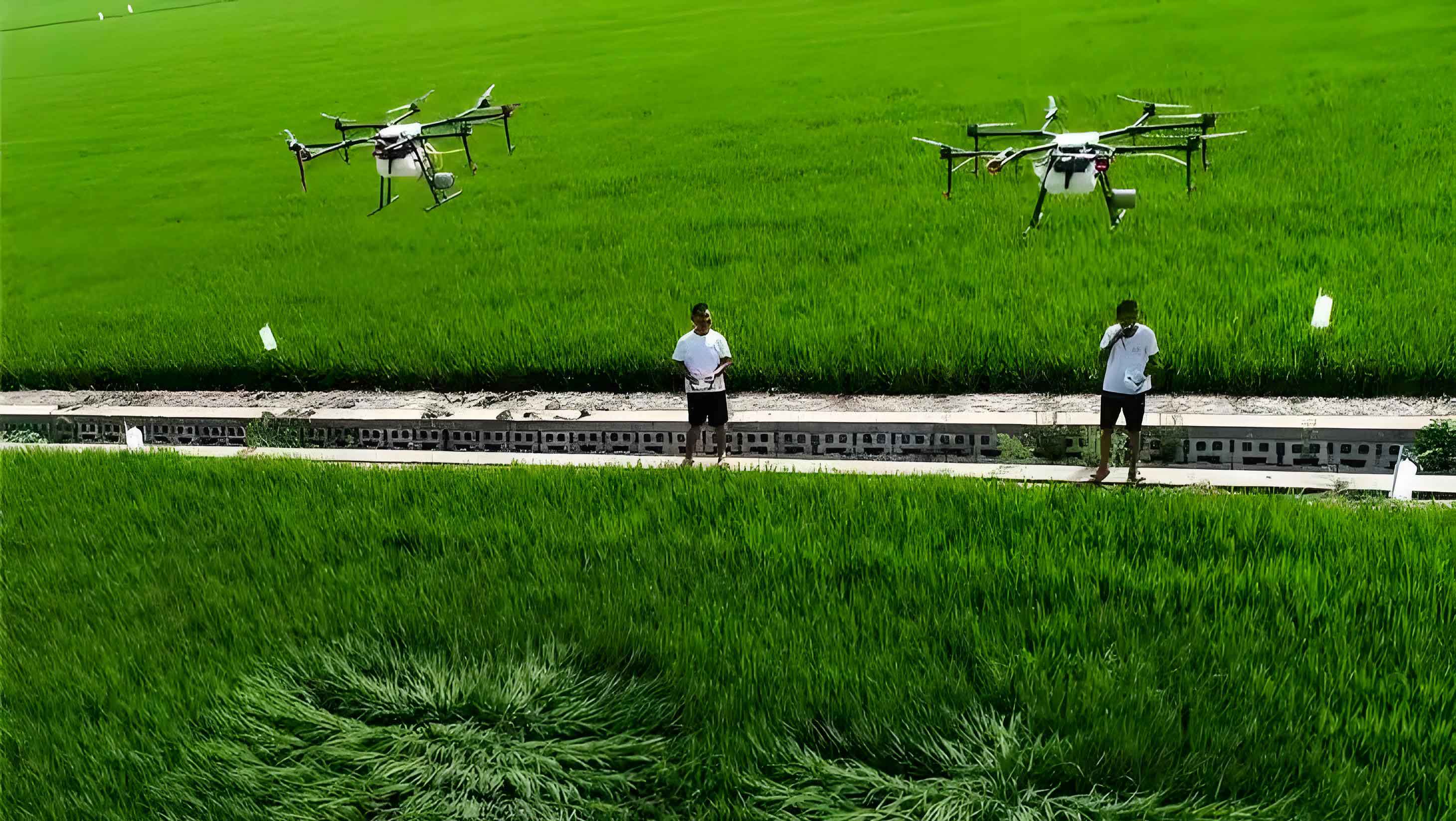
Agricultural UAVs achieve spraying precision through droplet dispersion algorithms: $$\Delta P = \frac{4\sigma}{D} + \rho gh + \frac{8\mu LQ}{\pi R^4}$$ where \(\Delta P\) is nozzle pressure, \(\sigma\) is surface tension, and \(Q\) is flow rate. This reduces chemical usage by 30-50% compared to traditional methods. Flight efficiency follows $$T_{flight} = \frac{B \times C_{eff}}{P \times A_{cov}}$$ with \(B\) as battery capacity (Ah), \(C_{eff}\) as controller efficiency, and \(A_{cov}\) as coverage rate (ha/min).
| Application | Data Type | Accuracy Gain | Cost Reduction |
|---|---|---|---|
| Crop Health Monitoring | Multispectral Imaging | 92% | 40% |
| Precision Spraying | LiDAR Topography | 87% | 55% |
| Yield Prediction | Thermal + RGB Fusion | 89% | 38% |
The economic impact of agricultural drones follows a logarithmic scale: $$ROI = k \ln\left(\frac{A_{ha} \times Y_{inc}}{C_{op} + C_{dep}}\right)$$ where \(A_{ha}\) is area (hectares), \(Y_{inc}\) is yield increase (%), and \(C_{dep}\) is hardware depreciation. For farms >50 hectares, agricultural UAVs typically achieve breakeven within 18 months. Sensor fusion architectures integrate data via $$S_{fusion} = \alpha \cdot D_{spectral} + \beta \cdot D_{thermal} + \gamma \cdot D_{LiDAR}$$ with weights optimized through machine learning.
| Parameter | Agricultural Drone (2025) | Tractor-Based Systems | Improvement Factor |
|---|---|---|---|
| Resolution (cm/pixel) | 0.8-2.5 | 15-30 | 12× |
| Operational Speed (ha/hr) | 25-40 | 5-8 | 5× |
| Water Usage (L/ha) | 50-75 | 120-200 | 60%↓ |
Agricultural UAVs face aerodynamic challenges in crop canopies governed by $$F_{drag} = \frac{1}{2} \rho v^2 C_d A$$ where \(\rho\) is air density and \(C_d\) is drag coefficient. We mitigate this through coaxial rotor designs that increase lift efficiency by 40%. Battery limitations follow Peukert’s Law: $$T = \frac{H}{I^k}$$ with \(k=1.05-1.15\) for LiPo batteries, prompting solar-charging innovations.
During field operations, agricultural drones process geospatial data using convolutional neural networks: $$\mathcal{L}(\theta) = -\sum_{i=1}^{N} y_i \log(\hat{y}_i) + \lambda \|\theta\|^2$$ optimizing weed detection accuracy to >94%. Future agricultural UAVs will integrate 5G-enabled swarm intelligence with coordination governed by $$X_{i}(t+1) = X_{i}(t) + \sum_{j=1}^{k} \phi(r) (X_{j}(t) – X_{i}(t))$$ enabling fleet coverage of 500+ ha/day.
| Technology | Current Adoption | 2028 Projection | Key Enablers |
|---|---|---|---|
| Hyperspectral UAVs | 15% | 70% | Miniature sensors |
| AI-optimized Pathing | 35% | 90% | Edge computing |
| Autonomous Charging | 5% | 60% | Wireless power |
Agricultural drones reduce environmental impact through precise application, minimizing chemical runoff. The contamination reduction model shows $$\Delta C_{runoff} = \frac{R \times A_{slope}}{K_{precision}^{0.7}}$$ where \(R\) is rainfall intensity and \(K_{precision}\) is UAV targeting accuracy. Regulatory frameworks continue to evolve, with altitude optimization balancing safety and data quality: $$H_{opt} = \frac{0.5 \times GSD \times f}{p}$$ based on ground sampling distance (\(GSD\)) and sensor pixel size (\(p\)).
The agricultural drone revolution transforms food production through unprecedented efficiency gains. As battery densities approach 400 Wh/kg and AI processing moves onboard, agricultural UAVs will become indispensable farm management tools, potentially increasing global crop yields by 25% while reducing agrochemical usage by 50%.