The proliferation of small unmanned aerial vehicles (UAVs) has introduced significant challenges to low-altitude airspace security. Their low cost, ease of acquisition, intelligent operation, and flexible deployment make them potential tools for malicious activities, ranging from contraband smuggling to, in worst-case scenarios, terrorist attacks on critical infrastructure such as government facilities, communication hubs, transportation centers, and public gatherings. While regulatory measures like geo-fencing, mandatory registration, and pilot licensing can mitigate unintentional airspace violations, they are insufficient against intentionally malicious actors who may bypass or modify these controls. Consequently, there is a pressing need for active, non-cooperative anti-drone systems capable of detecting, identifying, tracking, and neutralizing hostile UAV threats independently of their onboard control protocols.
This article presents the design and implementation of a comprehensive anti-drone system specifically engineered for the protection of critical sites. The system integrates heterogeneous sensors—including radar, electro-optical/infrared (EO/IR) trackers, and radio frequency (RF) detectors—with command, control, and countermeasure subsystems into a unified operational framework. The core technical challenges addressed are the effective data fusion from these disparate sensors and their coordinated operation to ensure continuous, reliable tracking of small, low-flying UAVs. We propose novel track fusion rules for multi-source data and introduce a “fan-scan” search method for EO/IR sensors to overcome precision mismatches when guided by radar, thereby enabling seamless multi-sensor handover and sustained tracking. The system has been successfully deployed in real-world scenarios, including major public event security and perimeter defense for sensitive installations like nuclear power plants, demonstrating a marked enhancement in the capability to detect, track, identify, and mitigate small UAV threats.
1. System Composition
The anti-drone system is a modular ensemble comprising several key subsystems that work in concert. The system architecture is illustrated in the following diagram, which shows the interconnection and data flow between the intelligent management subsystem and the various sensing and effector units.
Intelligent Management and Control Subsystem: This subsystem serves as the brain of the anti-drone system. It is responsible for ingesting data from all connected sensors, performing multi-source data fusion to generate a unified air picture, and displaying the integrated situational awareness on a Geographic Information System (GIS) interface. It provides real-time monitoring of all subsystem statuses, issues alerts for anomalies, and facilitates command decisions for countermeasure deployment.
Radar Detection Subsystem: A two-dimensional phased-array radar with a circular antenna provides 360-degree surveillance. Compared to mechanical scanning radars, this configuration offers a much higher data refresh rate (up to 0.2 seconds), which is crucial for the continuous and stable tracking of small, agile UAVs. It provides three-dimensional (range, azimuth, elevation) track data that can be used to cue other sensors and guide countermeasure systems.
Electro-Optical/Infrared (EO/IR) Tracking Subsystem: This subsystem provides high-resolution visual and thermal imaging for positive target identification. It offers excellent low-altitude observation capabilities, high tracking accuracy, and is immune to electromagnetic interference. Its primary role is to visually confirm and finely track targets initially detected by radar or RF sensors.
Radio Frequency (RF) Detection Subsystem: A passive sensor that detects and analyzes RF emissions from UAVs, such as remote control and video transmission signals. It can provide early warning and direction-finding as soon as a drone is powered on, even before it takes off. In some configurations, it can also perform direction-finding on the pilot’s controller. This information can be used to cue the radar to search specific sectors.
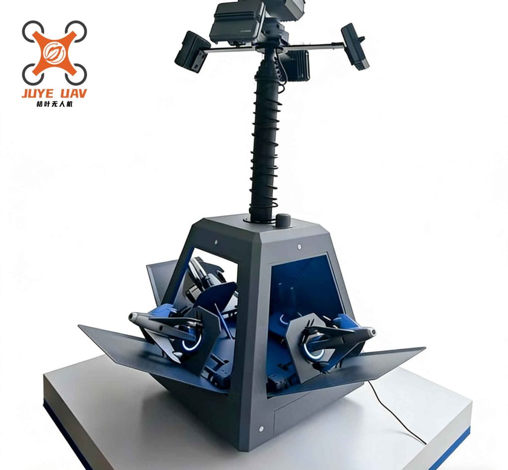
Countermeasure (Jamming) Subsystem: This effector unit neutralizes threats by emitting directed RF interference. It typically targets the UAV’s command and control (C2) links, video downlink, and Global Navigation Satellite System (GNSS, e.g., GPS) signals. By employing specific jamming strategies, it can force a drone to execute a return-to-home maneuver, land in place, or be driven away from the protected zone.
2. Overall System Design
2.1. System Architecture
The system is designed based on a client-server model to ensure scalability and centralized data processing. The architecture is structured into four layers: Hardware Platform, Data Layer, Service Layer, and Application Layer.
Hardware Platform: This foundational layer encompasses all physical components: sensors (radar, EO/IR, RF detectors), communication networks, and computing/storage servers.
Data Layer: This layer manages the core data entities:
| Data Type | Description | Examples |
|---|---|---|
| Track Data | Raw and processed target information from sensors. | 3D radar plots, 2D EO/IR angles, 1D/2D RF bearing/cross-fix, video streams. |
| Geospatial Data | Contextual mapping and location information. | Vector maps, satellite imagery, sensor deployment coordinates. |
| Foundation Data | Configuration and reference data for system operation. | Alert rules, RF signature libraries for common drones, EO/IR visual target templates. |
Service Layer: This layer provides the core processing capabilities as reusable services:
| Service | Function |
|---|---|
| Information Ingestion | Acquires and parses data streams from all connected subsystems. |
| Information Processing | Performs data fusion, track correlation, and threat evaluation. |
| Geospatial Service | Manages map data and provides geospatial calculations (e.g., coordinate transformation). |
Application Layer: This top layer implements the user-facing functional modules, such as the integrated situational display, command and control console, sensor coordination logic, threat analysis engine, and forensic data review tools.
2.2. System Workflow
The operational workflow integrates two primary threads: Multi-source Heterogeneous Information Processing and Intelligent Control & Coordination.
Multi-source Information Processing & Display Workflow:
1. Data Acquisition: Dedicated software interfaces subscribe to data feeds from each subsystem (RF bearing/fix, EO/IR video/angles, radar plots).
2. Parsing & Normalization: Incoming data packets are decoded and transformed into a common internal data format.
3. Information Processing: The core fusion engine performs spatio-temporal alignment, error correction, and single-sensor track management. It then correlates and fuses data from different sensors to produce a single, coherent “system track” for each target.
4. Situational Display: The GUI displays the fused air picture overlaid on a map, along with live video from EO/IR sensors. Operators can toggle layers to view individual sensor tracks or the fused system tracks.
5. Recording & Playback: All track data and synchronized video are logged for post-mission analysis and replay.
Intelligent Control & Coordination Workflow:
1. Early Warning & Cueing: The RF detector provides an initial azimuth alert. The system automatically configures the radar to perform a focused sector scan in that direction, significantly reducing search time and false alarms from birds or other clutter.
2. Radar Tracking & EO/IR Cueing: Once the radar acquires and tracks the target, the system uses the radar track’s azimuth and elevation to command the EO/IR platform’s pan-tilt unit to slew to the predicted target location.
3. Visual Identification & Fine Tracking: The EO/IR operator (or automated video tracker) acquires the target in the camera’s field of view, enabling visual confirmation and high-precision tracking.
4. Threat Assessment & Countermeasure: Based on predefined rules (e.g., target speed, altitude, proximity, and identification confidence), the system assesses the threat level. If engagement is authorized, it automatically or semi-automatically guides the jammer to point at the target and initiates the appropriate jamming protocol.
3. Key Technologies
The efficacy of the anti-drone system hinges on solving the challenges of fusing data from dissimilar sensors and orchestrating their synergistic operation. Each sensor has distinct advantages and limitations, as summarized below:
| Sensor | Advantages | Disadvantages/Limitations |
|---|---|---|
| RF Detector | Early passive detection, target identification (model/frequency), pilot location possible. | Lower precision, high false alarms in dense RF environments, no range information (single station). |
| Radar | All-weather, day/night active detection, good range/azimuth precision, provides 3D data. | Cannot identify target type, susceptible to clutter and low-RCS targets. |
| EO/IR Tracker | Positive visual identification, very high angular precision, immune to RF interference. | Requires cueing, limited field of view, performance degraded by weather (fog, rain). |
The fusion and coordination strategies are designed to create a “composite sensor” where the whole is greater than the sum of its parts.
3.1. Multi-Sensor Data Fusion Processing
The fusion architecture handles both homogeneous (multi-radar) and heterogeneous (radar + RF, radar + EO/IR) fusion. The primary algorithm flow involves spatio-temporal alignment, track-to-track correlation, and state vector estimation.
Homogeneous Fusion (Radar Network): The goal is to eliminate redundancy and contradiction while improving overall accuracy. The process includes outlier rejection, spatio-temporal registration, systematic error correction, and track association. A “Reference Track Association” method is employed: the track from the radar with the highest estimated accuracy for a given target is chosen as the reference. Subsequent tracks from other radars are associated with this reference track using statistical distance gates (e.g., Mahalanobis distance). The association decision is based on a hypothesis test. For two tracks with state estimates $\hat{X}_1$, $\hat{X}_2$ and covariance matrices $P_1$, $P_2$, the innovation and its covariance are:
$$ \nu = \hat{X}_1 – \hat{X}_2 $$
$$ S = P_1 + P_2 $$
The normalized distance is:
$$ d^2 = \nu^T S^{-1} \nu $$
If $d^2$ is less than a threshold $\gamma$ (from the chi-square distribution), the tracks are associated, and their states are fused, often using a covariance intersection or weighted average method to yield a more accurate system track.
Heterogeneous Fusion: This fusion complements capabilities and increases confidence. The rules are:
| Condition | Fusion Action | Rationale |
|---|---|---|
| RF detects, Radar does not | Initiate system track from RF data. | Exploit RF’s early warning capability. |
| Radar detects, RF does not | Initiate/system track from Radar data. | Rely on radar’s reliable 3D tracking. |
| Both Radar and RF detect | Fuse: Use Radar’s kinematic state, augment with RF’s ID attributes (model, frequency). | Combine radar’s precision with RF’s classification. |
| Both Radar and EO/IR track | Fuse: Use EO/IR’s superior azimuth/elevation angles with Radar’s precise range. | Create a highly accurate 3D track: $\text{Fused Track} = (R_{radar}, \theta_{EO/IR}, \phi_{EO/IR})$. |
The fusion of radar range with EO/IR angles provides a significant accuracy boost. In one test, the average 3D position error of the fused track was reduced to approximately 11.53 meters, compared to 39.7 meters for the radar-only track prior to fusion. This enhancement is critical for effective countermeasure guidance in a densely packed anti-drone environment.
3.2. Multi-Sensor Coordinated Detection
Coordination ensures efficient sensor handover and optimal resource utilization. The primary challenge in radar-to-EO/IR cueing is the mismatch between radar elevation error and the EO/IR’s narrow field of view (FOV).
RF-to-Radar Coordination: The RF detector’s azimuth output $\theta_{RF}$ is used to define a priority search sector for the radar, centered on $\theta_{RF}$ with a width $\Delta \theta$. The radar’s search mode is adjusted to concentrate energy and time on this sector, dramatically improving the probability of quick acquisition and reducing false alarms from outside the sector. If no RF alert is present, the radar defaults to a 360° surveillance pattern.
Radar-to-EO/IR Coordination: The radar provides a cue point $(\theta_R, \phi_R, R_R)$. The EO/IR platform slews to $(\theta_R, \phi_R)$. However, the radar’s elevation accuracy $\sigma_{\phi_R}$ (e.g., $\leq 2^\circ$) is often larger than the EO/IR sensor’s vertical FOV $\alpha_v$ (e.g., $0.8^\circ$). A simple “point-and-stare” cue may fail if the target lies outside this narrow vertical slice.
Solution – EO/IR Fan-Scan Search: To overcome this, an automated vertical fan-scan pattern is executed. The EO/IR’s elevation is commanded to scan through a vertical window centered on the radar’s reported elevation $\phi_R$, with a total scan range equal to the radar’s elevation uncertainty interval $[\phi_R – \sigma_{\phi_R}, \phi_R + \sigma_{\phi_R}]$.
$$ \text{Scan Range: } \phi_{\text{start}} = \phi_R – \sigma_{\phi_R}, \quad \phi_{\text{stop}} = \phi_R + \sigma_{\phi_R} $$
The scan step $\Delta \phi_s$ is set to half the EO/IR vertical FOV to ensure overlap and avoid gaps:
$$ \Delta \phi_s = \frac{\alpha_v}{2} $$
The number of steps $N$ in one complete scan is:
$$ N = \frac{2 \sigma_{\phi_R}}{\Delta \phi_s} + 1 $$
The total scan time $T_{scan}$ is:
$$ T_{scan} = N \times (t_{slew} + t_{proc}) $$
where $t_{slew}$ is the mechanical settling time per step and $t_{proc}$ is the image processing/recognition time per step. For $\sigma_{\phi_R}=2^\circ$, $\alpha_v=0.8^\circ$, $\Delta \phi_s=0.4^\circ$, we get $N = 10$. With $t_{slew} + t_{proc} \approx 1.2$ seconds, $T_{scan} \approx 12$ seconds. This method guarantees target acquisition within the vertical uncertainty zone, as validated in field tests where the time from cue initiation to EO/IR lock consistently matched this theoretical duration. This fan-scan technique is a pivotal innovation for robust sensor coordination in practical anti-drone systems.
4. Conclusion and Future Work
This article has presented a holistic approach to the design and implementation of a modern anti-drone system for critical site protection. By integrating radar, EO/IR, and RF sensors with a central fusion and control core, the system achieves a capability greater than any single sensor component. The proposed multi-sensor fusion rules and the innovative EO/IR fan-scan coordination method effectively address the key challenges of tracking small, low-signature UAVs, enabling continuous, high-confidence tracking from early detection through to successful countermeasure engagement.
The system’s effectiveness has been proven in real-world deployments, safeguarding high-profile public events and sensitive infrastructure. It represents a significant step forward in operational anti-drone technology, moving from standalone detection or jamming devices towards an integrated, intelligent, and networked defense system.
Future work will focus on enhancing the robustness and intelligence of the fusion algorithms. Investigating advanced data association techniques (e.g., Multi-Hypothesis Tracking – MHT) to better handle dense target environments and high false alarm rates is a priority. Furthermore, integrating machine learning for automatic RF fingerprinting and visual UAV classification will streamline the identification process, making the anti-drone system more autonomous and responsive to evolving threats.