The landscape of criminal investigation is undergoing a profound metamorphosis, driven by technological convergence and evolving procedural standards. The shift towards a trial-centered litigation model places unprecedented emphasis on the integrity, timeliness, and comprehensiveness of evidence. Within this demanding framework, traditional two-dimensional, ground-level investigative methods often encounter significant limitations, particularly when dealing with volatile, violent, or emergent criminal cases. These scenarios demand rapid response, pose high risks to personnel, and are susceptible to rapid evidence degradation or contamination. It is within this critical niche that Police Unmanned Aerial Vehicles (UAVs) have emerged as a transformative force. By transitioning investigative operations from a planar to a three-dimensional paradigm, police UAVs equipped with advanced警务 payloads are redefining tactical response, forensic documentation, and suspect apprehension. This article explores the conceptual foundation, unique advantages, and practical applications of police UAVs, arguing for their indispensable role in modern criminal侦查.
I. Conceptual Foundation and Functional Taxonomy of Police UAVs
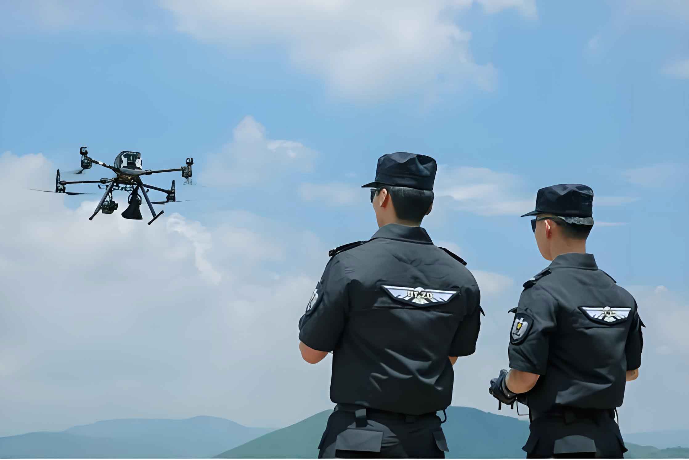
A Police UAV is defined as an unmanned aerial system, typically based on multi-rotor or fixed-wing platforms, that has been specifically modified or designed to integrate law enforcement-centric hardware and software. These systems extend beyond commercial drones by incorporating functionalities tailored for surveillance, communication, forensic analysis, and tactical intervention within legal and operational boundaries.
The evolution of police UAVs parallels advancements in miniaturization, sensor technology, and data-linking. From early, limited experiments, their adoption has accelerated due to recognized benefits in operational flexibility and officer safety. Modern systems are categorized not just by their airframe (e.g., multi-rotor for hover, fixed-wing for endurance) but more pertinently by their investigative function. We can propose a functional taxonomy as follows:
| Functional Category | Primary Objective | Key Enabling Payloads/Features |
|---|---|---|
| Scene Preservation & Initial Response | Secure perimeter, provide initial intel, prevent contamination. | High-resolution live feed, loudspeaker, aerial lighting, virtual geofencing. |
| Forensic Documentation & Evidence Mapping | Capture comprehensive, geotagged scene data for reconstruction. | Photogrammetry cameras, multispectral sensors, LiDAR, RTK GPS. |
| Dynamic Tracking & Pursuit Assistance | Monitor and track subjects or vehicles over terrain. | Optical/thermal zoom cameras, AI-based tracking algorithms, long-range data links. |
| Tactical Intelligence & Covert Surveillance | Gather intelligence discreetly in high-risk or inaccessible environments. | Low-noise propellers, covert design, thermal imaging, signal intelligence packages. |
| Communication & Coordination Nexus | Serve as an aerial command/communication relay point. | Mesh networking nodes, 5G/4G relays, public address systems. |
The core capabilities of a modern police UAV system can be mathematically conceptualized as a function of its integrated payloads and flight performance. Let the total investigative utility \( U \) of a police UAV be expressed as a weighted sum:
$$U = \alpha \cdot R(t) + \beta \cdot S(\lambda) + \gamma \cdot P_{com} + \delta \cdot P_{spec}$$
Where:
– \( R(t) \) represents the **Range-Endurance product**, a function of flight time \( t \), crucial for prolonged searches.
– \( S(\lambda) \) is the **Sensor Suite effectiveness**, dependent on the wavelengths \( \lambda \) (visible, infrared, etc.) it can perceive.
– \( P_{com} \) denotes **Communication and Data-Link Power**, enabling real-time command and control.
– \( P_{spec} \) represents **Specialized Payload** capability (e.g., forensics, tactical).
– The coefficients \( \alpha, \beta, \gamma, \delta \) are weighting factors determined by the specific mission profile (e.g., \( \beta, \delta \) are high for forensic mapping, while \( \alpha, \gamma \) are high for wide-area search).
II. The Investigative Imperative: Why Police UAVs Are Indispensable
The integration of police UAVs into standard investigative protocol is not merely an upgrade but a necessary evolution to address systemic challenges. Their indispensability is rooted in three core pillars:
1. Overcoming Spatial-Temporal and Sensory Limitations of Human Investigators: Human perception is ground-bound and limited. A police UAV creates a dynamic, elevated sensor platform. The effective visual coverage area \( A_{coverage} \) from an altitude \( h \) with a sensor field-of-view \( \theta \) can be modeled as:
$$A_{coverage} \approx \pi \cdot (h \cdot \tan(\frac{\theta}{2}))^2$$
This equation shows that coverage area scales with the square of altitude, allowing a single police UAV operator to visually monitor an area exponentially larger than a ground team. In violent public order incidents or large-scale crime scenes, this is pivotal for maintaining situational awareness and identifying key actors or evidence.
2. Enhancing Evidence Quality for the Trial-Centered Model: Modern jurisprudence demands objective, incontrovertible evidence. Police UAVs facilitate this through:
– **Precision Photogrammetry:** Creating accurate 3D models and orthomosaics of crime scenes. The process involves solving the collinearity equations for hundreds of overlapping images:
$$x – x_p = -f \frac{m_{11}(X – X_0) + m_{12}(Y – Y_0) + m_{13}(Z – Z_0)}{m_{31}(X – X_0) + m_{32}(Y – Y_0) + m_{33}(Z – Z_0)}$$
$$y – y_p = -f \frac{m_{21}(X – X_0) + m_{22}(Y – Y_0) + m_{23}(Z – Z_0)}{m_{31}(X – X_0) + m_{32}(Y – Y_0) + m_{33}(Z – Z_0)}$$
Where \( (x,y) \) are image coordinates, \( (X,Y,Z) \) are object space coordinates, \( f \) is focal length, and \( m_{ij} \) are rotation matrix elements. This generates a geospatially accurate digital twin of the scene, preserving spatial relationships between pieces of evidence with centimeter-level accuracy.
– **Unbiased Documentation:** The aerial perspective reduces unconscious bias that can occur during initial ground-level scene assessment and sketching.
3. Mitigating Risk and Maximizing Operational Efficiency: The value of a police UAV in protecting life is paramount. It acts as a force multiplier and a risk absorber. In scenarios involving potentially armed suspects, hazardous materials (HAZMAT), unstable structures (post-blast, fire), or natural disasters affecting crime scenes, the police UAV can perform initial reconnaissance without exposing personnel. The operational efficiency gain \( E \) can be framed as a reduction in time-to-information \( \Delta T \) and a reduction in personnel exposure risk \( \Delta R \):
$$E \propto \frac{1}{\Delta T} + k \cdot \Delta R$$
where \( k \) is a high-priority risk coefficient. By providing critical information faster and safer, the police UAV allows commanders to make more informed, effective, and safer tactical decisions.
III. Applied Methodology: Police UAVs in the Investigative Workflow
The deployment of a police UAV is not a standalone action but a integrated phase within the investigative sequence. Its application can be systematically mapped across the timeline of a case, particularly critical in the initial “golden hours.”
| Investigative Phase | Police UAV Application | Technical & Operational Considerations |
|---|---|---|
| Immediate Response & Scene Lockdown | Rapid aerial arrival to establish a “bird’s-eye view.” Virtual perimeter marking via live feed. Loudspeaker commands to control the scene (e.g., ordering individuals to remain, dispersing crowds). | Pre-programmed rapid launch protocols. Low-latency, secure video downlink to command center. Coordination with first ground units. |
| Initial Scene Assessment & Evidence Preservation | High-altitude overview mapping to understand the macro-scene. Identification of potential evidence, ingress/egress routes, and secondary scenes. Thermal imaging to locate recently discarded items or hidden subjects. | Use of wide-angle and zoom cameras simultaneously. Thermal contrast analysis: \( \Delta T_{object-background} \). Adherence to forensic “preserve first” principle from the air. |
| Comprehensive Forensic Scene Documentation | Automated, grid-pattern photogrammetric capture for 3D reconstruction. Multispectral imaging to reveal latent evidence (e.g., blood stains, disturbed soil). Precise geotagging of all visual data. | Flight planning software for optimal image overlap (e.g., >80% frontlap, >70% sidelap). Calibration of all sensors. Secure, chain-of-custody compliant data storage. |
| Active Search, Pursuit, & Apprehension Support | Tracking fleeing suspects over complex terrain (urban, rural, woodland). Providing continuous aerial surveillance during ground team maneuvers. Using AI-powered tracking to maintain a “lock” on a target subject. | Predictive path modeling. Seamless handoff between UAV and ground unit communications. Understanding and mitigating visual obstructions. |
| Covert Intelligence Gathering & Pre-Raid Surveillance | Discreetly monitoring locations associated with suspects (e.g., meeting points, stash houses). Assessing tactical approaches and potential hazards before a raid. | Stealth flight profiles (altitude, noise reduction). Use of long-range optics. Electronic counter-countermeasures (ECCM) to avoid detection. |
| Post-Incident Analysis & Court Presentation | Using the 3D scene model for virtual walkthroughs, trajectory analysis (e.g., in shootings), and demonstrative evidence for juries. | Exporting data to compatible forensic analysis software (e.g., 3D point cloud analysis). Maintaining metadata integrity for courtroom admissibility. |
The efficacy of a police UAV in search operations, a common task, can be modeled using search theory. The probability \( P_{detect} \) of detecting a target in an area \( A \) with a sensor sweep width \( W \) after a search path length \( L \) is approximated by:
$$P_{detect} \approx 1 – e^{-\frac{W \cdot L}{A}}$$
For a police UAV, the effective sweep width \( W \) is enhanced by its altitude and sensor capabilities (especially thermal), and the path length \( L \) it can cover is a function of its endurance. This formula quantitatively demonstrates why a police UAV is superior to ground-based searchers for covering large areas like fields, forests, or waterways in manhunts or searches for evidence.
IV. Case Integration and Future Trajectory
The theoretical advantages of police UAVs are borne out in practical applications. In homicide investigations, they map complex outdoor scenes with precision, revealing patterns invisible from the ground. In arson cases, they provide safe, early assessment of structural integrity and point of origin. In kidnapping or barricade scenarios, they offer a critical, non-invasive platform for surveillance and communication, often de-escalating volatile situations. In major traffic accident reconstructions, they capture the entire vehicle and debris field context in minutes, compared to hours of manual measurement.
The future trajectory of police UAV technology points toward even greater integration and autonomy. Key developments will include:
1. Advanced Swarm Intelligence: Deploying multiple, coordinated police UAVs that autonomously share information and divide tasks. The collective search capacity of a swarm of \( n \) UAVs scales favorably, with interdependencies managed by algorithms. Search effectiveness could be modeled as a cooperative function:
$$P_{detect}^{swarm} = 1 – \prod_{i=1}^{n} (1 – P_{detect}^i(F(I_{shared})))$$
where \( P_{detect}^i \) is the detection probability of the i-th police UAV, enhanced by a shared information function \( F(I_{shared}) \).
2. Enhanced AI and Onboard Processing: Moving from simple object detection to predictive behavioral analysis, automatic anomaly detection in crowds, and real-time forensic processing (e.g., on-scene bloodstain pattern analysis from imagery).
3. Beyond Visual Line of Sight (BVLOS) and Extended Endurance: Regulatory progress will enable single police UAVs to patrol vast jurisdictions or investigate scenes miles from the operator, facilitated by hybrid (e.g., VTOL fixed-wing) designs and automated charging stations.
4. Specialized Payload Proliferation: Development of non-lethal tactical payloads (for extreme scenarios), advanced chemical, biological, radiological, and nuclear (CBRN) sensors, and ground-aerial hybrid platforms that can enter buildings.
In conclusion, the police UAV is far more than a flying camera; it is the cornerstone of the modern three-dimensional investigation. It systematically addresses the critical pressures of time, safety, and evidentiary rigor. As the technology matures and integrates deeper with artificial intelligence and robust data systems, the police UAV will become as fundamental to investigative operations as the patrol vehicle or the radio. It represents a necessary evolution in the forensic and tactical toolkit, ensuring that law enforcement can meet the complex challenges of contemporary criminal investigations with maximum effectiveness, efficiency, and ethical responsibility. The continued research, development, and strategic deployment of police UAV systems is not just an operational choice, but an imperative for the future of justice.