
As we step into the 5G era, the promise of transforming society through enhanced connectivity is becoming a reality. 5G technology is poised to revolutionize various vertical industries, including artificial intelligence, smart manufacturing, agriculture, healthcare, and notably, civilian UAV (Unmanned Aerial Vehicle) applications. Civilian UAVs, or drones, have seen exponential growth over the past decade, emerging as critical tools in commercial, governmental, and consumer sectors. They are increasingly deployed in fields such as construction, oil and gas, energy, utilities, and agriculture, offering innovative solutions for tasks like inspection, surveillance, and delivery. However, despite their potential, statistics indicate that nearly 90% of civilian UAVs remain inactive, largely due to limitations in wireless communication support. In this article, I will explore the current state of civilian UAV communication, analyze the demands in the 5G era, evaluate existing network deployment strategies, and propose feasible solutions to integrate civilian UAVs into 5G networks, thereby unlocking their full potential.
Civilian UAV communication encompasses three primary links: the command and control link, the video transmission link, and the navigation signal. Currently, most civilian UAVs operate using unlicensed ISM (Industrial, Scientific, and Medical) bands for command and control, with common technologies like FHSS (Frequency-Hopping Spread Spectrum), DSSS (Direct Sequence Spread Spectrum), Wi-Fi, and Bluetooth in the 2.4 GHz band. For video transmission, the 5.8 GHz band with Wi-Fi digital signals is widely adopted, while navigation relies on satellite systems such as GPS, GLONASS, and BeiDou. These approaches, while cost-effective, present significant challenges. The use of unlicensed bands restricts control range to a few hundred meters due to power limitations (typically under 1 W), compromises security as signals are susceptible to interception, and exposes civilian UAVs to interference from other wireless devices, leading to potential failures or crashes. Moreover, the point-to-point nature of current connections prevents integration with cellular networks, hindering the development of “connected civilian UAVs” that could benefit from robust, wide-area coverage.
The advent of 5G brings new opportunities for civilian UAV communication, with requirements extending beyond traditional ground coverage to include low-altitude airspace. Key demands include high uplink and downlink rates for real-time ultra-high-definition video streaming, low end-to-end latency for remote control, persistent connectivity for prolonged operations, and precise positioning. Importantly, coverage height becomes a critical factor, as many civilian UAV applications necessitate operation at altitudes above 100 meters. For instance, in logistics, aerial surveying, and emergency response, civilian UAVs may need to fly at heights ranging from 100 to 300 meters to avoid obstacles and optimize performance. The following table summarizes the coverage height requirements for various civilian UAV applications, as outlined in industry white papers:
| Application Domain | Business Attribute | Coverage Height (m) | Coverage Range |
|---|---|---|---|
| Logistics | Autonomous Flight | 100 | Urban, Suburban, Rural |
| Logistics | Human Takeover Based on Video | 100 | Urban, Suburban, Rural |
| Logistics | Human Takeover Based on HD Video | 100 | Urban, Suburban, Rural |
| Agricultural Operations | Pesticide Spraying | 10 | Rural |
| Agricultural Operations | Land Surveying | 200 | Rural |
| Live Streaming | 4K Video Upload | 100 | Urban Security Coverage |
| Inspection, Security, Rescue | 1080p Video Upload | 100 | Infrastructure Coverage |
| Mapping | Laser Mapping | 300 | Urban, Rural |
| Formation Flight | UAV Formation Flying | 200 | Urban, Rural |
| Future Cloud AI | Cloud-Based Autonomous Flight | 300 | Urban, Rural |
From this table, it is evident that civilian UAV operations often require coverage heights exceeding 100 meters, with some applications like mapping and cloud AI demanding up to 300 meters. This highlights a gap in current network deployment strategies, which primarily focus on ground-level coverage.
Currently, 5G network deployment by major operators largely follows the patterns established in 4G era, relying on outdoor macro cells for exterior coverage and indoor distributed antenna systems for interior spaces. Macro cells are typically mounted on building rooftops at heights below 60 meters, with antennas tilted downward to cover streets and structures. This approach ensures strong signal strength and quality at altitudes below 60 meters, with received signal levels around -60 to -80 dBm. However, between 60 and 100 meters, coverage relies on antenna side lobes, resulting in weaker signals (-80 to -100 dBm) and increased interference from neighboring cells, degrading quality. Above 100 meters, signals diminish significantly, creating weak coverage zones or blind spots. This limitation poses a major obstacle for civilian UAV communication, as drones operating at higher altitudes may lose connectivity, compromising safety and functionality.
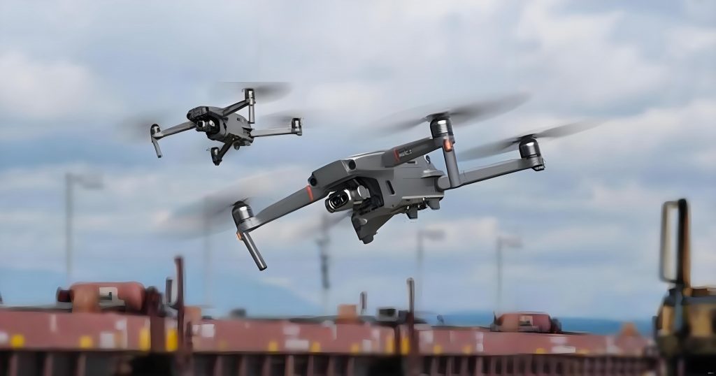
To address these challenges, I propose solutions that leverage existing 5G infrastructure while optimizing for civilian UAV needs. Building dedicated networks or allocating separate frequency bands for civilian UAVs, though ideal for ensuring dedicated resources and minimal interference, may not be economically viable given the current scale of civilian UAV adoption. Instead, a more practical approach involves enhancing current deployment strategies through layered network planning. This method segments the vertical airspace from 0 to 300 meters into three strata: low-altitude (0–100 meters), mid-altitude (100–200 meters), and high-altitude (200–300 meters). Traditional macro cells with downward-tilted antennas can continue to serve ground users and low-altitude civilian UAVs, while additional cells installed on taller structures (above 100 meters) can employ upward-tilted antennas to cover mid- and high-altitude zones. This layered deployment ensures comprehensive coverage for both terrestrial and aerial users without necessitating a complete network overhaul.
To assess the feasibility of this approach, I conducted a coverage simulation using the Catherine base station planning tool. Assuming a base station height of 100 meters, an antenna tilt angle of 20 degrees upward, and a vertical half-power beamwidth of 30 degrees for 5G antennas, the main lobe coverage radius extends to approximately 2,286 meters. For a typical three-sector cell, the coverage area per base station can be estimated as:
$$S = \pi r^2 = 3.14 \times (2.286)^2 \approx 16.4 \text{ km}^2$$
This calculation indicates that each base station can cover about 16.4 square kilometers of airspace up to 300 meters in altitude. As a case study, consider the urban area of a major city like Fuzhou, which has a core region of roughly 880 square kilometers. The number of base stations required for low-altitude coverage can be approximated as:
$$N = \frac{880}{16.4} \approx 53.6$$
Thus, around 54 additional macro cells deployed on high-rise buildings could provide seamless coverage for civilian UAVs across the city’s airspace. In practice, a comprehensive 5G rollout might involve thousands of ground-oriented macro cells supplemented by these aerial-focused cells, offering a balanced solution for diverse user demands.
From a link budget perspective, the coverage for civilian UAVs can be analyzed using free-space path loss models, given the lack of obstructions in aerial environments. The path loss formula is:
$$L_d = 32.4 + 20 \log_{10}(d) + 20 \log_{10}(f)$$
where \(L_d\) is the path loss in dB, \(d\) is the distance in kilometers, and \(f\) is the frequency in MHz. For 5G operating at 3.5 GHz (3,500 MHz) and a coverage distance of 2.5 km, the path loss computes to:
$$L_d = 32.4 + 20 \log_{10}(2.5) + 20 \log_{10}(3500) \approx 111.24 \text{ dB}$$
Assuming typical 5G AAU (Active Antenna Unit) parameters—such as a transmit power per resource element of 12.65 dBm, antenna gain of 19 dBi, and civilian UAV terminal antenna gain of 2 dBi—the received signal level at the civilian UAV can be derived as:
$$\text{RxLEV} = P_{\text{RE}} + G_{\text{AAU}} – L_d + G_{\text{UAV}}$$
Substituting the values:
$$\text{RxLEV} = 12.65 + 19 – 111.24 + 2 = -77.59 \text{ dBm}$$
This signal strength, around -77.59 dBm, is well within acceptable limits for reliable civilian UAV communication, supporting data transmission and control functions. Therefore, from a technical standpoint, the proposed layered deployment is viable, but practical implementation requires careful consideration of several network optimization aspects.
First, neighbor cell planning is crucial to ensure seamless handovers for civilian UAVs moving across different cells and altitudes. As a civilian UAV ascends or descends, it must transition between low-altitude and high-altitude coverage zones, necessitating well-defined neighbor relationships between cells. Handover zones should be strategically placed around 100 meters altitude to minimize service disruption. Additionally, interference management becomes paramount in a layered network. Since 5G is a self-interfering system sharing a common bandwidth (e.g., 100 MHz), overlapping coverage from ground and aerial cells could lead to signal interference, degrading performance for both civilian UAVs and ground users. To mitigate this, precise antenna tilt adjustments, power control, and frequency planning are essential. For instance, using different frequency slices or beamforming techniques can isolate aerial and terrestrial traffic, reducing cross-tier interference. Simulation tools and field trials will be invaluable in refining these parameters to achieve optimal network performance.
Moreover, the dynamic nature of civilian UAV operations introduces unique mobility challenges. Unlike ground users, civilian UAVs can move rapidly in three dimensions, requiring robust tracking and predictive handover algorithms. The 5G network must support enhanced mobility features, such as UAV-specific signaling protocols and quality of service (QoS) profiles, to maintain low latency and high reliability. Security is another critical concern; integrating civilian UAVs into 5G networks leverages the inherent security mechanisms of cellular systems, including encryption and authentication, which are superior to unlicensed band solutions. This enhances data confidentiality and protects against jamming or hijacking attempts, fostering trust in civilian UAV applications for sensitive tasks like surveillance or delivery.
Looking ahead, the convergence of 5G and civilian UAV technology promises to unlock innovative use cases. For example, in smart cities, civilian UAVs could perform real-time traffic monitoring or infrastructure inspections, streaming 4K video to control centers via 5G links. In agriculture, civilian UAVs equipped with sensors could map crop health over vast areas, with data processed in the cloud for actionable insights. The table below extrapolates potential future applications and their network requirements, emphasizing the role of 5G in enabling advanced civilian UAV services:
| Future Application | Key Requirement | 5G Enhancement | Impact on Civilian UAV |
|---|---|---|---|
| Autonomous Delivery Networks | Ultra-Low Latency (<10 ms) | Edge Computing Integration | Enables real-time obstacle avoidance and route optimization for civilian UAVs. |
| Large-Scale Environmental Monitoring | High Uplink Bandwidth (>100 Mbps) | Massive MIMO and mmWave | Facilitates continuous data upload from civilian UAV sensor arrays. |
| Disaster Response Swarms | Network Slicing for Priority | Dynamic Resource Allocation | Ensures reliable communication for civilian UAV fleets in emergency zones. |
| Urban Air Mobility Integration | Seamless Vertical Handovers | Multi-Connectivity and Dual Connectivity | Supports smooth transitions between ground and aerial networks for civilian UAVs. |
To realize this vision, ongoing research and standardization efforts are vital. Organizations like the IMT-2020 (5G)推进组 have published white papers outlining roadmap for UAV integration, but practical deployment requires collaboration among telecom operators, UAV manufacturers, and regulatory bodies. For instance, spectrum allocation policies may need revision to accommodate aerial users, and flight regulations must evolve to support beyond-visual-line-of-sight (BVLOS) operations enabled by 5G connectivity. In my analysis, a phased implementation strategy is recommended: initial pilots in controlled environments can validate technical feasibility, followed by scaled deployments in urban corridors, and eventually nationwide coverage for civilian UAVs.
In conclusion, the integration of civilian UAVs into 5G networks represents a transformative opportunity to create a “connected sky,” where drones operate safely, efficiently, and intelligently across diverse sectors. By adopting a layered network deployment strategy that leverages existing infrastructure, we can address coverage gaps in low-altitude airspace without prohibitive costs. The case study of Fuzhou demonstrates that a modest addition of aerial-focused base stations—around 54 for an 880 km² area—can enable comprehensive coverage for civilian UAVs up to 300 meters, supported by favorable link budget outcomes. However, success hinges on meticulous planning for neighbor relations, interference mitigation, mobility management, and security enhancement. As 5G rollout accelerates globally, prioritizing civilian UAV communication will not only boost drone utilization rates but also spur innovation in logistics, agriculture, public safety, and beyond. I believe that through continued technological refinement and cross-industry cooperation, civilian UAVs will become integral components of our smart, connected future, powered by the robust foundation of 5G networks.