In recent years, the application of crop spraying drones, also known as spraying UAVs, has gained significant attention in agricultural practices, particularly in challenging terrains like hilly and mountainous orchards. Traditional ground-based equipment faces difficulties in navigating uneven terrain, leading to inefficiencies and potential safety hazards. This study focuses on developing a comprehensive three-dimensional path planning method for crop spraying drones to optimize energy consumption and ensure full coverage in such environments. The approach leverages real-world 3D models of orchards to generate paths that account for terrain variations, drone dynamics, and spray distribution. By integrating energy consumption models and optimizing flight parameters, we aim to enhance the efficiency and effectiveness of crop spraying drone operations. The following sections detail the methodology, including coordinate system transformations, energy modeling, path planning algorithms, simulation experiments, and field validation. Throughout this work, the terms crop spraying drone and spraying UAV are used interchangeably to refer to unmanned aerial vehicles designed for agricultural spraying tasks.
The core challenge in hilly orchards is the irregular topography, which requires spraying UAVs to adjust their flight paths in three dimensions to maintain consistent spray coverage and avoid obstacles. Existing path planning methods often rely on two-dimensional approaches, which are insufficient for such terrain. This research addresses this gap by proposing a 3D path planning framework that incorporates terrain data from photogrammetric models. The energy consumption of a crop spraying drone is critically influenced by its movement, payload changes, and environmental factors. Thus, we develop an energy model that considers these aspects to optimize the flight path. The path planning algorithm is based on a modified boustrophedon pattern, extended to 3D, and optimized for minimal energy use by varying the heading angle. Simulation and field experiments demonstrate that this approach reduces energy consumption and operation time while ensuring uniform spray deposition. This work contributes to the advancement of autonomous crop spraying drone technologies in complex agricultural landscapes.
To begin, the coordinate system transformation is essential for aligning the path planning with the terrain’s orientation. The real-world coordinates obtained from 3D models are typically in geographic systems like longitude and latitude, which are converted to a local Cartesian coordinate system for computational simplicity. Let the original coordinates of a point be denoted as (x, y) in a global system. We transform these to a new coordinate system (x’, y’) rotated by an angle θ (the heading angle) to align with the desired flight direction. The transformation is given by:
$$ \begin{bmatrix} x’ \\ y’ \end{bmatrix} = \begin{bmatrix} \cos \theta & \sin \theta \\ -\sin \theta & \cos \theta \end{bmatrix} \begin{bmatrix} x \\ y \end{bmatrix} $$
where θ ranges from 1° to 180° for optimization. This rotation ensures that the path planning occurs in a coordinate system where the x’-axis is parallel to the flight direction, simplifying the generation of parallel paths. After path planning, the coordinates are transformed back to the original system using the inverse rotation. This step is crucial for accurately mapping the 3D path onto the terrain model. The heading angle θ is optimized to minimize energy consumption, as different angles affect the path length and elevation changes, which directly impact the crop spraying drone’s energy usage.
The energy consumption model for a spraying UAV is derived from the aerodynamic principles of multi-rotor drones. The total power required for flight consists of induced power for lift, profile power for overcoming air resistance, and parasitic power for forward motion. For a crop spraying drone flying with horizontal velocity v_xy and vertical velocity v_z, the power components are expressed as follows. The horizontal flight power P_xy is given by:
$$ P_{xy} = \frac{G_{RW}^2}{R_W \sqrt{2 S_{RW}}} \frac{1}{\sqrt{\|v_{xy}\|^2 + \sqrt{\|v_{xy}\|^4 + 4 P_h^4}}} $$
where G_RW is the total weight of the spraying UAV, including the drone’s mass and the liquid payload, R_W is a resistance factor, S_RW is the total rotor area, and P_h is the hover power parameter defined as:
$$ P_h = \sqrt{\frac{G_{RW}}{2 \rho S_{RW}}} $$
Here, ρ is the air density. The weight G_RW varies with time due to payload changes during spraying:
$$ G_{RW} = (m_s + m_l – v_l t) g $$
where m_s is the empty mass of the crop spraying drone, m_l is the maximum liquid mass, v_l is the spraying rate, t is time, and g is gravitational acceleration. The vertical flight power P_z accounts for climbing or descending:
$$ P_z = G_{RW} v_z $$
The drag power P_RW due to air resistance is:
$$ P_{RW} = \frac{C_{D0} \rho S_{RW} \|v\|^3}{8} $$
where C_D0 is the drag coefficient and v is the total velocity. Combining these, the total power for horizontal flight P_TD and vertical flight P_v are:
$$ P_{TD} = P_{xy} + P_{RW} $$
$$ P_v = P_z + P_{RW} $$
The energy consumed during work W_w is the integral of power over time for all path segments:
$$ W_w = \sum_{i=1}^{n} \left( \int_{t_i}^{t_{i+1}} P_{TD} \, dt + \int_{t_i}^{t_{i+1}} P_v \, dt \right) $$
where n is the number of path segments, and t_i and t_{i+1} are the times at consecutive path points. Additionally, for operations requiring refilling, the energy for return trips W_r includes the energy for empty and loaded flights. The total energy for a heading angle θ is:
$$ W_\theta = W_w + W_r $$
This model allows us to evaluate the energy efficiency of different paths for the spraying UAV.
The 3D path planning algorithm builds on the boustrophedon method, which involves generating parallel lines covering the operation area. First, the terrain’s 3D model is imported and interpolated to obtain a continuous surface. The boundary vertices are used to define the operation area in a local coordinate system. For each heading angle θ from 1° to 180°, the coordinate system is rotated, and parallel lines spaced by the spray swath width w are generated. Path points are placed along these lines at intervals based on the tree spacing d. These points are then projected onto the 3D terrain model to account for elevation changes, ensuring the crop spraying drone maintains a consistent height above the canopy. The path points are connected sequentially, forming a 3D path that the spraying UAV can follow. The algorithm iterates over all heading angles, computes the energy consumption for each path using the model, and selects the path with minimal energy. This process ensures full coverage while optimizing performance.
In simulation experiments, we applied this method to a hilly orchard area with significant elevation variations. The parameters for the crop spraying drone were based on a typical multi-rotor model, such as the DJI T30, with specifications including flight speed, payload capacity, and spray characteristics. The table below summarizes the key parameters used in the simulation:
| Parameter | Value | Description |
|---|---|---|
| Flight Speed | 2 m/s | Constant velocity during operation |
| Empty Mass | 35 kg | Mass of the spraying UAV without payload |
| Max Liquid Mass | 30 kg | Maximum payload of spray liquid |
| Spraying Rate | 0.1 kg/s | Rate at which liquid is expelled |
| Air Density | 1.21 kg/m³ | Standard atmospheric condition |
| Drag Coefficient | 0.5 | Dimensionless coefficient for air resistance |
| Rotor Area | 4.39 m² | Total area covered by rotors |
| Gravity | 9.8 m/s² | Acceleration due to gravity |
The simulation results indicated that the optimal heading angle for minimal energy consumption was 91°, with a total energy of 83.47 kJ, compared to the maximum energy of 139.77 kJ at 147°. This represents a 40.28% reduction in energy. The operation time was also reduced by 30.11% at the optimal angle. The energy savings are attributed to shorter path lengths and reduced elevation changes, which minimize the power required for vertical adjustments. The following table compares the results for minimal and maximal energy paths:
| Parameter | Min Energy (91°) | Max Energy (147°) | Average |
|---|---|---|---|
| Refill Count | 0 | 1 | — |
| Total Energy (kJ) | 83.47 | 139.77 | 100.72 |
| Work Energy (kJ) | 83.47 | 111.83 | 100.46 |
| Refill Energy (kJ) | 0 | 27.95 | 0.26 |
| Total Time (s) | 292.63 | 425.29 | 377.24 |
| Work Time (s) | 292.63 | 380.47 | 319.03 |
| Refill Time (s) | 0 | 66.82 | 58.21 |
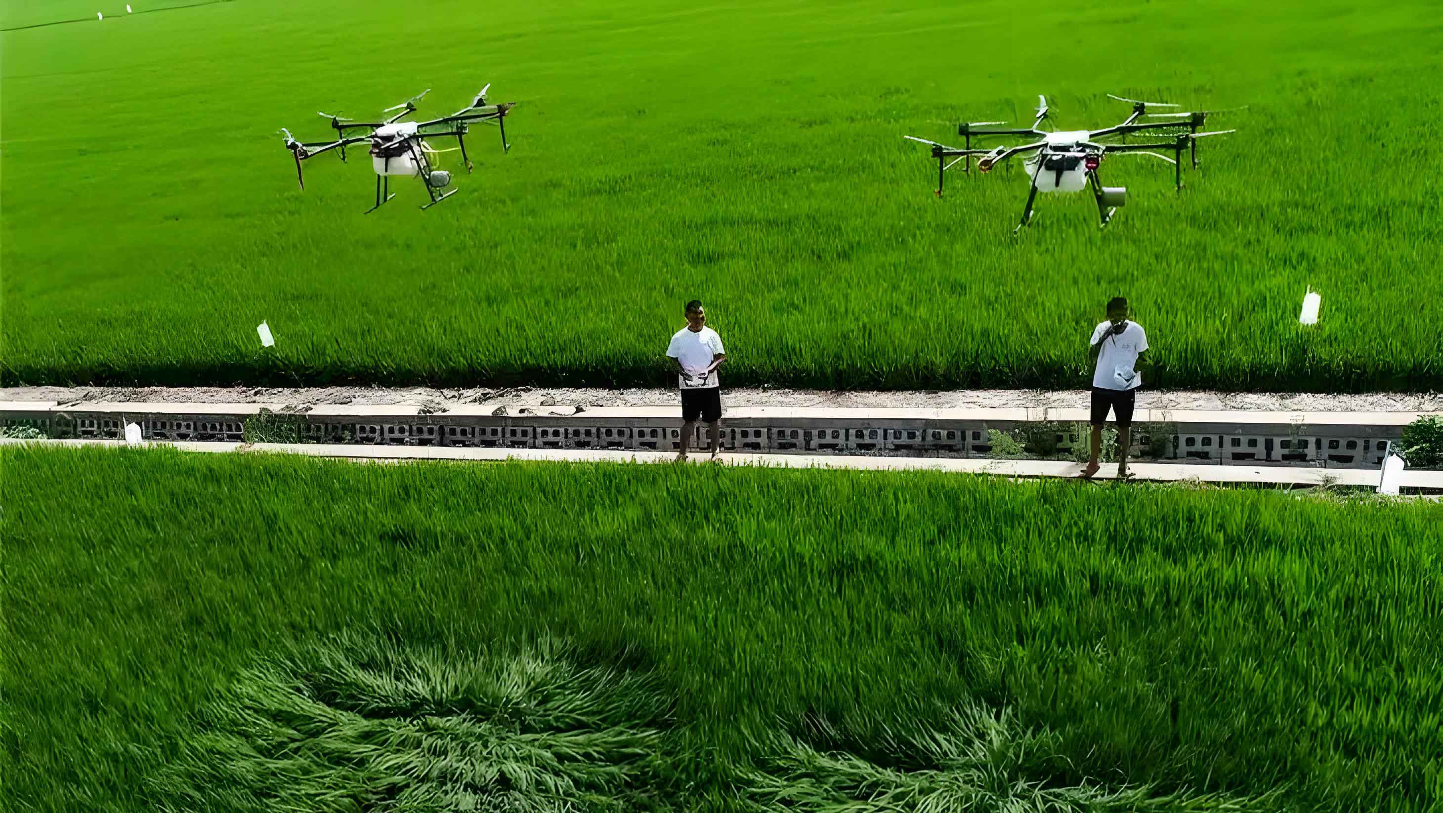
Field validation experiments were conducted in a real orchard with similar terrain characteristics. The crop spraying drone was programmed to follow the optimal path (91° heading) and the worst-case path (147° heading). Energy consumption was measured based on battery usage, and spray uniformity was assessed using water-sensitive papers placed at various sampling points. The results showed that the optimal path reduced total energy consumption by 20.88% and operation time by 16.31% compared to the worst-case path. The spray deposition was uniform across sampling points, with minimal variation, indicating full coverage. The table below presents the field trial results:
| Parameter | Min Energy (91°) | Max Energy (147°) |
|---|---|---|
| Heading Angle (°) | 91 | 147 |
| Refill Count | 1 | 1 |
| Total Energy (mA·h) | 20,880 | 26,390 |
| Work Energy (mA·h) | 17,122 | 21,112 |
| Refill Energy (mA·h) | 3,758 | 5,283 |
| Total Time (s) | 557.98 | 666.73 |
| Work Time (s) | 480.57 | 582.69 |
| Refill Time (s) | 77.41 | 84.04 |
The spray deposition data from the field trials demonstrated that the crop spraying drone achieved consistent coverage, with droplet densities meeting agricultural standards. The minimal energy path not only saved energy but also maintained spray quality, proving the effectiveness of the 3D path planning approach for spraying UAVs in hilly orchards. This method can be extended to larger areas and integrated with real-time sensors for dynamic adjustments.
In conclusion, this study presents a robust framework for 3D path planning of crop spraying drones in mountainous orchards. By combining terrain modeling, energy optimization, and coverage path planning, we have shown that spraying UAVs can operate efficiently in challenging environments. The energy model accounts for dynamic payload changes and flight conditions, providing a realistic assessment of performance. Future work could incorporate real-time data and machine learning to further enhance path adaptability and energy efficiency. The widespread adoption of such technologies will contribute to sustainable agriculture by reducing resource consumption and improving crop protection. As the use of crop spraying drones continues to grow, advancements in path planning will play a crucial role in maximizing their benefits.
The integration of 3D path planning with energy models opens new possibilities for autonomous agricultural systems. For instance, the spraying UAV could adjust its path in real-time based on wind conditions or obstacle detection, further optimizing energy use. Additionally, the methodology can be applied to other types of unmanned aerial vehicles for tasks like monitoring or mapping. The key takeaway is that optimizing the heading angle and accounting for 3D terrain significantly impact the overall efficiency of crop spraying drone operations. This research underscores the importance of holistic approaches that consider both spatial and energetic factors in agricultural robotics.
Overall, the proposed method offers a practical solution for deploying spraying UAVs in hilly regions, where traditional methods fall short. By leveraging modern modeling techniques and optimization algorithms, we can unlock the full potential of crop spraying drones to support precision agriculture. The continued evolution of these technologies will rely on interdisciplinary efforts combining aerodynamics, control systems, and agricultural science. As demonstrated, even small improvements in path planning can lead to substantial gains in energy savings and operational effectiveness, making crop spraying drones a viable tool for modern farming challenges.